MyTopo
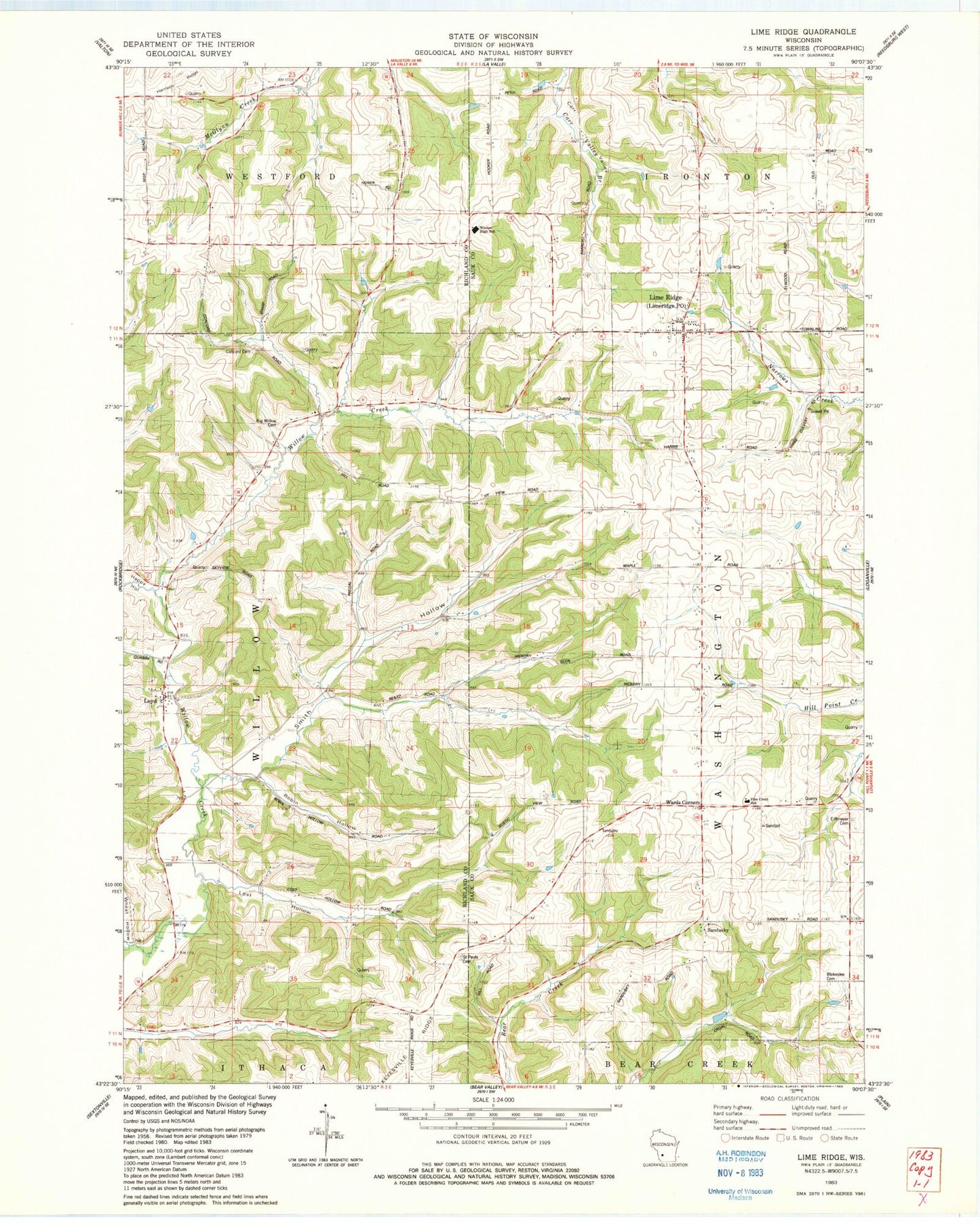
Classic USGS Lime Ridge Wisconsin 7.5'x7.5' Topo Map
Couldn't load pickup availability
Historical USGS topographic quad map of Lime Ridge in the state of Wisconsin. Map scale may vary for some years, but is generally around 1:24,000. Print size is approximately 24" x 27"
This quadrangle is in the following counties: Richland, Sauk.
The map contains contour lines, roads, rivers, towns, and lakes. Printed on high-quality waterproof paper with UV fade-resistant inks, and shipped rolled.
Contains the following named places: Big Willow Creek Stock Farm, Blakeslee Cemetery, Block School, Blue Silo Stock Farm, Butternut School, Concord Cemetery, Concord Church, Elm Grove School, Erffmeyer Cemetery, Fairview Grain and Hop Farm, Far View Farm, Harris School, Larch Fruit Farm, Lime Ridge, Lime Ridge Post Office, Lost Hollow, Loyd, Loyd Cemetery, Maple Grove Stock Farm, Meyers School, Oakwood Dairy Farm, Pine Crest School, Plain View School, Plainview Dairy and Grain Farm, Pleasant Valley Dairy Farm, Robin Hollow, Saint Paul Lutheran Cemetery, Saint Pauls Church, Sandusky, Smith Hollow, Smith Hollow School, Spring Brook Farm, Spring Valley Stock Farm, Town of Washington, Union Church, Upper Big Willow Cemetery, Valley View Farm, Village of Lime Ridge, Wards Corners, Weston Elementary School, Weston High School, Weston Junior High School, White School, Willow Stock Farm, Woods Homestead, ZIP Code: 53937