MyTopo
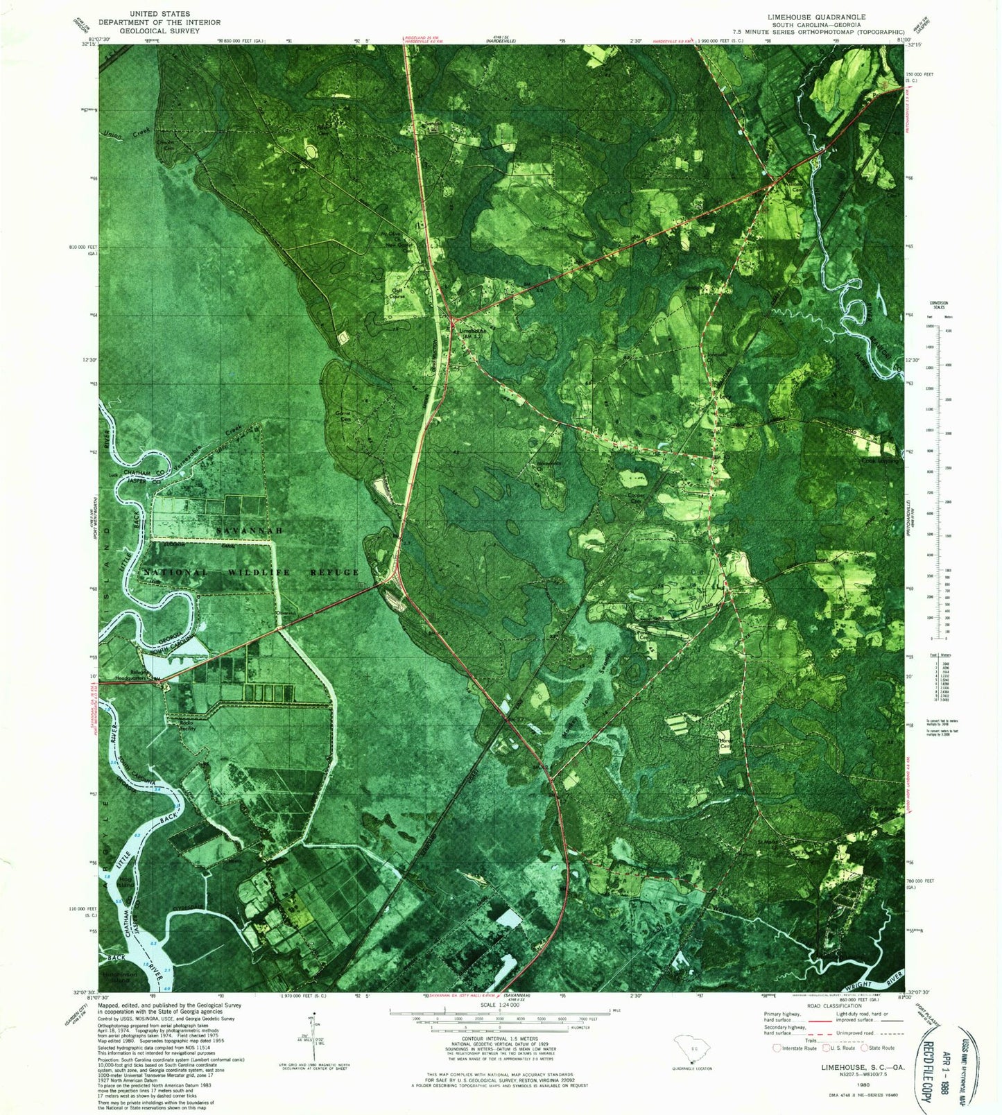
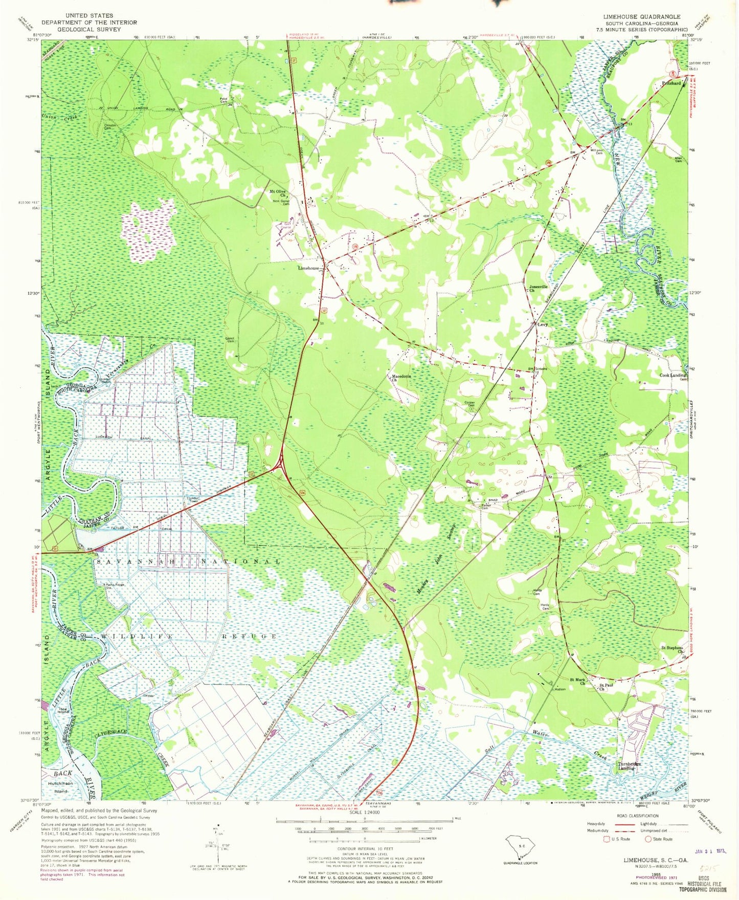
Classic USGS Limehouse South Carolina 7.5'x7.5' Topo Map
Couldn't load pickup availability
Historical USGS topographic quad map of Limehouse in the states of South Carolina, Georgia. Map scale may vary for some years, but is generally around 1:24,000. Print size is approximately 24" x 27"
This quadrangle is in the following counties: Beaufort, Chatham, Jasper.
The map contains contour lines, roads, rivers, towns, and lakes. Printed on high-quality waterproof paper with UV fade-resistant inks, and shipped rolled.
Contains the following named places: Allen Cemetery, Chisolm Cemetery, Clydesdale Creek, Cook Landing, Cooper Cemetery, Cross Tides, Garret Cemetery, Hardeeville Division, Hardy Cemetery, Hog Island, Jonesville Church, Levy, Levy Fire Department Station 25, Limehouse, Little Back River, Lucknow Canal, Macedonia Church, Monkey John Swamp, Mount Olive Church, Murray Hill Canal, New Garret Cemetery, New River Bridge, Parker Cemetery, Pelot Cemetery, Pritchard, Rutledges Rice Mill, Saint Mark Church, Saint Paul Church, Saint Stephens Church, Salt Water Creek, Shad School, Taylor Canal, Tunbridge Neck, Turnbridge Landing, Union Landing, Vernezobre Creek, Williams Cemetery, ZIP Code: 29927