MyTopo
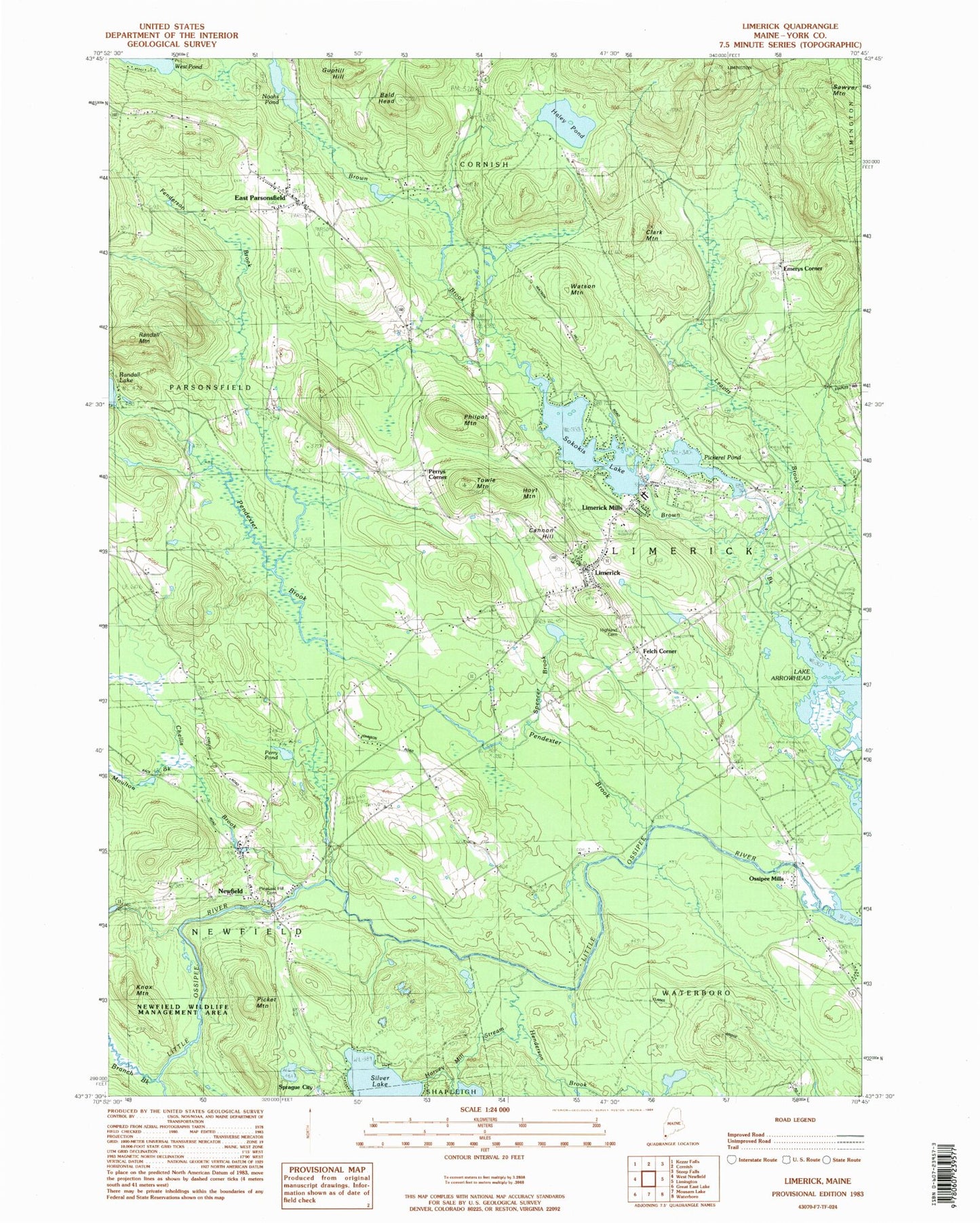
Classic USGS Limerick Maine 7.5'x7.5' Topo Map
Couldn't load pickup availability
Historical USGS topographic quad map of Limerick in the state of Maine. Typical map scale is 1:24,000, but may vary for certain years, if available. Print size: 24" x 27"
This quadrangle is in the following counties: York.
The map contains contour lines, roads, rivers, towns, and lakes. Printed on high-quality waterproof paper with UV fade-resistant inks, and shipped rolled.
Contains the following named places: Bald Head, Benson Brook, Branch Brook, Buff Brook, Cannon Hill, Chellis Brook, Clark Mountain, Clarks Bridge, East Parsonsfield, Felch Corner, Fenderson Brook, Guptill Hill, Haley Pond, Harvey Mill Stream, Highland Cemetery, Hoyt Mountain, Knox Mountain, Leavitt Brook, Limerick, Limerick Mills, Moulton Brook, Newfield, Noahs Pond, Ossipee Mills, Pendexter Brook, Perrys Corner, Philpot Mountain, Pickerel Pond, Picket Mountain, Pleasant Hill Cemetery, Silver Lake, Randall Mountain, Sawyer Mountain, Sokokis Lake, Spencer Brook, Towle Mountain, Watson Mountain, Emerys Corner, Sprague City, Town of Limerick, Sokokis Lake Dam, Symmes Pond Dam, Limerick Post Office, Newfield Historic District, Perry Pond, Newfield Post Office, Willowbrook Museum, Limerick Volunteer Fire Department, Day Cemetery, Dearborn - Foss Cemetery, Emerys Corner Cemetery, Highland Cemetery Annex, Nason Gray Lot, Baptist Society Cemetery, Sanborn Eastman Lot, Stone Cemetery, Thompson Family Cemetery, Line Elementary School, Ossipee Valley Christian School, Limerick Public Library, Newfield Village Library Reading Room