MyTopo
Classic USGS Limington Maine 7.5'x7.5' Topo Map
Couldn't load pickup availability
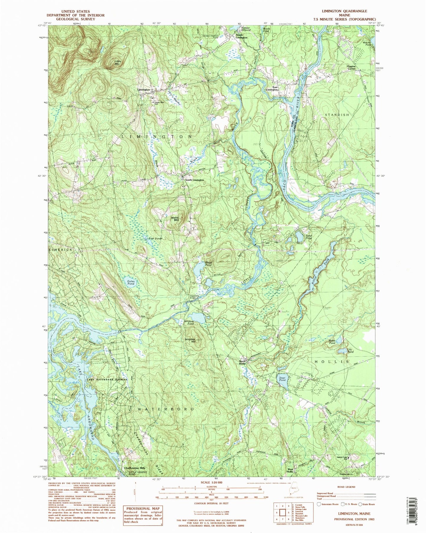
Historical USGS topographic quad map of Limington in the state of Maine. Typical map scale is 1:24,000, but may vary for certain years, if available. Print size: 24" x 27"
This quadrangle is in the following counties: Cumberland, York.
The map contains contour lines, roads, rivers, towns, and lakes. Printed on high-quality waterproof paper with UV fade-resistant inks, and shipped rolled.
Contains the following named places: Black Brook, Boyd Pond, Brown Brook, Deer Pond, Doles Pond, East Limington, Edgecomb Bridge, Emerson School, Foss Ponds, Hamlin Brook, Isinglass Hill, Isinglass Pond, Killick Pond, Libby Mountain, Lily Pond, Limington, Little Ossipee River, Maloy Mountain, North Hollis, North Limington, Sand Pond, South Limington, Swetts Meadow, Lake Arrowhead, Wales Pond, West Hollis, Whittier School, Chadbournes Ridge, Chadbournes Mills, Higgins Corner, Town of Limington, Ledgemere Dam, The Flowage Reservoir, Watchic Pond Dam, Little Ossipee Pond Dam, Little Ossipee Pond, North Limington Dam, Lake Arrowhead, Davis Memorial Library, H B Emery Junior Memorial School, Lake Arrowhead Estates, Limington Academy, Limington Congregation Church, Limington Post Office, Pleasant Hill Baptist Church, Pleasant Hill Church, Salmon Falls School, Horse Pond Brook, Lake Arrowhead Census Designated Place, Limington Fire Department, Limington Volunteer Fire Department Station 2, Hollis Fire Department Station 2, Boulter John Cemetery, George Dresser Cemetery, Dominicus Hasty Lot, Earl Gerry Whitehouse Cemetery, Elder Grey Cemetery, Kinrick Hanson Lot, Brackett Lot, Caleb Carpenter Cemetery, Maple Hill Cemetery