MyTopo
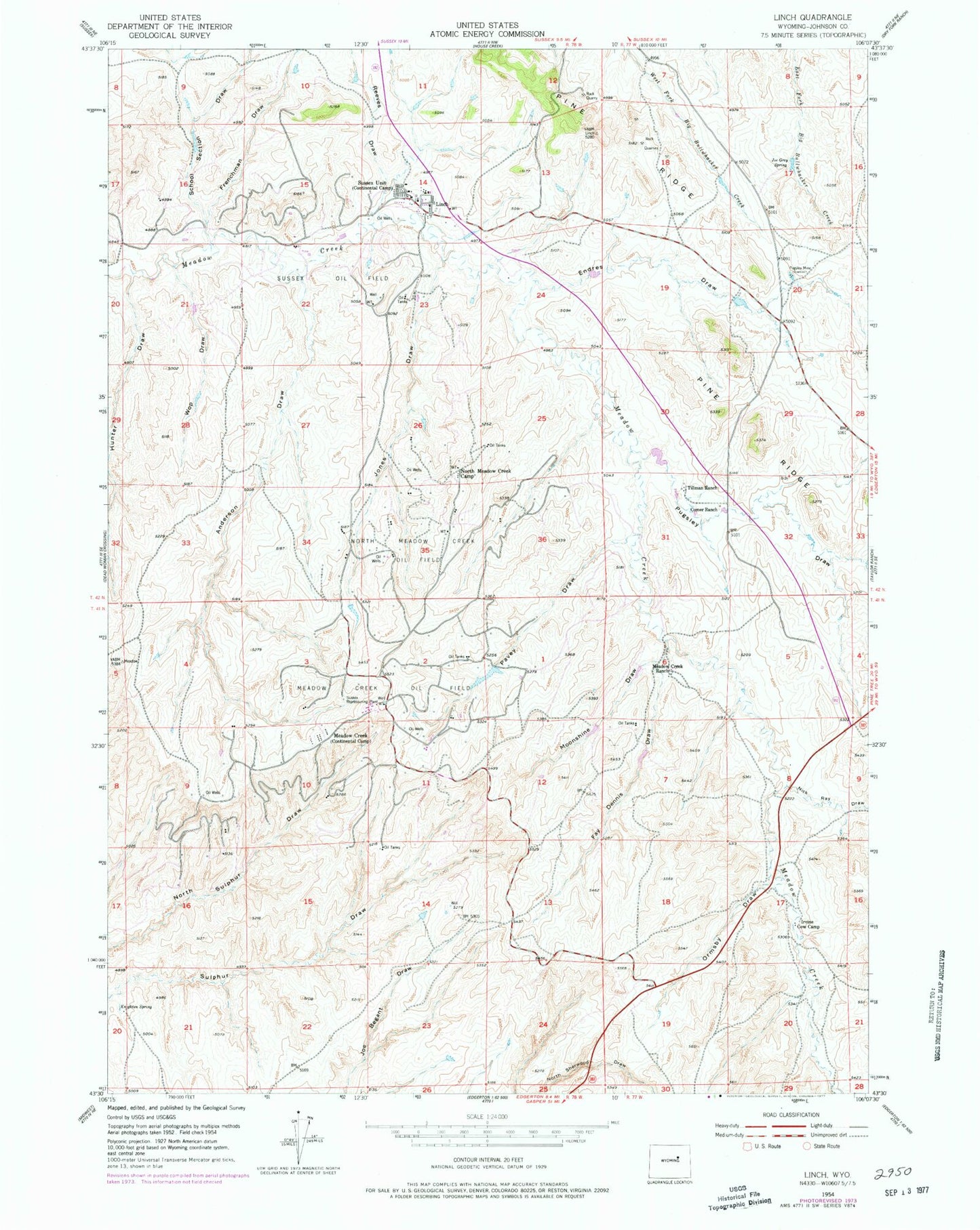
Classic USGS Linch Wyoming 7.5'x7.5' Topo Map
Couldn't load pickup availability
Historical USGS topographic quad map of Linch in the state of Wyoming. Map scale may vary for some years, but is generally around 1:24,000. Print size is approximately 24" x 27"
This quadrangle is in the following counties: Johnson.
The map contains contour lines, roads, rivers, towns, and lakes. Printed on high-quality waterproof paper with UV fade-resistant inks, and shipped rolled.
Contains the following named places: Anderson Draw, Comer Ranch, Endres Draw, Fay Dennis Draw, Frenchman Draw, Hunter Draw, Irvine Cow Camp, Jack Rabbit Numbers One and Two Claims, Jim Dandy Mine, Joe Grey Spring, Jones Draw, Knighton Spring, Linch, Linch Post Office, Linch School, Meadow Creek, Meadow Creek Oil Field, Microwave Pit, Moonshine Draw, Nick Ray Draw, North Meadow Creek Camp, North Meadow Creek Oil Field, Ormsby Draw, Pavey Draw, Pugsley Draw, Pugsley Mine, Reeves Draw, School Section Draw, Sussex Oil Field, Sussex Repressuring Plant, Sussex Unit, Taylor Mine, Tillman Ranch, Wop Draw, ZIP Code: 82640