MyTopo
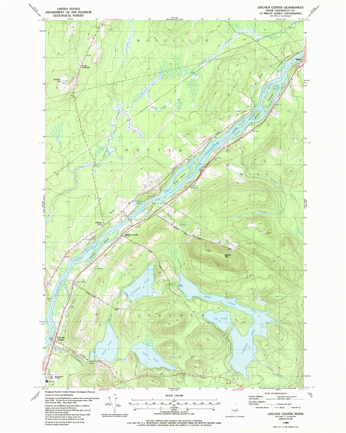
Classic USGS Lincoln Center Maine 7.5'x7.5' Topo Map
Couldn't load pickup availability
Historical USGS topographic quad map of Lincoln Center in the state of Maine. Typical map scale is 1:24,000, but may vary for certain years, if available. Print size: 24" x 27"
This quadrangle is in the following counties: Penobscot.
The map contains contour lines, roads, rivers, towns, and lakes. Printed on high-quality waterproof paper with UV fade-resistant inks, and shipped rolled.
Contains the following named places: Bagley Mountain, Blood Brook, Brown Islands, Cambolasse Pond, Cambolasse Stream, Caribou Pond, Center Pond, Chester Siding (historical), Egg Pond, Flowers Brook, Glidden Hill, Hersey Island, Lincoln Center, Long Pond, Marianne School, North Chester Cemetery, North Lincoln, Salmon Stream, Sebonibus Rapids, Smith Brook, Snow Island, South Winn Cemetery, Stump Pond, Tobin Brook, Snow Cemetery, Chester, South Woodville, Middle Chester Cemetery, Lincoln Center Cemetery, Mattanawcook Academy, Ella P Burr Elementary School, Snag Pond Dam, Long Pond Dam, Mill Pond Dam, Cambolasse Stream Reservoir