MyTopo
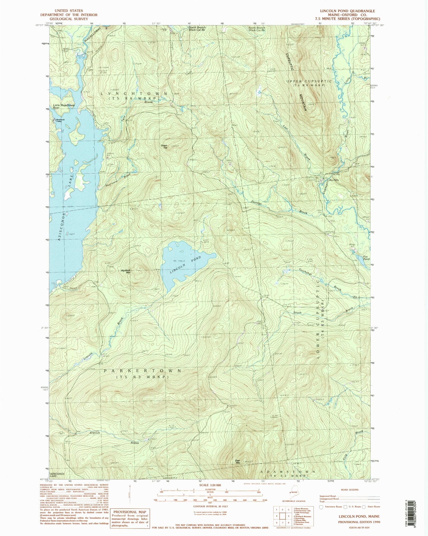
Classic USGS Lincoln Pond Maine 7.5'x7.5' Topo Map
Couldn't load pickup availability
Historical USGS topographic quad map of Lincoln Pond in the state of Maine. Typical map scale is 1:24,000, but may vary for certain years, if available. Print size: 24" x 27"
This quadrangle is in the following counties: Oxford.
The map contains contour lines, roads, rivers, towns, and lakes. Printed on high-quality waterproof paper with UV fade-resistant inks, and shipped rolled.
Contains the following named places: Big Buck Mountain, Big Falls, Cupsuptic Mountain, Deer Mountain, Fox Pond, Bosebuck Camp, Green Top, Hammel Brook, Hurricane Brook, Lincoln Pond, Little East Branch Cupsuptic River, Little Magalloway River, Lost Brook, Nasons Camp (historical), Portage Brook, Riverside Camp (historical), Twin Brook, Township of Lynchtown, Township of Parkertown