
MyTopo
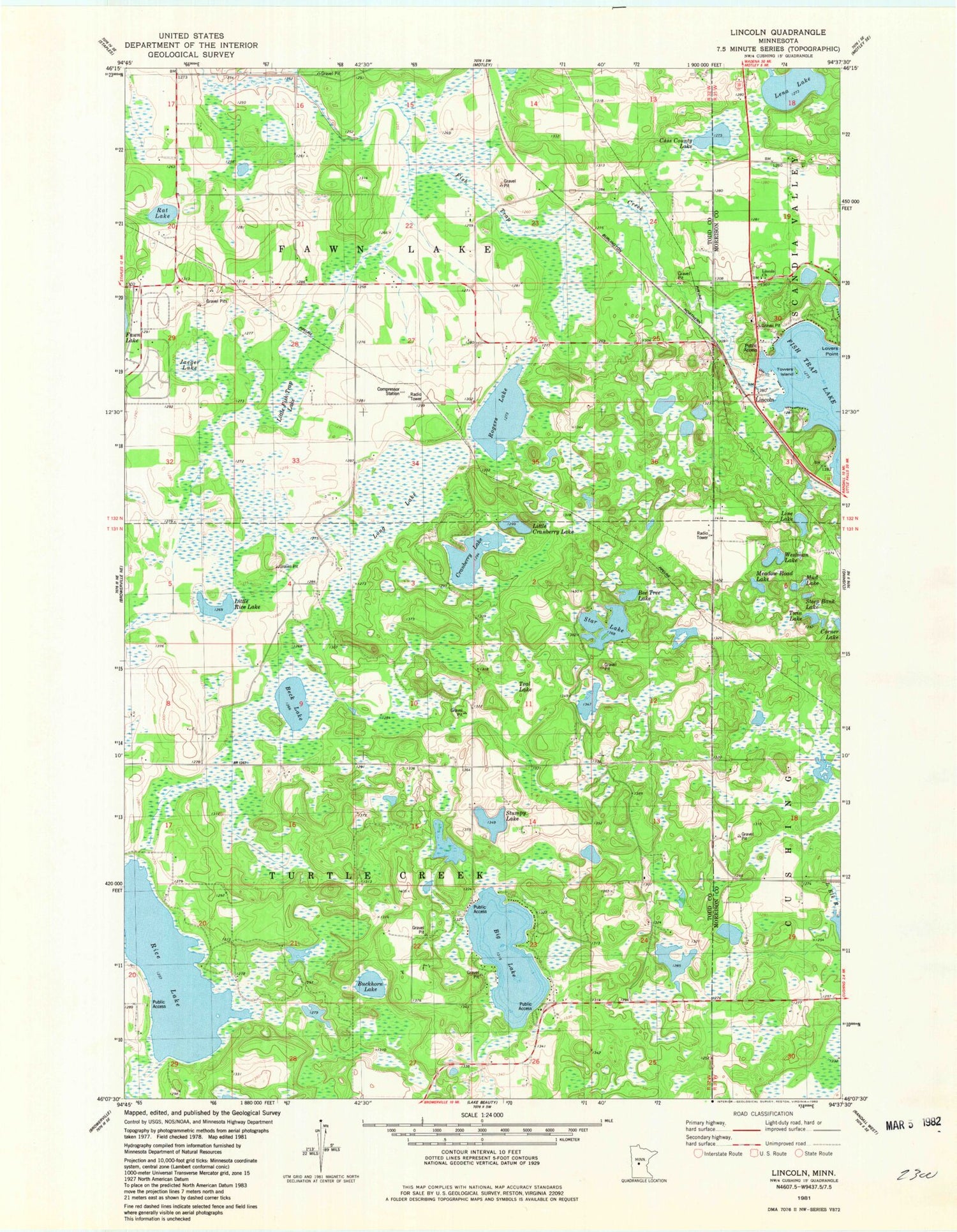
Classic USGS Lincoln Minnesota 7.5'x7.5' Topo Map
Couldn't load pickup availability
Historical USGS topographic quad map of Lincoln in the state of Minnesota. Map scale may vary for some years, but is generally around 1:24,000. Print size is approximately 24" x 27"
This quadrangle is in the following counties: Morrison, Todd.
The map contains contour lines, roads, rivers, towns, and lakes. Printed on high-quality waterproof paper with UV fade-resistant inks, and shipped rolled.
Contains the following named places: Beck Lake, Bee Tree Lake, Big Lake, Buckhorn Lake, C D Johnson Pond, C D Johnson Pond Dam, Cass County Lake, Cranberry Lake, D Stoerzinger Pond, D Stoerzinger Pond Dam, Fish Trap Lake, Jaeger Lake, L Kominek Pond, L Kominek Pond Dam, Lena Lake, Lincoln, Lincoln Church, Lincoln Evangelical Church, Lincoln Post Office, Line Lake, Little Cranberry Lake, Little Fish Trap Lake, Little Rice Lake, Long Lake, Lovers Point, Meadow Road Lake, Mud Lake, Rat Lake, Rice Lake, Rodgers Lake, School Number 106, School Number 111, School Number 137, School Number 159, School Number 20, School Number 761, Star Lake, Steep Bank Lake, Stumpy Lake, Teal Lake, Towers Island, Township of Fawn Lake, Township of Turtle Creek, Twin Lake, Westman Lake


