MyTopo
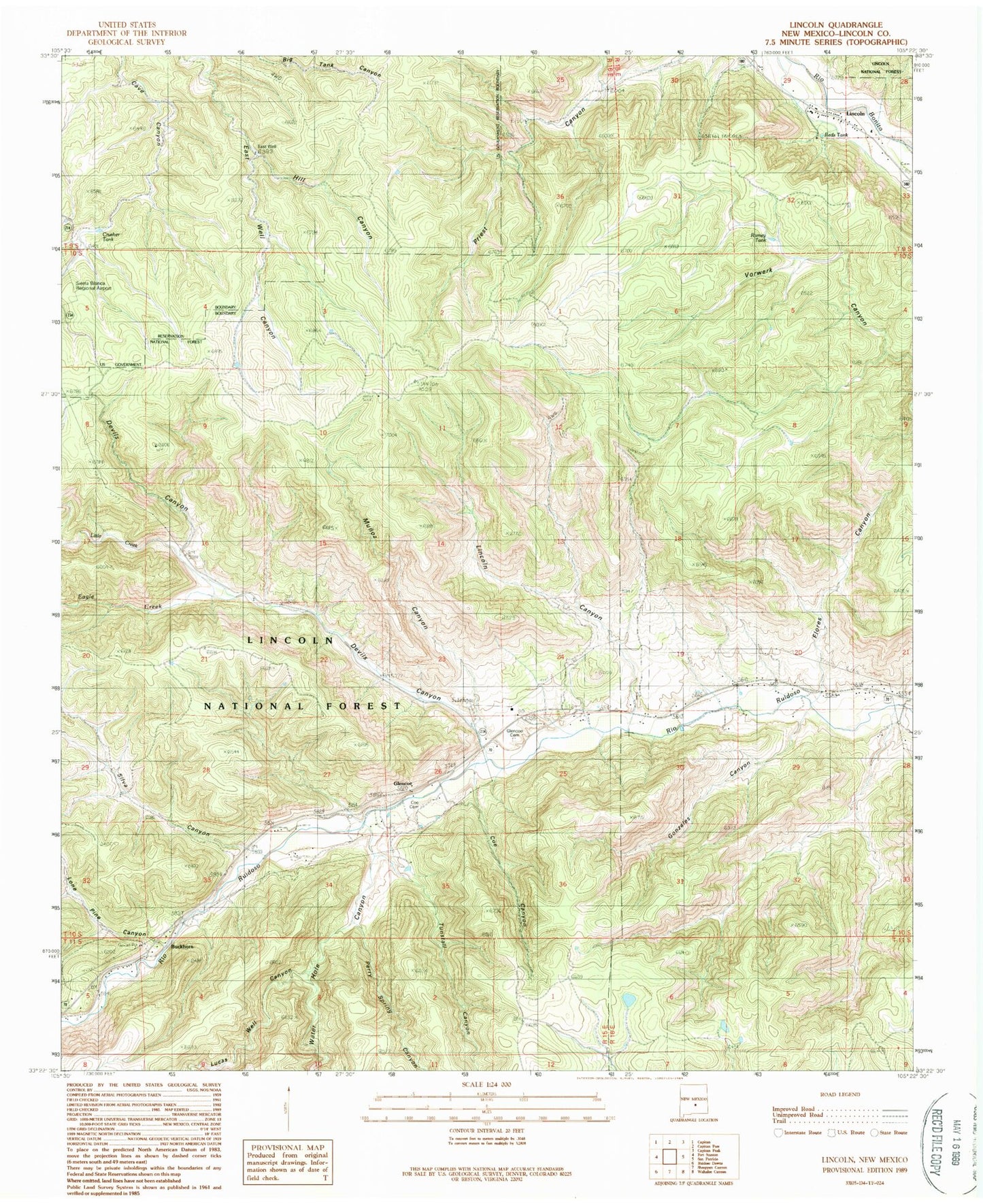
Classic USGS Lincoln New Mexico 7.5'x7.5' Topo Map
Couldn't load pickup availability
Historical USGS topographic quad map of Lincoln in the state of New Mexico. Map scale may vary for some years, but is generally around 1:24,000. Print size is approximately 24" x 27"
This quadrangle is in the following counties: Lincoln.
The map contains contour lines, roads, rivers, towns, and lakes. Printed on high-quality waterproof paper with UV fade-resistant inks, and shipped rolled.
Contains the following named places: 10193 Water Well, 88324, 88338, Baca Canyon, Big Tank, Bonnell Ranch, Buckhorn, Coe Canyon, Coe Ranch, Crusher Tank, Deer Spring, Devils Canyon, Double Crossing Historic Site, Eagle Creek, East Tank, East Well, English Spring, Fence Tank, Flores Canyon, George Coe Cemetery, Glencoe, Glencoe Cemetery, Glencoe Post Office, Gonzales Canyon, Gonzales Tank, Hatt Ranch, Hill Canyon, LA 12153, LA 12155, LA 61200, LA 61201, LA 61202, LA 61204, LA 61208, LA 61210, LA 61211, Lincoln, Lincoln Canyon, Lincoln Cemetery, Lincoln County Courthouse Historic Site, Lincoln County Heritage Trust, Lincoln Historic District, Lincoln Historical Marker, Lincoln Post Office, Lincoln State Monument Point of Interest, Lincoln Volunteer Fire Department, Little Creek, Little Tank, Lone Pine Canyon, Lucas Well Canyon, McDaniel Ranch, Munoz Canyon, Munoz Tank, Nome Tank, Perry Spring, Perry Spring Canyon, Ramey Tank, Rancho Torres, Reds Tank, Saint Annes Chapel, Saint Annes Episcopal Chapel, Silva Canyon, Silva Tank, Trapt Tank, Tully Tank, Tully Well, Tunstall Canyon, Water Hole Canyon, West Tank