MyTopo
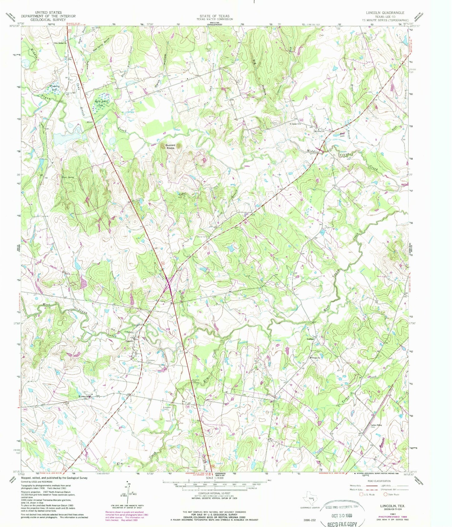
Classic USGS Lincoln Texas 7.5'x7.5' Topo Map
Couldn't load pickup availability
Historical USGS topographic quad map of Lincoln in the state of Texas. Map scale may vary for some years, but is generally around 1:24,000. Print size is approximately 24" x 27"
This quadrangle is in the following counties: Lee.
The map contains contour lines, roads, rivers, towns, and lakes. Printed on high-quality waterproof paper with UV fade-resistant inks, and shipped rolled.
Contains the following named places: Blue Buck Creek, Buzzard Knobs, C and H Lake, C and H Lake Dam, Cedar Creek, Christ Church, Copperas Cemetery, Copperas Creek, Doak Spring Branch, Doak Spring School, Doak Springs, Elm Creek, Evergreen Cemetery, Field Branch, Gloyna Cemetery, Gum Spring, Indian Camp Branch, Knox Lake, Lee County, Leo, Lincoln, Lincoln Post Office, Lincoln Volunteer Fire Department, Lincoln-Dime Box Division, Loebau, Loebau Siding, Marsh Hollow, Molty Smith Lake, Moore Branch, Mount Olive Church, New Bethel Cemetery, New Bethel Church, Pin Oak Creek, Saint James Church, Saint Johns School, Saint Peters Cemetery, Scott Cemetery, Smith Chapel, The Colony Public Library, Warsaw Branch, Wimberry Lake, ZIP Code: 78948