
MyTopo
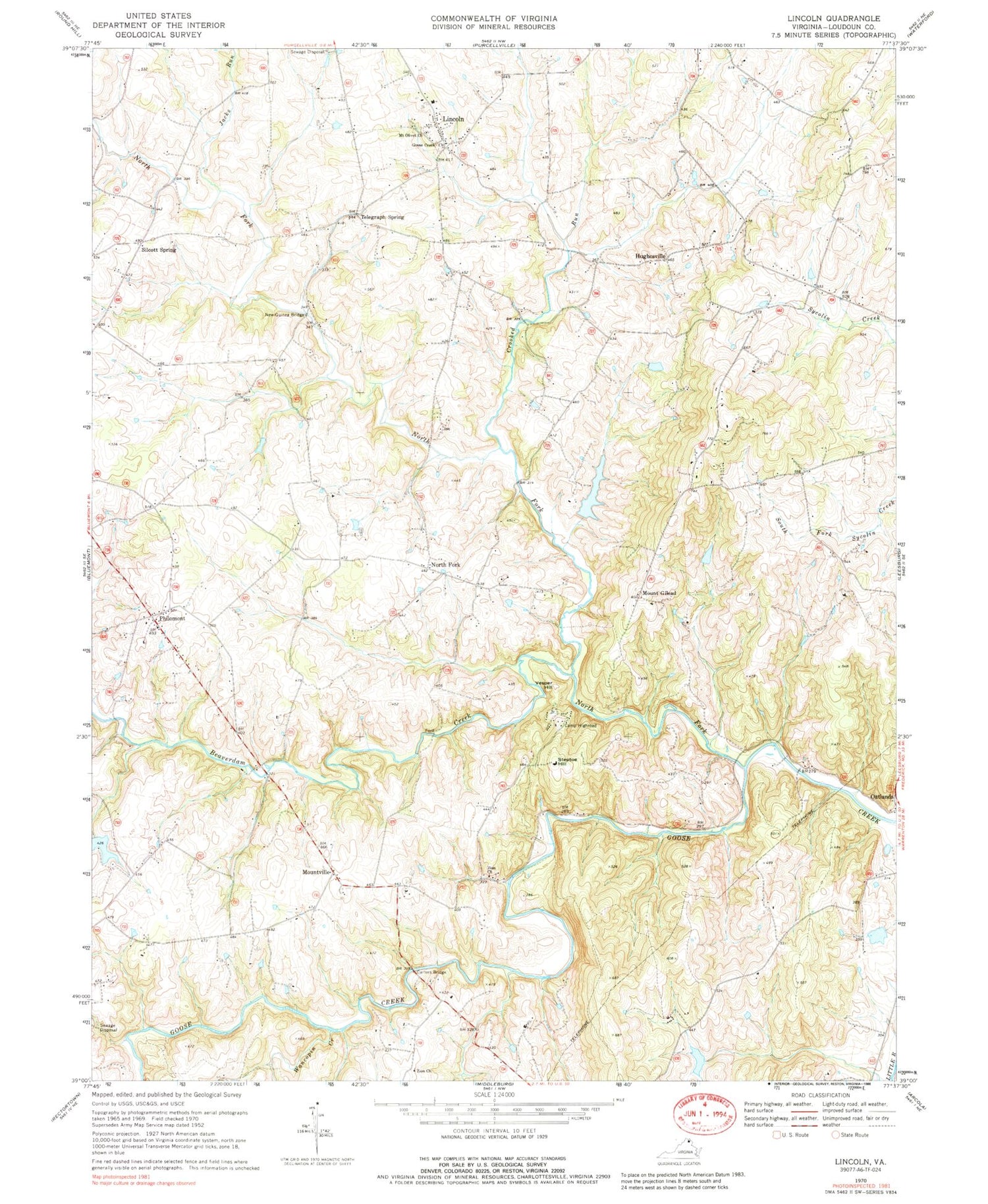
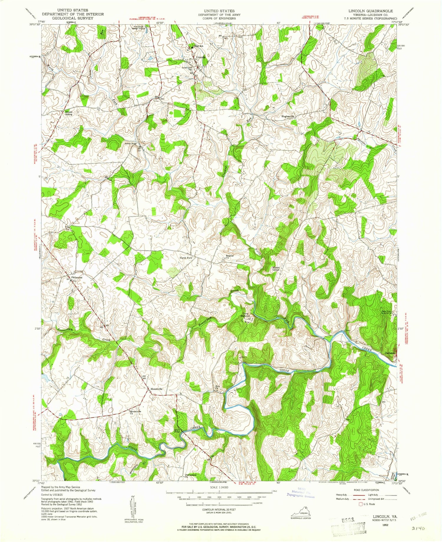
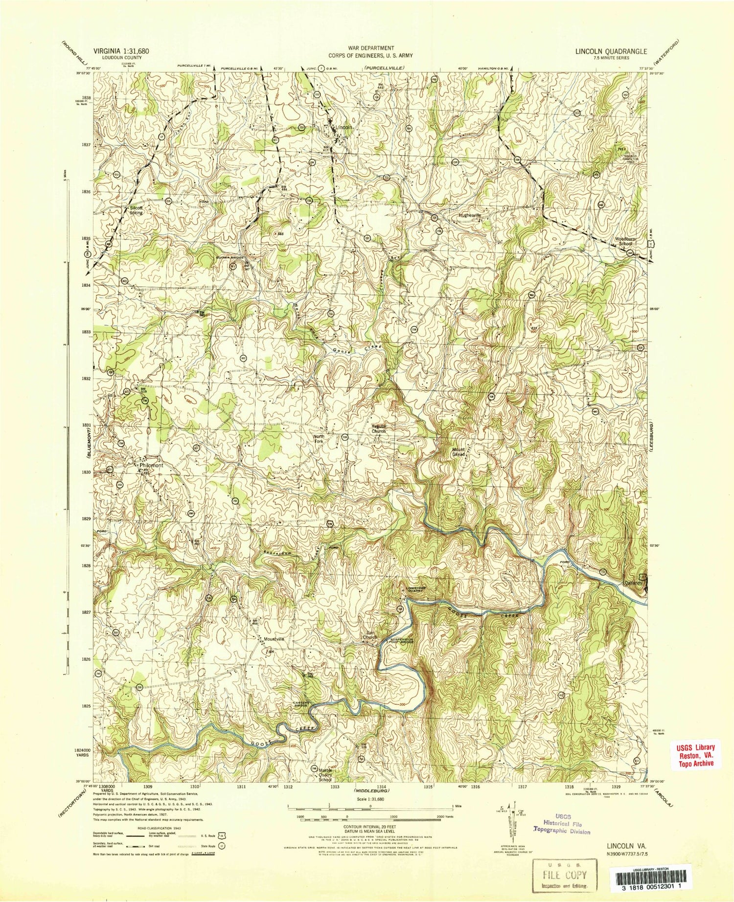
Classic USGS Lincoln Virginia 7.5'x7.5' Topo Map
Couldn't load pickup availability
Historical USGS topographic quad map of Lincoln in the states of Virginia, Maryland. Typical map scale is 1:24,000, but may vary for certain years, if available. Print size: 24" x 27"
This quadrangle is in the following counties: Loudoun.
The map contains contour lines, roads, rivers, towns, and lakes. Printed on high-quality waterproof paper with UV fade-resistant inks, and shipped rolled.
Contains the following named places: Beaverdam Creek, Camp Highroad, Carters Bridge, Crooked Run, Goose Creek Meeting House, Jacks Run, Mount Olive Baptist Church, New Guinea Bridge, North Fork Goose Creek, New Zion Baptist Church, Zion Church, Wancopin Creek, Loudoun County, Kingsley Lake, Izaak Walton League Dam, Izaak Walton League Pond, McGhee Dam, McGhee Lake, Oliver Dam, Oliver Lake, Woodall Dam, Woodall Pond, Bell Dam, Bell Pond, Hughesville, Lincoln, Mountville, North Fork, Philomont, Silcott Spring, Steptoe Hill, Telegraph Spring, Vesper Hill, Mount Gilead, Trammeltown (historical), Circleville, Egypt Farm, Flint Hill, Fox Chase, Goose Creek Burying Ground, Goose Creek Historic District, Greggsville, Hibbs Bridge, Hibbs Mill (historical), Lincoln Elementary School, Lincoln Post Office, Marble Quarry, Marble Quarry School (historical), Mount Olive Cemetery, Philomont Post Office, Roszell Chapel United Methodist Church, Woodburn School (historical), Blue Ridge District, Mercer District (historical), Loudoun County Fire and Rescue Philomont Station 8, Philomont Community Center, Dogwood Farm, Bell Dam, Bronze Hill Farm Dam, Corti-Jencen Dam, Creekspring Court Dam, Haynes Dam, Hibbs Bridge, Huber-Mount Gilead Road Dam, Lawrence Dam, Loudoun County Agricultural and Chemical Institute (historical), NW Arkansas Dam, Oliver Dam, Reckmeyer Dam, The Quarry Dam, Watermill Road Dam, White Goose Lane Dam, Naval Surface Warfare Center Fire Station 55, Beaverdam Creek, Camp Highroad, Carters Bridge, Crooked Run, Goose Creek Meeting House, Jacks Run, Mount Olive Baptist Church, New Guinea Bridge, North Fork Goose Creek, New Zion Baptist Church, Zion Church, Wancopin Creek, Loudoun County, Kingsley Lake, Izaak Walton League Dam, Izaak Walton League Pond, McGhee Dam, McGhee Lake, Oliver Dam, Oliver Lake, Woodall Dam, Woodall Pond, Bell Dam, Bell Pond, Hughesville, Lincoln, Mountville, North Fork, Philomont, Silcott Spring, Steptoe Hill, Telegraph Spring, Vesper Hill, Mount Gilead, Trammeltown (historical), Circleville, Egypt Farm, Flint Hill, Fox Chase, Goose Creek Burying Ground, Goose Creek Historic District, Greggsville, Hibbs Bridge, Hibbs Mill (historical), Lincoln Elementary School, Lincoln Post Office, Marble Quarry, Marble Quarry School (historical), Mount Olive Cemetery, Philomont Post Office, Roszell Chapel United Methodist Church, Woodburn School (historical), Blue Ridge District, Mercer District (historical), Loudoun County Fire and Rescue Philomont Station 8, Philomont Community Center, Dogwood Farm, Bell Dam, Bronze Hill Farm Dam, Corti-Jencen Dam, Creekspring Court Dam, Haynes Dam, Hibbs Bridge, Huber-Mount Gilead Road Dam, Lawrence Dam, Loudoun County Agricultural and Chemical Institute (historical), NW Arkansas Dam, Oliver Dam, Reckmeyer Dam, The Quarry Dam, Watermill Road Dam, White Goose Lane Dam, Naval Surface Warfare Center Fire Station 55


