
MyTopo
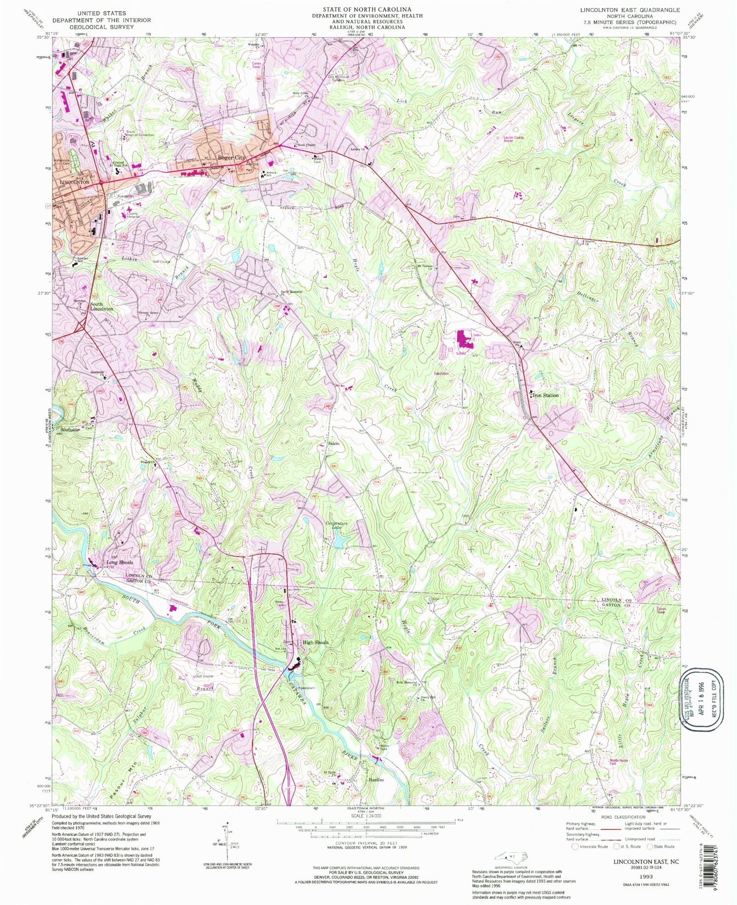
Classic USGS Lincolnton East North Carolina 7.5'x7.5' Topo Map
Couldn't load pickup availability
Historical USGS topographic quad map of Lincolnton East in the state of North Carolina. Typical map scale is 1:24,000, but may vary for certain years, if available. Print size: 24" x 27"
This quadrangle is in the following counties: Gaston, Lincoln.
The map contains contour lines, roads, rivers, towns, and lakes. Printed on high-quality waterproof paper with UV fade-resistant inks, and shipped rolled.
Contains the following named places: Asbury Church, Beaverdam Creek, Carpenters Lake, Central Junior High School, David Memorial Church, Fancy Hill Church, Hardins, Herndon Church, High Shoals, Hollybrook Cemetery, Indian Creek, Iron Station, Lick Run, Long Shoals, Mount Vernon Church, Muddy Creek, Ore Bank Branch, Pearl Church, Rattle Shoal Creek, Ruth Memorial Church, Sailors Branch, Saint Pauls Church, Sharon Church, South Lincolnton, Sulphur Branch, Wayside Church, Dallas Lake, Dallas Lake Dam, High Shoals Lake, High Shoals Lake Dam, Long Shoals Lake, Long Shoals Lake Dam, Carpenters Lake Dam, Beals Chapel, Holy Cross Church, Southside Church, Victory Grove Church, Gallagher Trails Golf and Swim Club, High Shoals Elementary School, Goodsonville, Iron Station Elementary School, Lincolnton-Lincoln County Regional Airport, Lithia Springs, Miller Siding, Lincoln Country Club, Midland Shopping Center, Boger City United Methodist Church, First Assembly of God, Boger City First Will Baptist Church, Boger City Baptist Church, Mount Olive Church, Providence Baptist Church, Temple Baptist Church, Four Square Gospel Church, Pentecostal Apostle Church of Jesus Christ, Lincolnton Plaza, Lincoln County Health Center, Lincoln County, Salem, Southside, Boger City, Asbury Elementary School, S Ray Lowder Elementary School, Carolinas Medical Center - Lincoln, Township of Ironton, Township of Lincolnton, City of Lincolnton, City of High Shoals, Covenant Bible Church, Iron Station Census Designated Place, Boger City Fire Department, South Fork Volunteer Fire Department, North Gaston Volunteer Fire and Rescue, Harvest Church, Lincoln County Emergency Medical Services, Lincolnton Police Department, Lincoln County Sheriff's Office, Lincoln Correctional Center, High Shoals Post Office, Iron Station Post Office, City Memorial Gardens, Asbury Church Cemetery, Mount Vernon Church Cemetery, Pearl Church Cemetery, David Memorial Church Cemetery, Moores Chapel Cemetery, Pisgah Church Cemetery, Salem Cemetery


