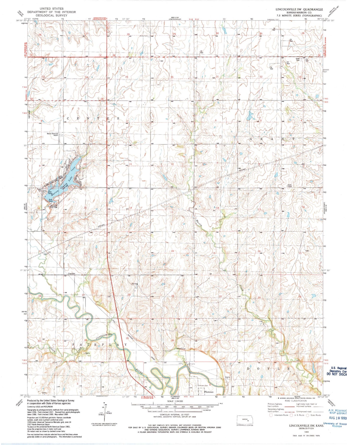
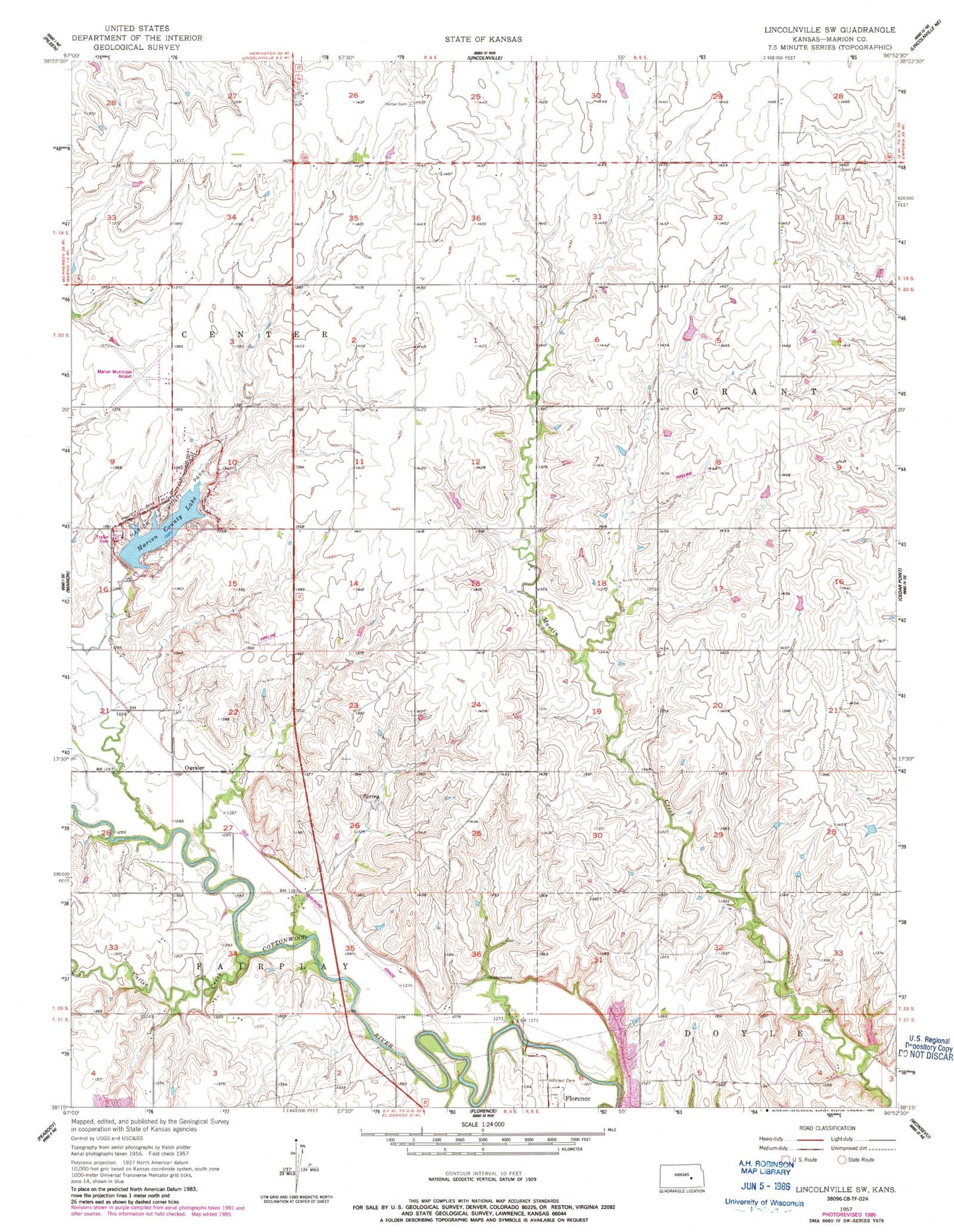
MyTopo
Classic USGS Lincolnville SW Kansas 7.5'x7.5' Topo Map
Couldn't load pickup availability
Historical USGS topographic quad map of Lincolnville SW in the state of Kansas. Map scale may vary for some years, but is generally around 1:24,000. Print size is approximately 24" x 27"
This quadrangle is in the following counties: Marion.
The map contains contour lines, roads, rivers, towns, and lakes. Printed on high-quality waterproof paper with UV fade-resistant inks, and shipped rolled.
Contains the following named places: Bixler School, Brown School, Catlin Creek, City Spring, Folsom School, Folson School, Grant Cemetery, Harter Cemetery, Hillcrest Cemetery, Marion County Dam, Marion County Lake, Marion County Lake Hall, Marion County Park, Marion Municipal Airport, Oursler, Township of Centre, Township of Grant