MyTopo
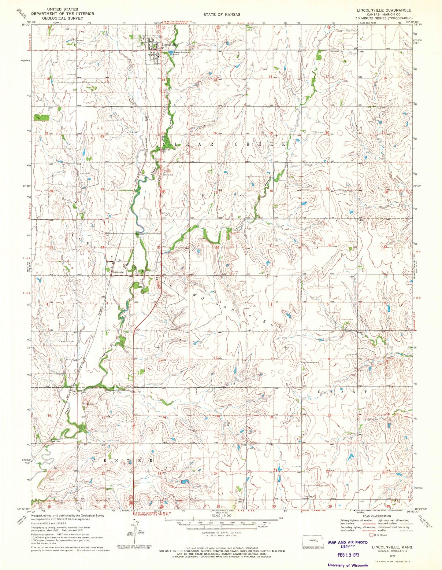
Classic USGS Lincolnville Kansas 7.5'x7.5' Topo Map
Couldn't load pickup availability
Historical USGS topographic quad map of Lincolnville in the state of Kansas. Map scale may vary for some years, but is generally around 1:24,000. Print size is approximately 24" x 27"
This quadrangle is in the following counties: Marion.
The map contains contour lines, roads, rivers, towns, and lakes. Printed on high-quality waterproof paper with UV fade-resistant inks, and shipped rolled.
Contains the following named places: Agricultural Producers Grain Elevator Number 6, Antelope, City of Lincolnville, East Branch Clear Creek, East Creek School, Kleinhammer School, Lincolnville, Lincolnville Cemetery, Lincolnville Community Center, Lincolnville Post Office, Lincolnville United Methodist Church, Lincolnville Wastewater Plant, Lost Creek Oil and Gas Field, Marion County Fire District 5 Lincolnville Fire Department, Oliver School, Pleasant View School, Quarry School, Saint John Lutheran Church, Township of Clear Creek, Youngstown, Youngstown School, Youngtown Church, ZIP Code: 66858