MyTopo
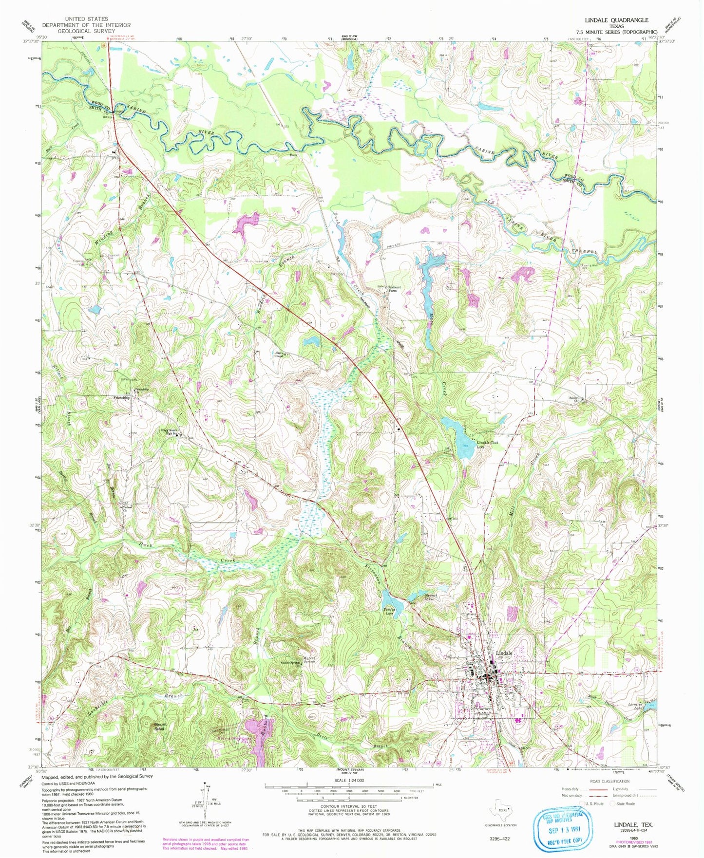
Classic USGS Lindale Texas 7.5'x7.5' Topo Map
Couldn't load pickup availability
Historical USGS topographic quad map of Lindale in the state of Texas. Map scale may vary for some years, but is generally around 1:24,000. Print size is approximately 24" x 27"
This quadrangle is in the following counties: Smith, Wood.
The map contains contour lines, roads, rivers, towns, and lakes. Printed on high-quality waterproof paper with UV fade-resistant inks, and shipped rolled.
Contains the following named places: Bartley Branch, Bell Branch, Bible Baptist Church, Bowdoin Branch, Bragg Morris High School, Carmel Church, Davis Branch, Duck Creek, First United Methodist Church of Lindale, Flewellen Cemetery, Fraser Farm Airport, Friendship, Friendship Church, Hall Branch, Harris Chapel, Harris Chapel Lake, Harris Chapel Lake Dam, Hide-A-Way Lake Number Two, Hubbard Branch, Hubbard Cemetery, Lake-Hide-Away Dam Number 2, Lindale, Lindale City Cemetery, Lindale Club Dam, Lindale Club Lake, Lindale Division, Lindale Fire Department Station 1, Lindale High School, Lindale Intermediate School, Lindale Middle School, Lindale Post Office, Lindale Primary School, Lorraine Lake, Luckeible Branch, Macs Creek, Macs Creek Dam, Macs Creek Lake, Mount Sinai, Oakhurst Farm, Rock Creek, Sabine Church, Smith Lake, Smith Lake Dam, Stevenson Branch, Stewart Lakes, Tomlin Lake, Tomlin Lake Dam, Velma Penny Elementary School, Walnut Spring, Walnut Springs Church, Winding Branch, ZIP Code: 75771