MyTopo
Classic USGS Lindeke Coulee Montana 7.5'x7.5' Topo Map
Regular price
$16.95
Regular price
Sale price
$16.95
Unit price
per
Couldn't load pickup availability
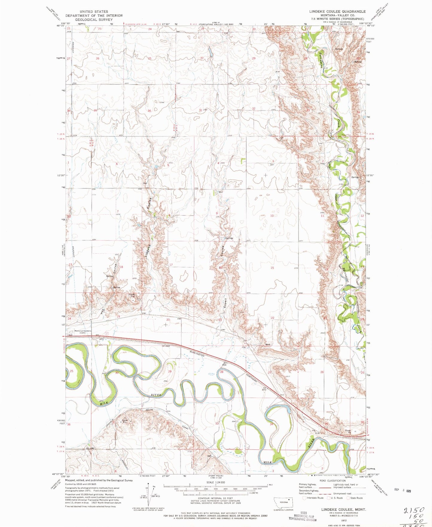
Historical USGS topographic quad map of Lindeke Coulee in the state of Montana. Map scale may vary for some years, but is generally around 1:24,000. Print size is approximately 24" x 27"
This quadrangle is in the following counties: Valley.
The map contains contour lines, roads, rivers, towns, and lakes. Printed on high-quality waterproof paper with UV fade-resistant inks, and shipped rolled.
Contains the following named places: 27N41E02BBDD01 Well, 28N41E20DBAB01 Well, 28N41E30BBAA01 Well, 28N41E32ABBD01 Well, 28N41E35DCCC01 Well, Accord, Accord School, Copeland School, Espeil Coulee, Hay Coulee, Lindeke Coulee, Memorial Gardens, Victory School