MyTopo
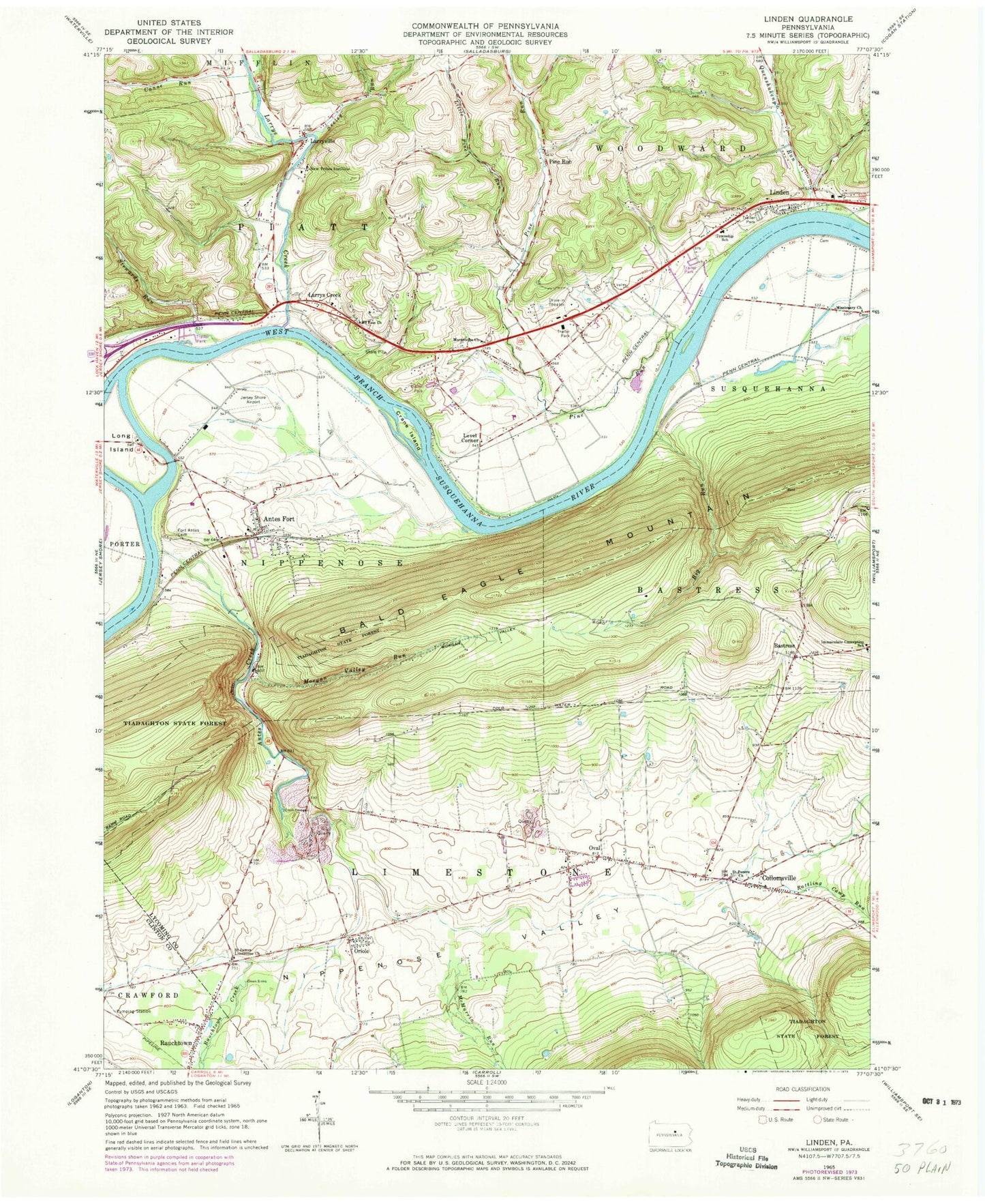
Classic USGS Linden Pennsylvania 7.5'x7.5' Topo Map
Couldn't load pickup availability
Historical USGS topographic quad map of Linden in the state of Pennsylvania. Map scale may vary for some years, but is generally around 1:24,000. Print size is approximately 24" x 27"
This quadrangle is in the following counties: Clinton, Lycoming.
The map contains contour lines, roads, rivers, towns, and lakes. Printed on high-quality waterproof paper with UV fade-resistant inks, and shipped rolled.
Contains the following named places: Antes Creek, Antes Fort, Antes Fort Post Office, Antes Fort Volunteer Fire Company Station 31, Bastress, Big Run, Canoe Run, Collomsville, Crane Island, Ecktown School, Fort Antes Cemetery, Garrett Airport, Gibson Farm Plot Cemetery, Hinaman Acres Airport, Jersey Shore Airport, Jersey Shore Station, Larrys Creek, Larryville, Level Corner, Level Corner School, Limestone Cemetery, Linden, Linden Post Office, Linden Station, Little Pine Run, Long Island, Maranatha Church, Martins School, McMurrin Run, Morgan Valley Run, Morgan Valley School, Mount Zion Church, New Tribes Institute, Nippenose Valley Elementary School, Nippenose Valley Fire Company Station 6, Nippenose Valley Volunteer Fire Company Station 2, Nippono Park, Oriole, Oval, Oval Cemetery, Oval Census Designated Place, Pennsylvania Game Commission Division Office, Pine Creek Quarry, Pine Run, Quenshukeny Run, Rattling Camp Run, Rauchtown Census Designated Place, Rauchtown Creek, River Mill School, Saint James Limestone Church, Saint Peters Church, Saint Peter's Lutheran Church Cemetery, Seeley Run, Stewards Run, Toms Landing Strip, Township of Limestone, Township of Nippenose, Township of Piatt, Township of Susquehanna, Township of Woodward, Whiteoak School, ZIP Code: 17744