MyTopo
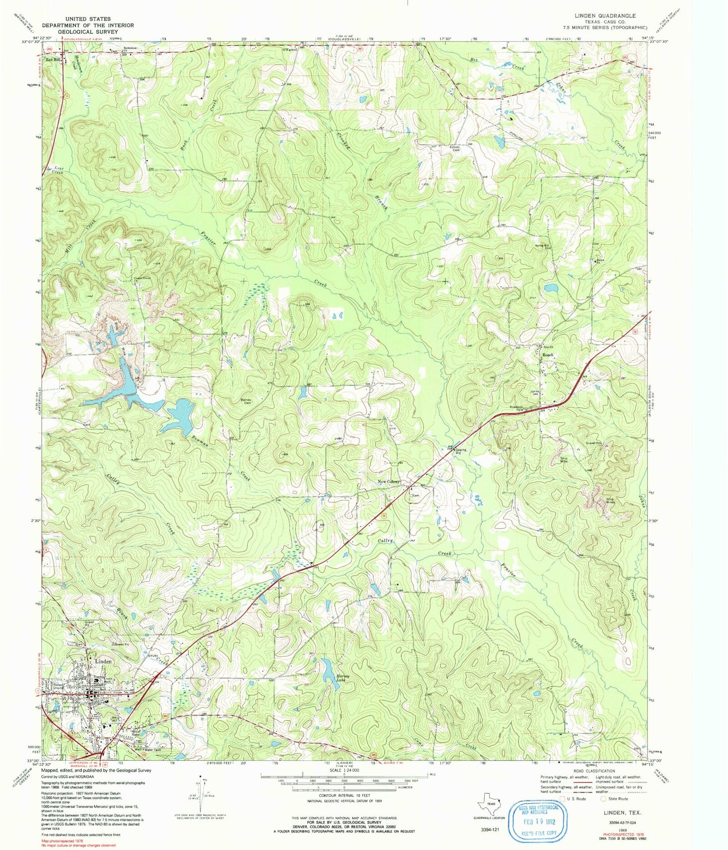
Classic USGS Linden Texas 7.5'x7.5' Topo Map
Couldn't load pickup availability
Historical USGS topographic quad map of Linden in the state of Texas. Map scale may vary for some years, but is generally around 1:24,000. Print size is approximately 24" x 27"
This quadrangle is in the following counties: Cass.
The map contains contour lines, roads, rivers, towns, and lakes. Printed on high-quality waterproof paper with UV fade-resistant inks, and shipped rolled.
Contains the following named places: Barnes Cemetery, Bee Creek, Bethlehem Church, Bowman Creek, Buck Creek, Cass County, Center Grove Church, City of Linden, Colley Creek, Crooked Branch, Echols Cemetery, Foreman Lake, Good Shepherd Medical Center, Harvey Lake, Harvey Lake Dam, Henderson Creek, Linden, Linden City Hall, Linden Police Department, Linden Post Office, Linden Volunteer Fire Department, Lions Park, Lost Creek, Mill Creek, New Colony, O'Farrell, Price Lake, Price Lake Dam, Red Hill, Red Hill Volunteer Fire Department, Roach, Shiloh Church, Silt Retainer Levee, Silt Retainer Reservoir, Spring Hill Church, Texas Forest Service Linden Office, Zion Church