MyTopo
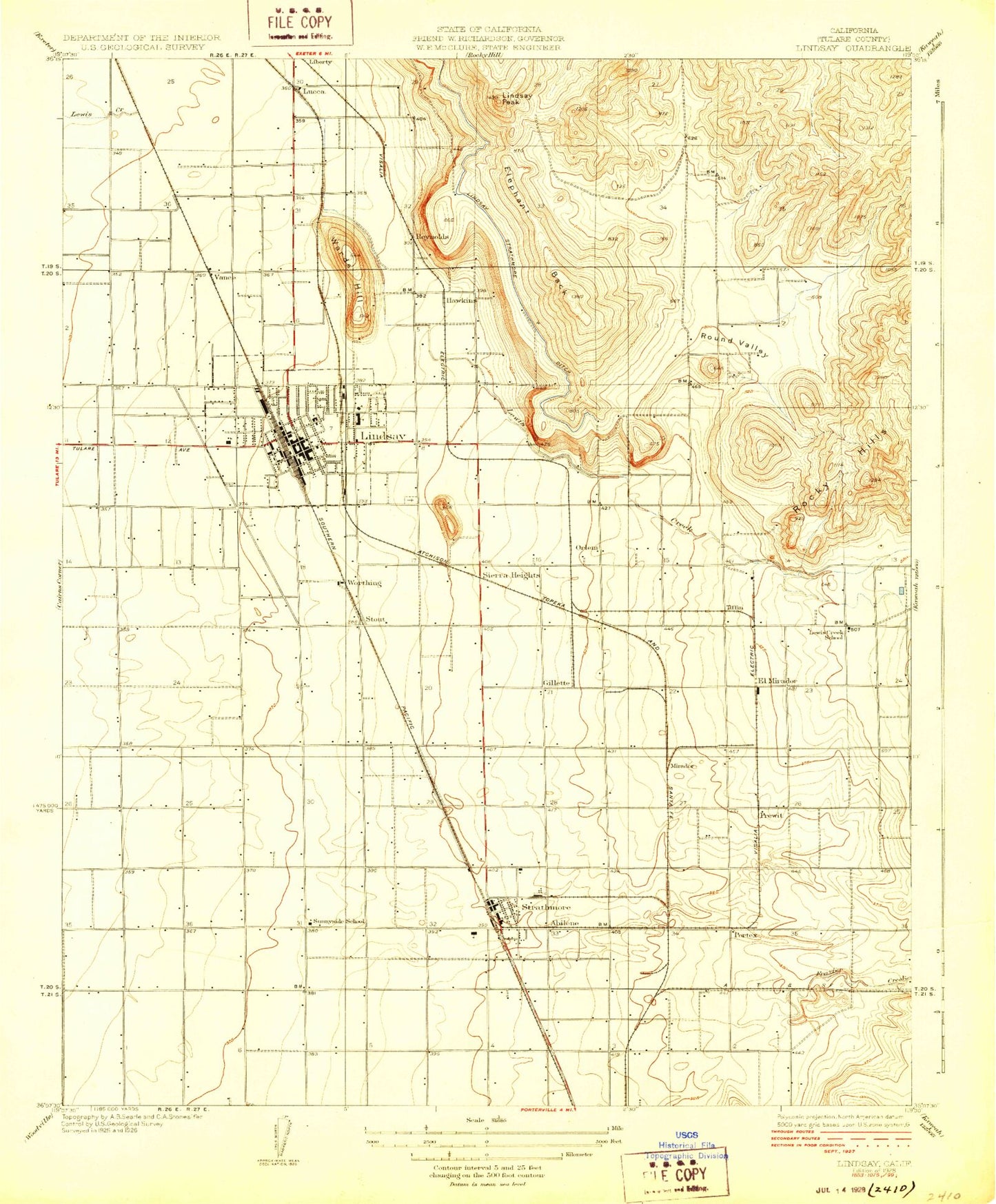
Classic USGS Lindsay California 7.5'x7.5' Topo Map
Couldn't load pickup availability
Historical USGS topographic quad map of Lindsay in the state of California. Map scale may vary for some years, but is generally around 1:24,000. Print size is approximately 24" x 27"
This quadrangle is in the following counties: Tulare.
The map contains contour lines, roads, rivers, towns, and lakes. Printed on high-quality waterproof paper with UV fade-resistant inks, and shipped rolled.
Contains the following named places: Abilene, Apostolic Assembly of God Church, Burr, Chrysoprase Hill, Church of Christ, Church of Jesus Christ, City of Lindsay, Eckert Field, El Mirador, El Rancho Census Designated Place, Elephant Back, Fayette, First Assembly of God Church, First Baptist Church of Lindsay, First Baptist Church of Strathmore, First Church of Christ Scientist, First Church of the Nazarene, First Presbyterian Church, Foursquare Gospel Church, Frazier Creek, Frazier Valley, Friant-Kern Canal, Full Gospel Assembly of God Church, Gillete, Grove High School, Harvard Park, Hawkins, Jefferson Elementary School, Kingdom Hall of Jehovahs Witnesses, La Puerta Abierto, Lewis Creek School, Lincoln Elementary School, Lindsay, Lindsay Branch Tulare County Library, Lindsay Christian Church, Lindsay City Hall, Lindsay City Park, Lindsay Evangelical Friends Church, Lindsay Fire Department, Lindsay Golf Course, Lindsay Hospital Medical Center, Lindsay Lutheran Church, Lindsay Peak, Lindsay Police Department, Lindsay Post Office, Lindsay Senior High School, Lindsay Strathmore Irrigation Ditch, Lindsay Unified School District Office, Lindsay United Methodist Church, Lindsay-Strathmore Building, Lucca, Mirador, Olive Bowl Park, Olive Cemetery, Olivewood Plaza Shopping Center, Orlem, Pentecostal Church of God, Portex, Prewit, Reynolds, Round Valley, Sacred Heart Roman Catholic Church, Saint Andrews Presbyterian Church, Saint James Episcopal Church, Sierra Heights, Steve Garvey Junior High School, Stout, Strathmore, Strathmore Branch Tulare County Library, Strathmore Census Designated Place, Strathmore Continuation High School, Strathmore Division, Strathmore Elementary School, Strathmore High School, Strathmore Indian Reservation, Strathmore Post Office, Sunnyside Elementary School, Tiffin, Todds Hill, Tonyville, Tonyville Census Designated Place, Tulare County Fire Department Battalion 2 Strathmore Fire Station 16, United Pentecostal Church, Vance, Washington Elementary School, Worthing, ZIP Codes: 93247, 93267