
MyTopo
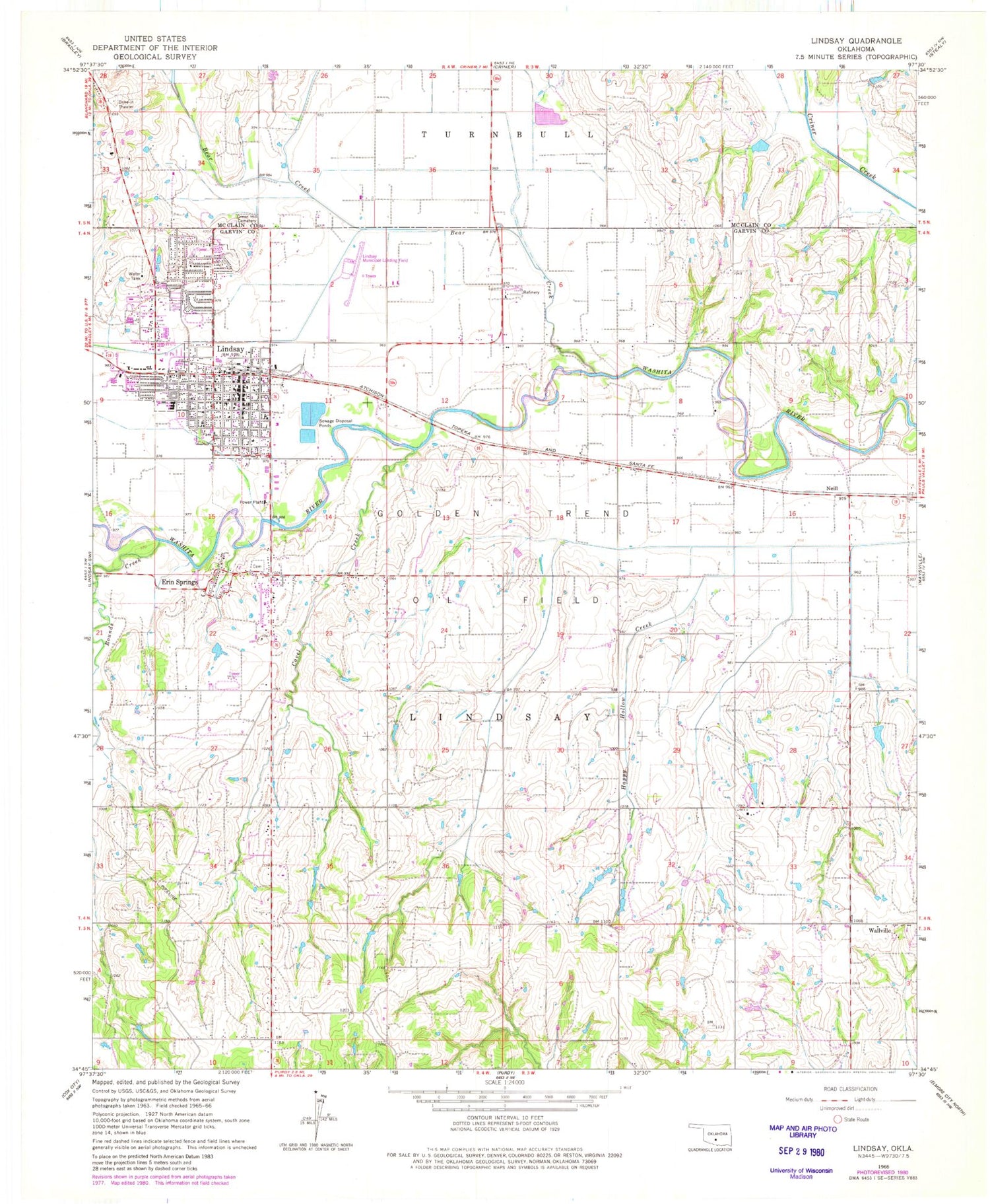
Classic USGS Lindsay Oklahoma 7.5'x7.5' Topo Map
Couldn't load pickup availability
Historical USGS topographic quad map of Lindsay in the state of Oklahoma. Map scale may vary for some years, but is generally around 1:24,000. Print size is approximately 24" x 27"
This quadrangle is in the following counties: Garvin, McClain.
The map contains contour lines, roads, rivers, towns, and lakes. Printed on high-quality waterproof paper with UV fade-resistant inks, and shipped rolled.
Contains the following named places: Bear Creek, Bear Hybarger Site 5 Dam, Bear Hybarger Site 5 Reservoir, Calvary Baptist Church, Cavel Creek, Christian Church, City of Lindsay, Daugherty Gss Number 1 Dam, Daugherty Gss Number 1 Reservoir, Erin Springs, Erin Springs Cemetery, First Baptist Church, Golden Trend Oil Field, Green Hill Cemetery, Hughes School, Hybarger Creek, Lindsay, Lindsay Division, Lindsay Elementary School, Lindsay Emergency Medical Services, Lindsay Fire Department, Lindsay High School, Lindsay Middle School, Lindsay Municipal Airport, Lindsay Police Department, Lindsay Post Office, Maysville Laterals Site H2 Dam, Maysville Laterals Site H2 Reservoir, Maysville Laterals Site H-34 Dam, Maysville Laterals Site H-34 Reservoir, Maysville Laterals Site H5 Dam, Maysville Laterals Site H5 Reservoir, Maysville Laterals Site H6 Dam, Maysville Laterals Site H6 Reservoir, Maysville Laterals Site H7 Dam, Maysville Laterals Site H7 Reservoir, Neill, Oknoname 04916 Dam, Oknoname 04916 Reservoir, Oknoname 04917 Dam, Oknoname 04917 Reservoir, Rounds Creek, Saint Michaels Episcopal Church, Town of Erin Springs, Township of Lindsay, Wallville, ZIP Code: 73052


