MyTopo
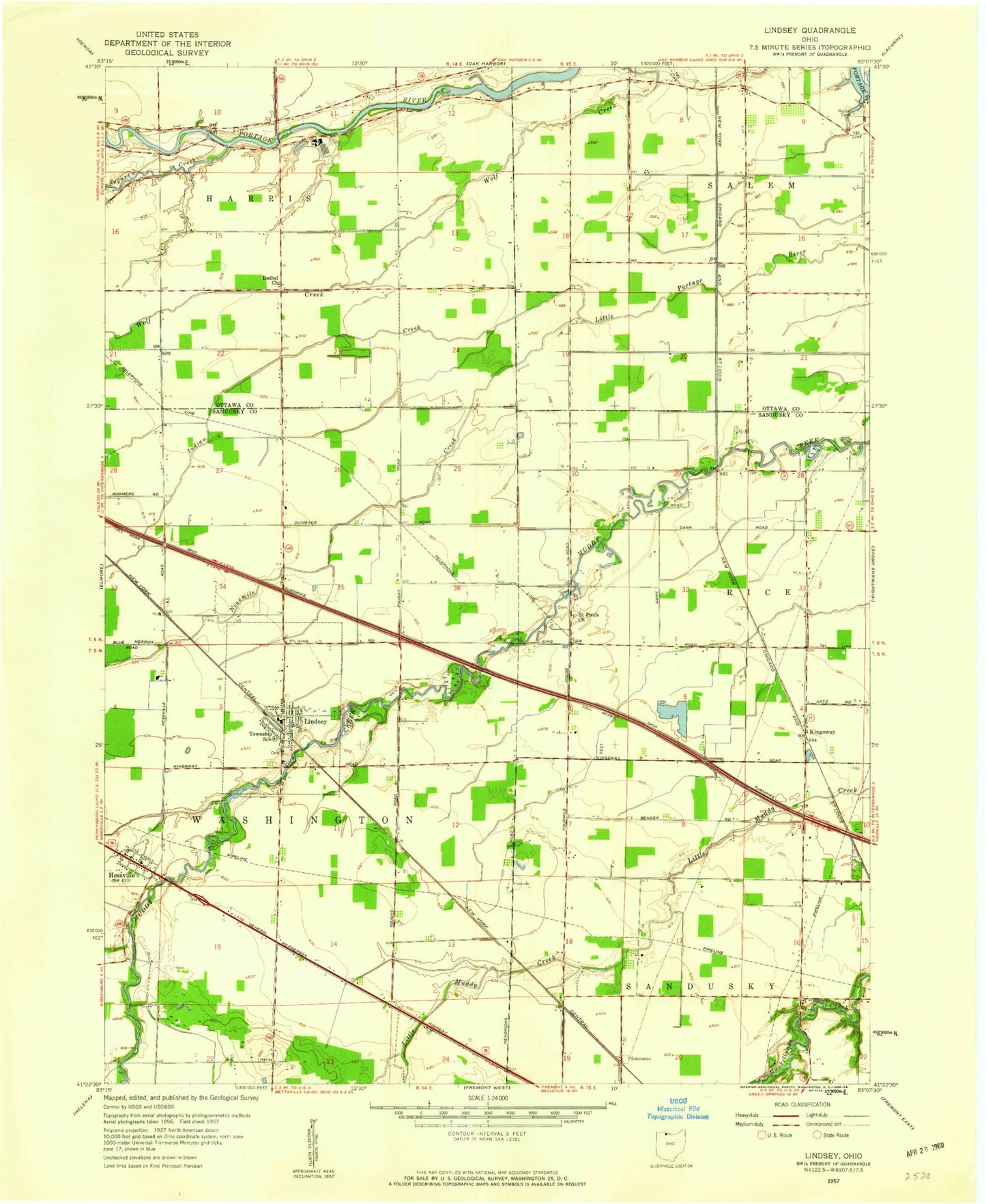
Classic USGS Lindsey Ohio 7.5'x7.5' Topo Map
Couldn't load pickup availability
Historical USGS topographic quad map of Lindsey in the state of Ohio. Map scale may vary for some years, but is generally around 1:24,000. Print size is approximately 24" x 27"
This quadrangle is in the following counties: Ottawa, Sandusky.
The map contains contour lines, roads, rivers, towns, and lakes. Printed on high-quality waterproof paper with UV fade-resistant inks, and shipped rolled.
Contains the following named places: Bethel United Brethren Church, Binkley Cemetery, Hessville, Hessville Cemetery, Hessville Census Designated Place, Hessville Post Office, Hineline Cemetery, Indian Creek, Kingsway, Kingsway Post Office, Lindsey, Lindsey Cemetery, Lindsey Post Office, Lindsey Volunteer Fire Department, Ninemile Creek, Overmyer Cemetery, Roose Cemetery, Saint Pauls Cemetery, Saint Pauls Church, Sandusky Township Fire Department and Emergency Medical Services, Sugar Creek, Township of Salem, Township of Sandusky, Township of Washington, Trinity United Methodist Church, Village of Lindsey, Washington Township School, ZIP Code: 43442