MyTopo
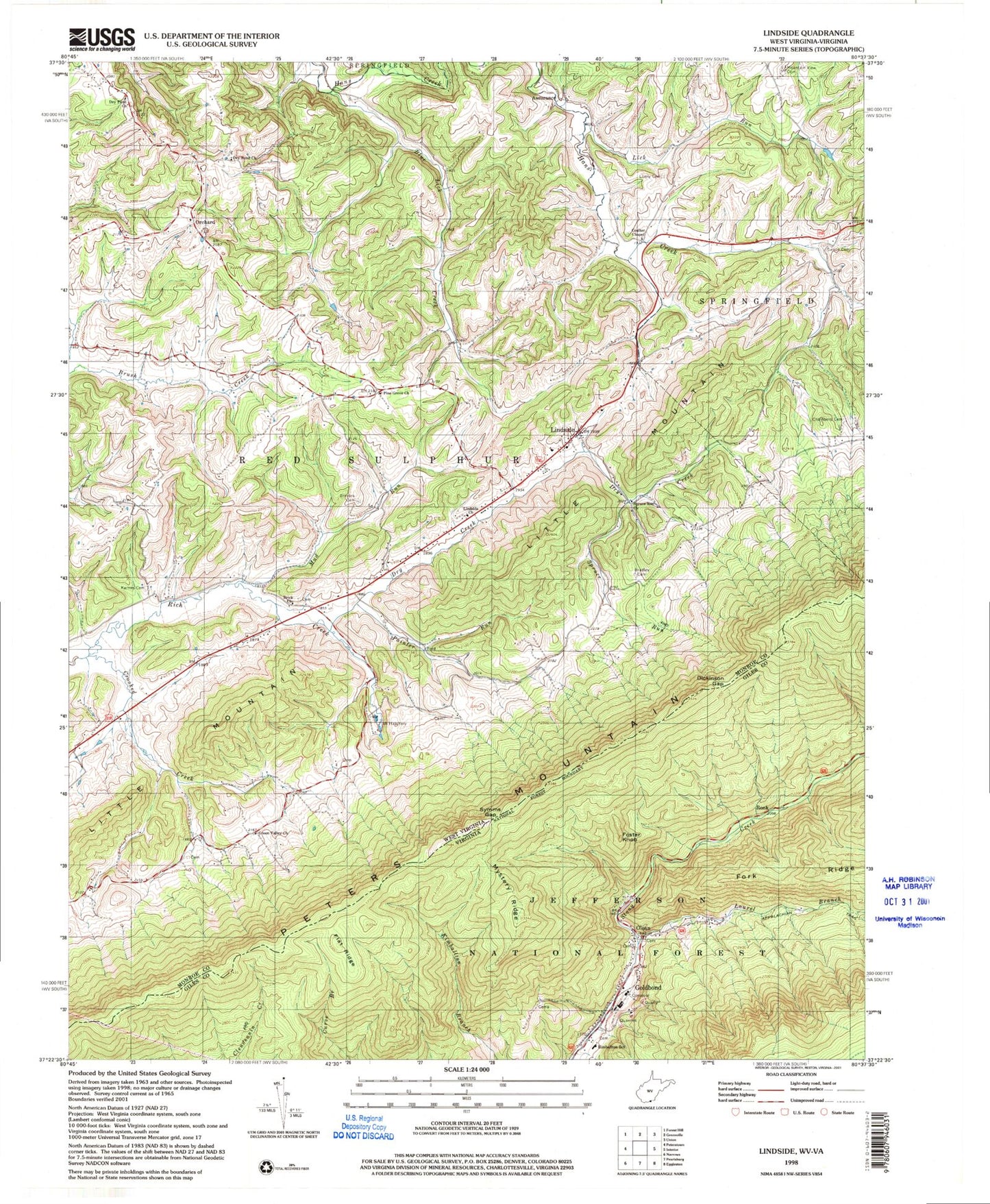
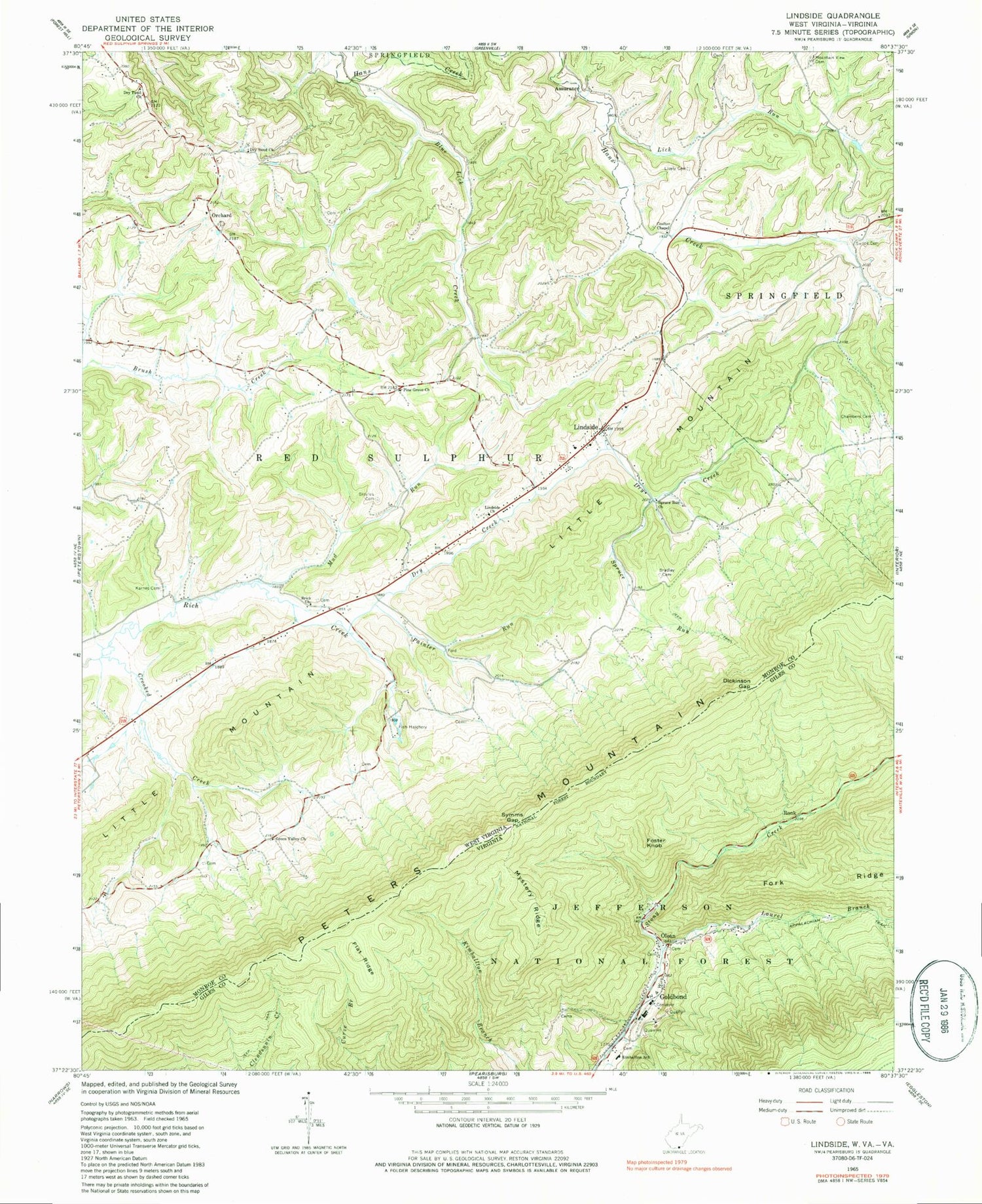
Classic USGS Lindside West Virginia 7.5'x7.5' Topo Map
Couldn't load pickup availability
Historical USGS topographic quad map of Lindside in the states of West Virginia, Virginia. Map scale may vary for some years, but is generally around 1:24,000. Print size is approximately 24" x 27"
This quadrangle is in the following counties: Giles, Monroe.
The map contains contour lines, roads, rivers, towns, and lakes. Printed on high-quality waterproof paper with UV fade-resistant inks, and shipped rolled.
Contains the following named places: Assurance, Blue Lick Creek, Blue Lick School, Bradley Cemetery, Brick Church, Broyles Cemetery, Chambers Cemetery, Coulter Chapel, Coulter Chapel School, Crooked Creek, Dickinson Gap, Dry Creek, Dry Creek School, Dry Pond Church, Dry Pond School, Flat Ridge, Flatwoods Church, Fork Ridge, Foster Knob, Fountain Springs Golf Course, German Baptist Church, Goldbond, Green Valley Church, Green Valley School, James Monroe High School, Karnes Cemetery, Kimballton School, Laurel Branch, Lick Run, Lindside, Lindside Church, Lindside Post Office, Lindside Volunteer Fire Department, Lively Cemetery, Martin Spring, Mercer Anglers Club Spring, Monroe County Spring, Monroe County Technical Center, Mountain View Cemetery, Mud Run, Mystery Ridge, Narrows of Hans Creek, Oak Hill School, Olean, Orchard, Painter Run, Peters Mountain Wilderness, Pine Grove Church, Pine Grove School, Red Sulphur District, Reed Cemetery, Rich Creek Spring, Ronk, Shires School, Spruce Run, Spruce Run Church, Spruce Run School, Swope Cemetery, Swope School, Symms Gap, Union Rescue - Monroe County Transport Station 2, Western District, WHFI-FM (Lindside), ZIP Codes: 24150, 24951