MyTopo
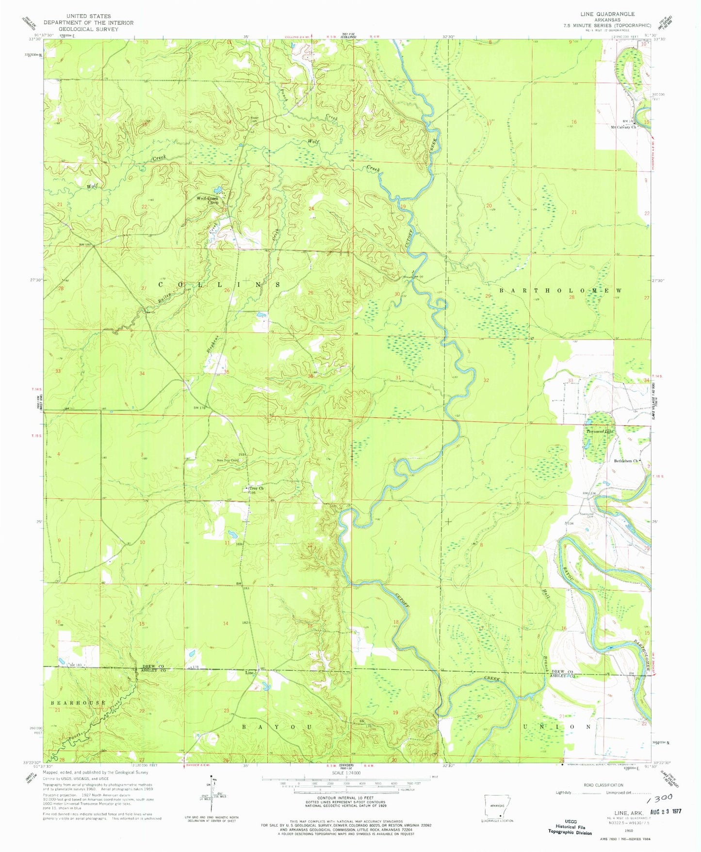
Classic USGS Line Arkansas 7.5'x7.5' Topo Map
Couldn't load pickup availability
Historical USGS topographic quad map of Line in the state of Arkansas. Map scale may vary for some years, but is generally around 1:24,000. Print size is approximately 24" x 27"
This quadrangle is in the following counties: Ashley, Drew.
The map contains contour lines, roads, rivers, towns, and lakes. Printed on high-quality waterproof paper with UV fade-resistant inks, and shipped rolled.
Contains the following named places: Bailey Creek, Bethlehem Church, Cutoff Creek State Wildlife Management Area, Hall Branch, Hedges Ferry, Line, Mount Calvary Church, New Troy Cemetery, Old Troy Cemetery, Punch Creek, Roper Cemetery, Stephens Creek, Townsend Cemetery, Townsend Lake, Township of Collins, Troy, Troy Church, Wolf Creek, Wolf Creek Camp