MyTopo
Classic USGS Lineboro Maryland 7.5'x7.5' Topo Map
Couldn't load pickup availability
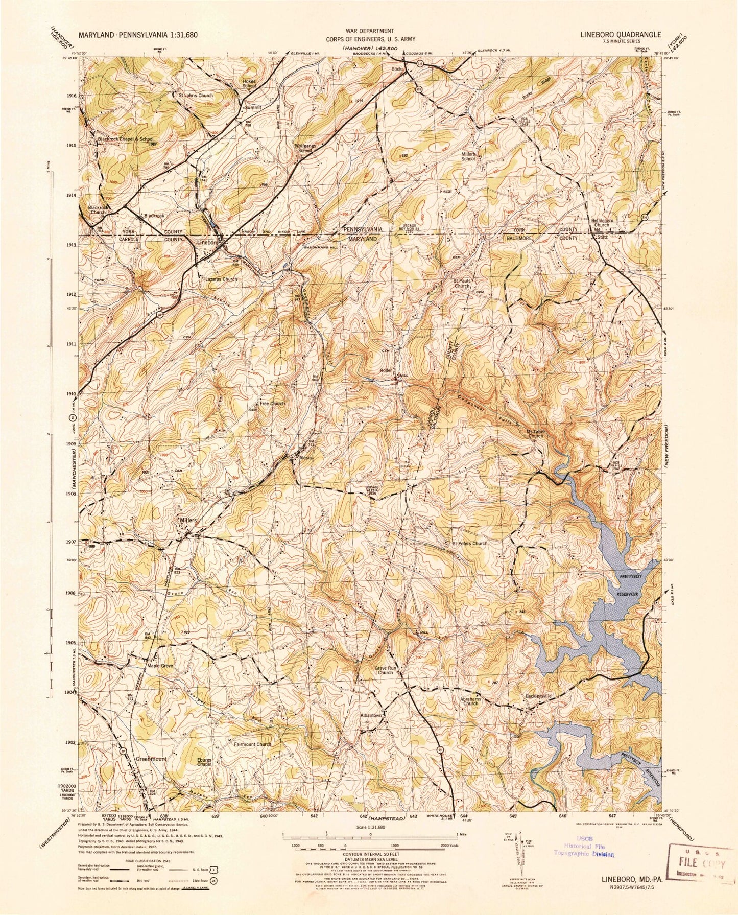
Historical USGS topographic quad map of Lineboro in the states of Maryland, Pennsylvania. Typical map scale is 1:24,000, but may vary for certain years, if available. Print size: 24" x 27"
This quadrangle is in the following counties: Baltimore, Carroll, York.
The map contains contour lines, roads, rivers, towns, and lakes. Printed on high-quality waterproof paper with UV fade-resistant inks, and shipped rolled.
Contains the following named places: South Branch Gunpowder Falls, Abraham Church, Compass Run, Fairmount Church, Free Church, Georges Run, Grave Run, Grave Run Church, Indian Run, Lazarus Church, Mount Tabor Cemetery, Muddy Creek, Poplar Run, Prettyboy Reservoir, Saint Pauls Church, Saint Peters Church, Salem Church, Silver Run, Walker Run, Albantown, Alesia, Beckleysville, Greenmount, Hoffmanville, Lineboro, Maple Grove, Millers, Rockdale, Roller, Breezy Hill Estates, Donney Brook Farms, Foreston Ridge Estates, Grave Run Mills (historical), Gunpowder Acres, Hollinsland, Middletown Downs, Middletown Estates, Mikules Manor, Mount Tabor Church (historical), Prettyboy Trails, Resh Mill Farms, Timberbrook Farm, Walkers Run, Alesia Free Methodist Church Cemetery, Bollinger Cemetery, Brothers Delight, Forest Knoll, Klein Estates, Krohs Mill Post Office (historical), Lazarus Cemetery, Leatherwood, Lineboro Post Office, Millers Post Office, Peaceful Valley, Stansbury Cemetery, Valley Vista, Webers Ridge, Wine Bel Valley, Saint Pauls, Alesia Heights, Baughman Mill (historical), Boones Meadows, Eberseld Mill (historical), Fairmount North, Greenmount Cemetery, Greenmount United Brethren in Christ Church (historical), Greenmount United Methodist Church, Gross Mill Estates, Gunpowder Ridge, Hampstead North Business Center, Happy Valley, Hi-View Estates, Hunt Ridge, Lincoln Manor, Log Schoolhouse Farms, Mason Dixon Estates, Mill Stream Hills, Miller United Brethren of Christ Church (historical), Millers United Methodist Church Cemetery, Millers United Methodist Church, Millwood, North Carroll Community Pond, North Carroll Farms, North Carroll Library, North Carroll Middle School, North Carroll Plaza Shopping Center, Prettyboy Hunt Club, River Valley Ranch, Rockbrook Trailer Park, Rolling Falls Estates, Seven Havens, Showers Old Mill (historical), Smithtown Ridge, Sugar Valley, Sunset Way, Treelin Manor, Vangline Acres, Walbrook Manor, Wil-Mar Acres, Young Mans Fancy, Zimmermans Mennonite Cemetery, Lineboro Spring, Dykes Creek, Carroll County Fire Department Station 7 Lineboro Volunteer Fire Department, Oak Mont Green Golf Course, Rockbrook Village, Kings Tree Farm, Two Springs Buffalo Farm, Galloping Goose Vineyard, Beecher Hill, Bethlehem Church, Blackrock, Blackrock Church, Blackrock School, Hokes School, Millers School, Saint Johns Church, Sticks, Wolfgangs School, Fairs Valley, Fiscal, Hildebrand, Hokes, Stiltz, Intersection