MyTopo
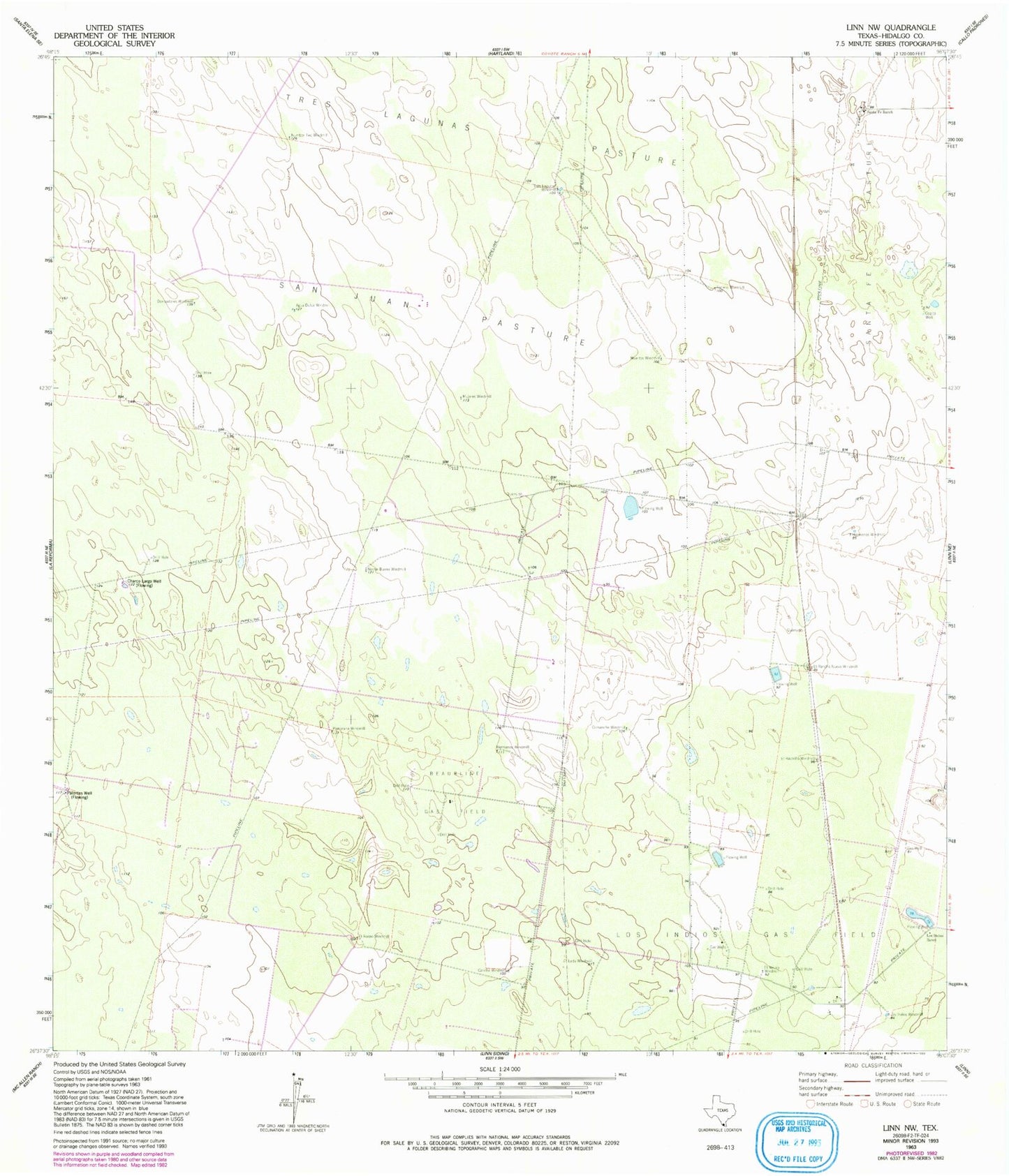
Classic USGS Linn NW Texas 7.5'x7.5' Topo Map
Couldn't load pickup availability
Historical USGS topographic quad map of Linn NW in the state of Texas. Map scale may vary for some years, but is generally around 1:24,000. Print size is approximately 24" x 27"
This quadrangle is in the following counties: Hidalgo.
The map contains contour lines, roads, rivers, towns, and lakes. Printed on high-quality waterproof paper with UV fade-resistant inks, and shipped rolled.
Contains the following named places: Agua Dulce Windmill, Beaurline Gas Field, Caliche Windmill, Comanche Windmill, Copita Well, Devisadores Windmill, El Neuvo Windmill, El Rancho Nuevo Windmill, El Rastrillo Windmill, El Rodeo Windmill, Hermanas Windmill, Hermanos Windmill, Leda Windmill, Los Indios Gas Field, Los Indios Ranch, Los Indios Windmill, Muertos Windmill, Mujeres Windmill, Noche Buena Windmill, Number Two Windmill, Pamorana Windmill, Potrero Windmill, San Juan Pasture, Santa Fe Ranch, Tres Lagunas Windmill