MyTopo
Classic USGS Linn SE Kansas 7.5'x7.5' Topo Map
Regular price
$16.95
Regular price
Sale price
$16.95
Unit price
per
Couldn't load pickup availability
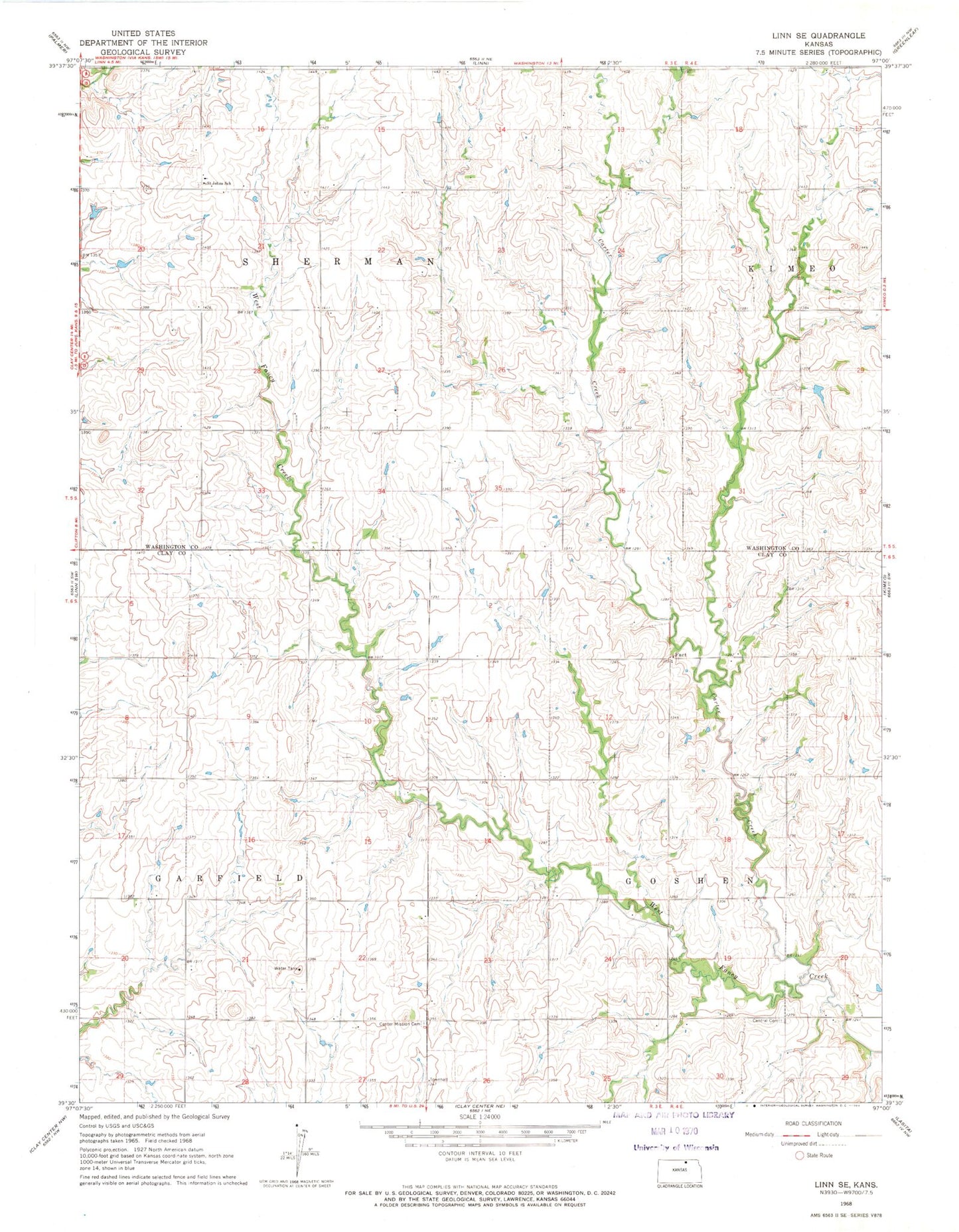
Historical USGS topographic quad map of Linn SE in the state of Kansas. Map scale may vary for some years, but is generally around 1:24,000. Print size is approximately 24" x 27"
This quadrangle is in the following counties: Clay, Washington.
The map contains contour lines, roads, rivers, towns, and lakes. Printed on high-quality waterproof paper with UV fade-resistant inks, and shipped rolled.
Contains the following named places: Carter Creek, Center Mission Cemetery, Central Cemetery, Fact, Fact United Methodist Church, Green Rural Fire Department Station 2, Morganville Area Fire Department Station 2, Saint John Lutheran Church, Township of Goshen, Township of Sherman, ZIP Code: 66962