MyTopo
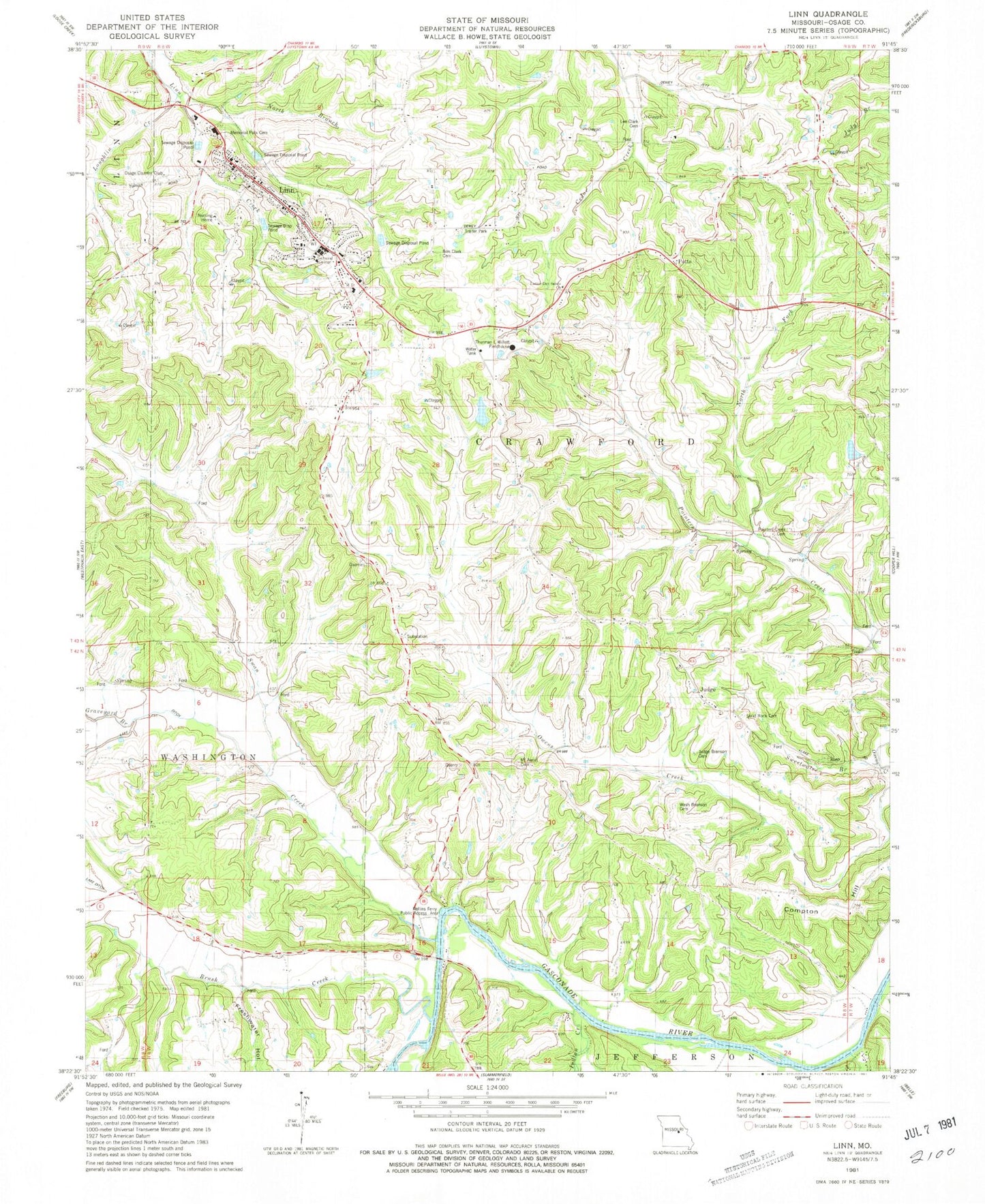
Classic USGS Linn Missouri 7.5'x7.5' Topo Map
Couldn't load pickup availability
Historical USGS topographic quad map of Linn in the state of Missouri. Map scale may vary for some years, but is generally around 1:24,000. Print size is approximately 24" x 27"
This quadrangle is in the following counties: Osage.
The map contains contour lines, roads, rivers, towns, and lakes. Printed on high-quality waterproof paper with UV fade-resistant inks, and shipped rolled.
Contains the following named places: Ben Clark Cemetery, Brush Creek, Buck Creek, Byington Lake, Byington Lake Dam, City of Linn, Clark - Mahan Cemetery, Compton Hill, Forest Grove School, Fresh Water Hollow, Graveyard Branch, Indian Creek, Judge, Judge Branson Cemetery, Latter Day Saints Church, Leboeuf Creek, Lee Dills Dam, Lee Dills Lake, Linn, Linn Fire Protection District Station 1, Linn Fire Protection District Station 3, Linn Nursing Home, Linn Police Department, Linn Post Office, Linn Public Cemetery, Linn Technical College, Lone Star School, Loughlin Creek, Missouri Department of Conservation Forestry Central Regional Field Fire Office Linn, Mount Aerial Church, Mount Aerial School, Mount Aeriel Cemetery, North Fork Pointers Creek, Osage Country Club, Osage County, Osage County Sheriff's Office, Owen Mills, Pointers Creek Cemetery, Pointers Creek School, Potts, Potts School, Rohlfing Dam, Rollins Ferry Public Access Area, Saint Georges Catholic Church, Solid Rock Cemetery, State Technical College of Missouri Airport, Swan Creek, Swan Lake, Sweetwater Branch, Thurman L Willett Fieldhouse, Township of Crawford, Victor School, Washington - Branson Cemetery, ZIP Code: 65051