MyTopo
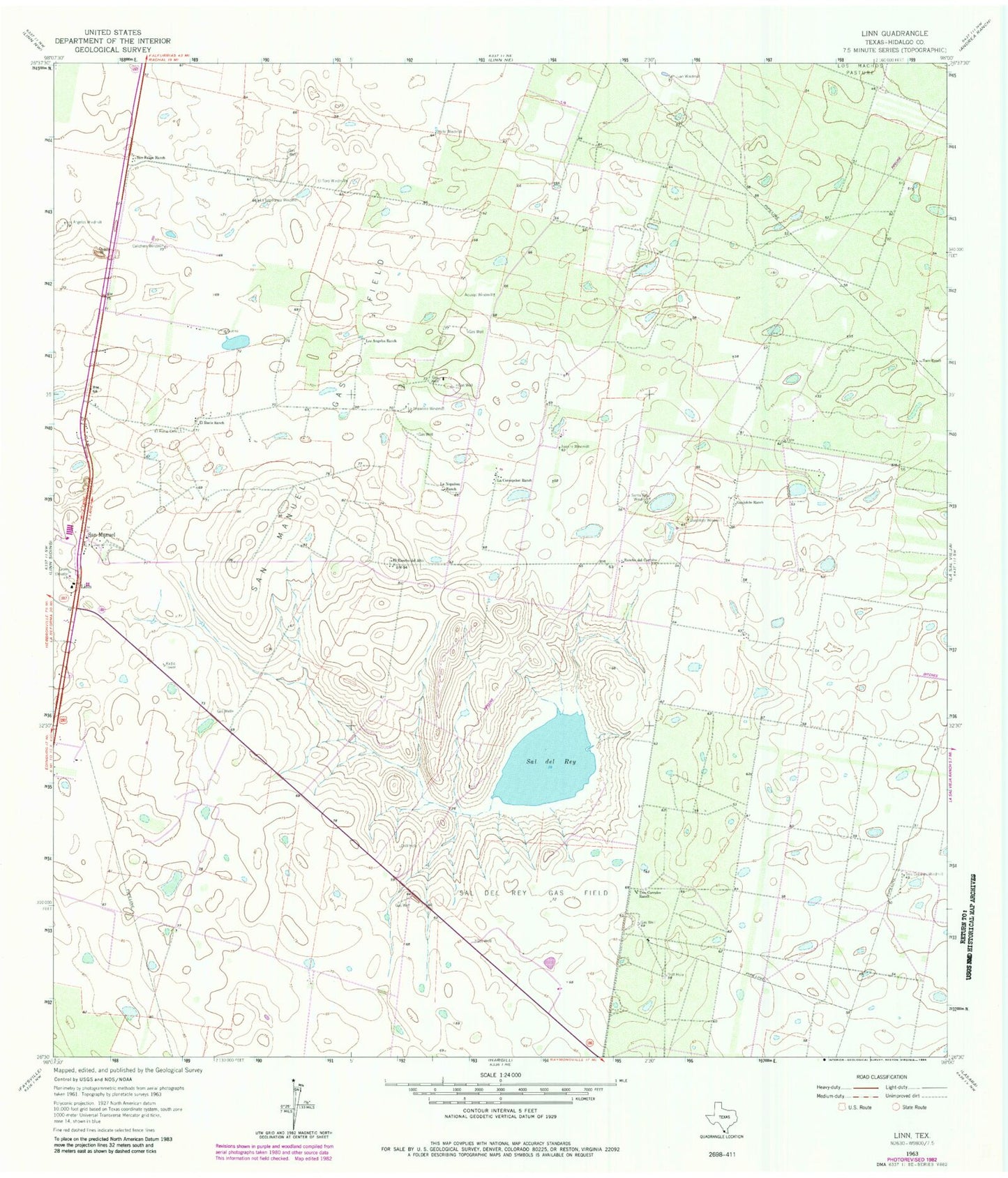
Classic USGS Linn Texas 7.5'x7.5' Topo Map
Couldn't load pickup availability
Historical USGS topographic quad map of Linn in the state of Texas. Map scale may vary for some years, but is generally around 1:24,000. Print size is approximately 24" x 27"
This quadrangle is in the following counties: Hidalgo.
The map contains contour lines, roads, rivers, towns, and lakes. Printed on high-quality waterproof paper with UV fade-resistant inks, and shipped rolled.
Contains the following named places: Aquage Windmill, Atole Windmill, Calichera Windmill, El Rancho del Alto, El Rucio Cemetery, El Rucio Ranch, El Toro Windmill, Guajolote Ranch, Guajolote Windmill, Juanita Windmill, La Concepcion Ranch, La Esperansa Windmill, La Nopalosa Ranch, La Nopalosa Windmill, La Santa Rita Windmill, Linn, Linn San Manuel Volunteer Fire Department, Los Angeles Ranch, Los Angeles Windmill, Rancho del Carmine, Sal del Ray, Sal del Rey Gas Field, San Felipe Ranch, San Manuel, San Manuel Gas Field, Taco Ranch, Tres Corrales Ranch, Tres Corrales Windmill