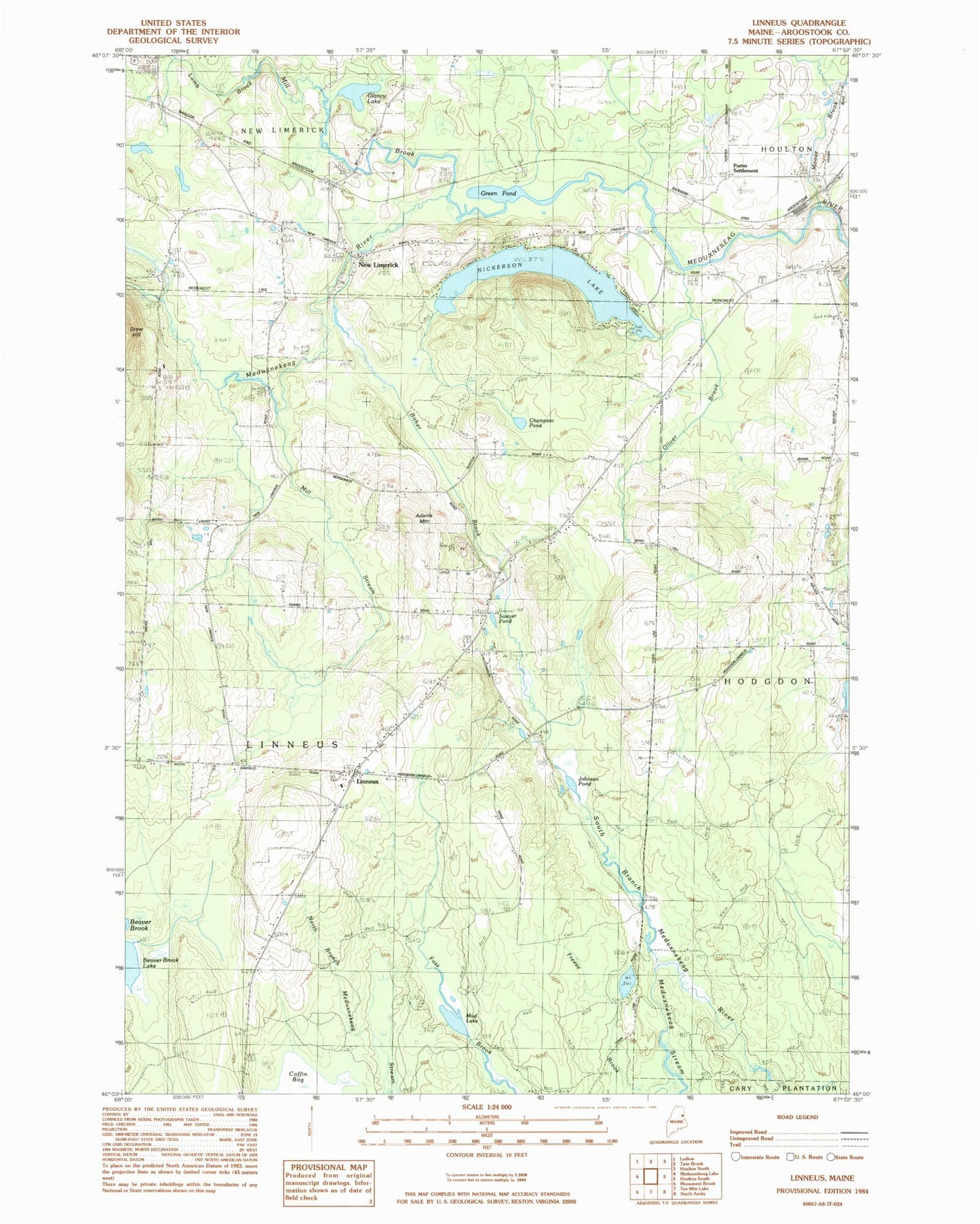
MyTopo
Classic USGS Linneus Maine 7.5'x7.5' Topo Map
Couldn't load pickup availability
Historical USGS topographic quad map of Linneus in the state of Maine. Map scale may vary for some years, but is generally around 1:24,000. Print size is approximately 24" x 27"
This quadrangle is in the following counties: Aroostook.
The map contains contour lines, roads, rivers, towns, and lakes. Printed on high-quality waterproof paper with UV fade-resistant inks, and shipped rolled.
Contains the following named places: Adams Mountain, Champion Pond, Clough School, Drew School, Freeze Brook, Glancy Lake, Green Pond, Hatfield School, Houlton Community Golf Course, Hunter Pond, Johnson Pond, Linneus, Linneus Cemetery, Linneus Free Will Baptist Church, Linneus Volunteer Fire Department, Meduxnekeag Stream, Mill Brook, Mill Stream, Moose Brook, Mud Lake, New Limerick, New Limerick Cemetery, New Limerick Freewill Baptist Church, Nickerson Lake, Peoples Church, Porter Settlement, Sawyer Pond, Town of Linneus, Town of New Limerick, ZIP Code: 04761