MyTopo
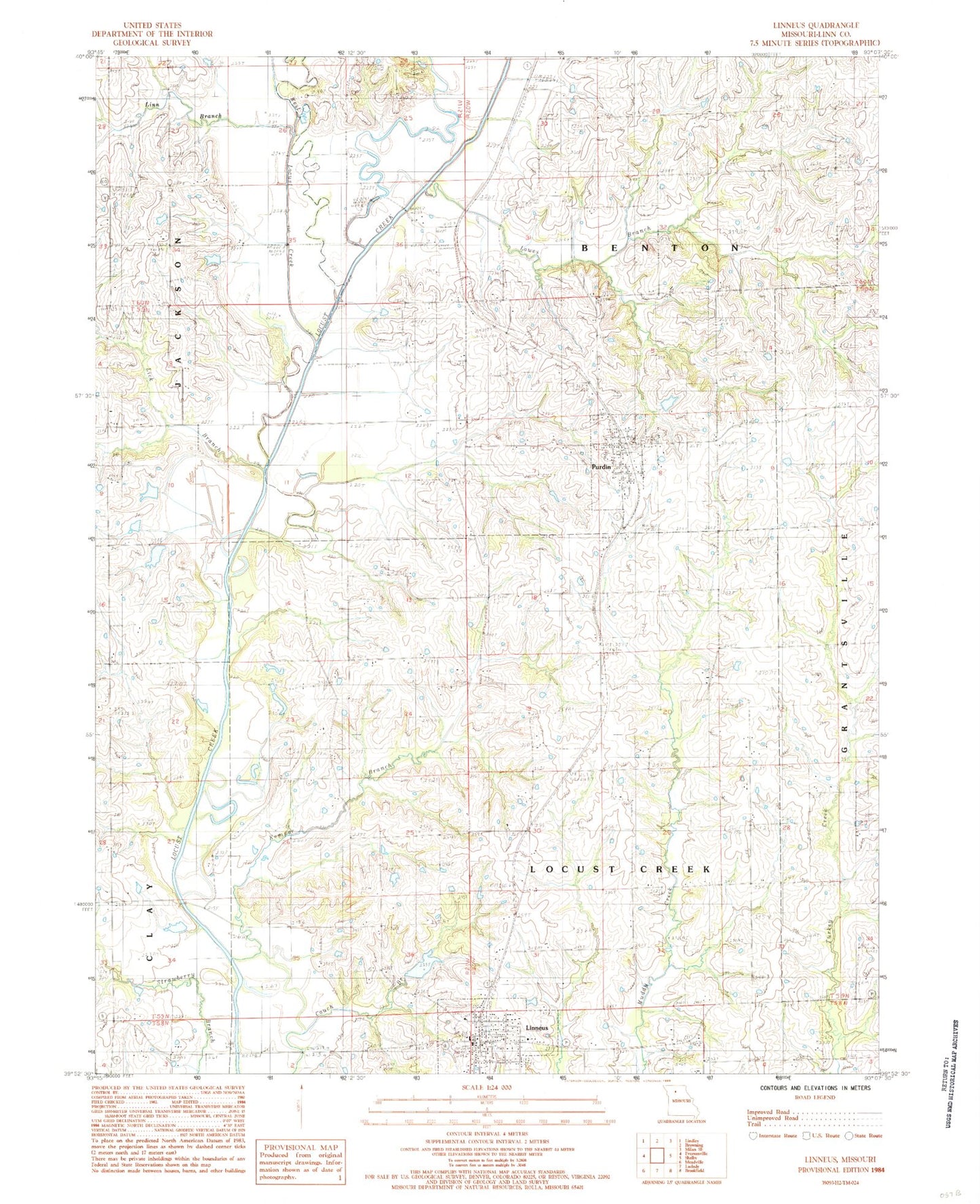
Classic USGS Linneus Missouri 7.5'x7.5' Topo Map
Couldn't load pickup availability
Historical USGS topographic quad map of Linneus in the state of Missouri. Map scale may vary for some years, but is generally around 1:24,000. Print size is approximately 24" x 27"
This quadrangle is in the following counties: Linn.
The map contains contour lines, roads, rivers, towns, and lakes. Printed on high-quality waterproof paper with UV fade-resistant inks, and shipped rolled.
Contains the following named places: Brown School, City of Linneus, City of Purdin, Couch Branch, Dryden Cemetery, Gooch Cemetery, Gooch School, Greenview School, Hale Lake Dam, Henning Lake Dam, Lee School, Liberty School, Lick Branch, Light School, Linn Branch, Linn County Sheriff's Office, Linneus, Linneus Fire Protection District, Linneus Lake Dam, Linneus Post Office, Linneus Reservoir, Lowes Branch, Magnolia Church, Number 217 Reservoir, Oak Grove School, Pierce School, Pleasant Point School, Pleasant Shade School, Purdin, Purdin Post Office, Southerland Cemetery, Township of Benton, Township of Locust Creek, West Locust Creek, Woodview School, ZIP Codes: 64653, 64674