
MyTopo
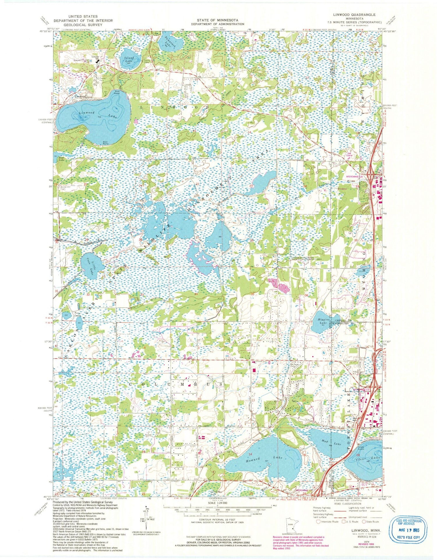
Classic USGS Linwood Minnesota 7.5'x7.5' Topo Map
Couldn't load pickup availability
Historical USGS topographic quad map of Linwood in the state of Minnesota. Map scale may vary for some years, but is generally around 1:24,000. Print size is approximately 24" x 27"
This quadrangle is in the following counties: Anoka, Chisago, Washington.
The map contains contour lines, roads, rivers, towns, and lakes. Printed on high-quality waterproof paper with UV fade-resistant inks, and shipped rolled.
Contains the following named places: Calvary Cemetery, Camp Salie, Carlos Avery State Wildlife Management Area, City of Columbus, Clear Lake, Columbus, Columbus Elementary School, County Ditch Number Fortyfour, County Ditch Number Thirtyfive, County Ditch Number Thirtyone, Crossroads Church, Fairview Lakes Medical Center, Forest Lake South Bound Rest Area, Greenwood Golf Links, Higgins Lake, Howard Lake, Immanuel Baptist Church, Island Lake, Linwood, Linwood Covenant Church, Linwood Elementary School, Linwood Lake, Linwood Post Office, Little Coon Lake, Mud Lake, Oak Park Cemetery, Tamarack Lake, Township of Columbus, Township of Linwood, Twin Lakes, Victor Hill Cemetery, WLKX-FM (Forest Lake), ZIP Codes: 55025, 55092


