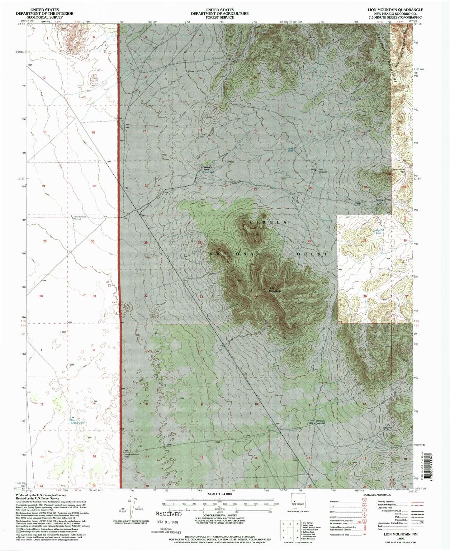
MyTopo
Classic USGS Lion Mountain New Mexico 7.5'x7.5' Topo Map
Regular price
$16.95
Regular price
Sale price
$16.95
Unit price
per
Couldn't load pickup availability
Historical USGS topographic quad map of Lion Mountain in the state of New Mexico. Map scale may vary for some years, but is generally around 1:24,000. Print size is approximately 24" x 27"
This quadrangle is in the following counties: Socorro.
The map contains contour lines, roads, rivers, towns, and lakes. Printed on high-quality waterproof paper with UV fade-resistant inks, and shipped rolled.
Contains the following named places: Antelope Flats, Double H Ranch, East Chavez Tank, East Tank, East Windmill, High Lonesome Well, Indian Tank, Lion Mountain, Little Well, Midway Well, Montosas Deep Well, Pat Well, Three Section Windmill, Whiskey Well Tank