MyTopo
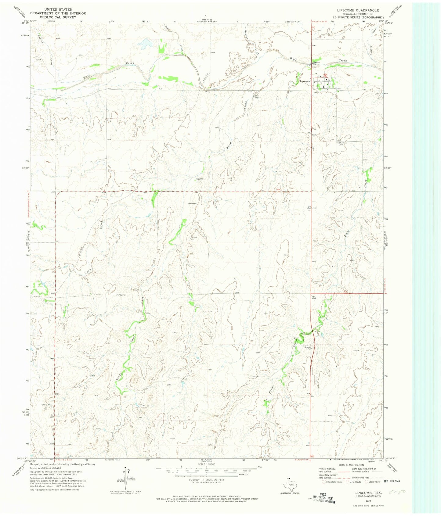
Classic USGS Lipscomb Texas 7.5'x7.5' Topo Map
Couldn't load pickup availability
Historical USGS topographic quad map of Lipscomb in the state of Texas. Map scale may vary for some years, but is generally around 1:24,000. Print size is approximately 24" x 27"
This quadrangle is in the following counties: Lipscomb.
The map contains contour lines, roads, rivers, towns, and lakes. Printed on high-quality waterproof paper with UV fade-resistant inks, and shipped rolled.
Contains the following named places: Chicken Creek, Dugout Creek, Fifth Creek, Fourth Creek, Gene Howe Wildlife Management Area - Murphy Unit, Higgins - Lipscomb Volunteer Fire Department Station 2, Higgins Division, Lipscomb, Lipscomb Cemetery, Lipscomb Census Designated Place, Lipscomb County Sheriff's Office, Lipscomb Post Office, Little Sand Creek, Saint John's Lutheran Cemetery, Sand Creek, Wolf Creek Heritage Museum