
MyTopo
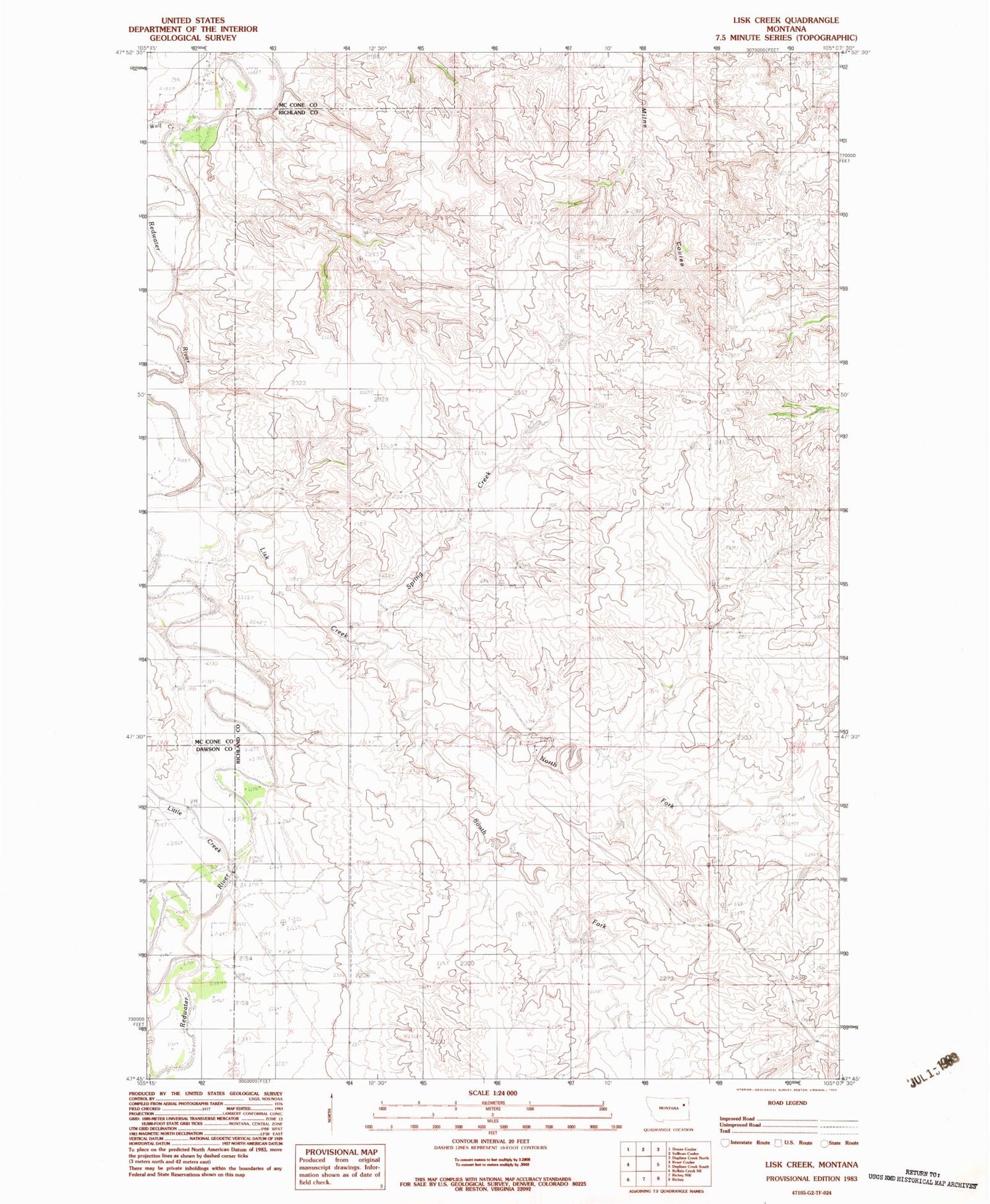
Classic USGS Lisk Creek Montana 7.5'x7.5' Topo Map
Couldn't load pickup availability
Historical USGS topographic quad map of Lisk Creek in the state of Montana. Map scale may vary for some years, but is generally around 1:24,000. Print size is approximately 24" x 27"
This quadrangle is in the following counties: Dawson, McCone, Richland.
The map contains contour lines, roads, rivers, towns, and lakes. Printed on high-quality waterproof paper with UV fade-resistant inks, and shipped rolled.
Contains the following named places: 23N51E04ABBB01 Well, 23N51E04ABBC01 Well, 23N51E04ABBC02 Well, 24N51E08CBCD01 Well, 24N51E18D___01 Well, 25N50E35DBAA01 Well, 25N50E36CBBB01 Well, Bickett Coulee, H S Coulee, Kraut Coulee, Lisk Creek, Little Creek, North Fork Lisk Creek, South Fork Lisk Creek, Spring Creek, Wolf Creek


