MyTopo
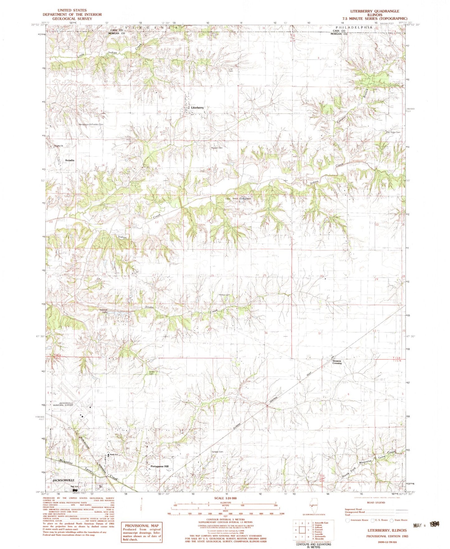
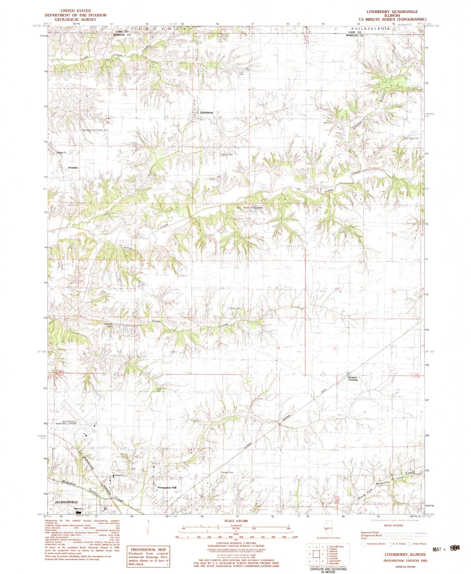
Classic USGS Literberry Illinois 7.5'x7.5' Topo Map
Couldn't load pickup availability
Historical USGS topographic quad map of Literberry in the state of Illinois. Map scale may vary for some years, but is generally around 1:24,000. Print size is approximately 24" x 27"
This quadrangle is in the following counties: Cass, Morgan.
The map contains contour lines, roads, rivers, towns, and lakes. Printed on high-quality waterproof paper with UV fade-resistant inks, and shipped rolled.
Contains the following named places: Arcadia, Arcadia Cemetery, Arcadia Church, Brownton, Brush College School, Cavanaugh Bluff, Clark Chapel, Conover Branch, Crazy Horse Campground, Fretag Lake, Fretag Lake Dam, Hazel Green Cemetery, Henderson - McFadden Cemetery, Hickory Grove School, Independence School, Jacksonville High School, Jacksonville Municipal Airport, Liter Cemetery, Literberry, Literberry Census Designated Place, Literberry Election Precinct, Literberry Post Office, Little Indian Creek, Mauvaise Terre School, North Jacksonville School, North Oakland School, Oak Ridge Cemetery, Oak Ridge School, Phillips Cemetery, Portuguese Hill, Prairie Union School, Rucker Cemetery, Sample Cemetery, Savage, Sherman School, Snake Creek, Strawns Crossing, Trinidad School, Union Grove School, Valevue Lake, Valevue Lake Dam