MyTopo
Classic USGS Little Bowstring Lake Minnesota 7.5'x7.5' Topo Map
Couldn't load pickup availability
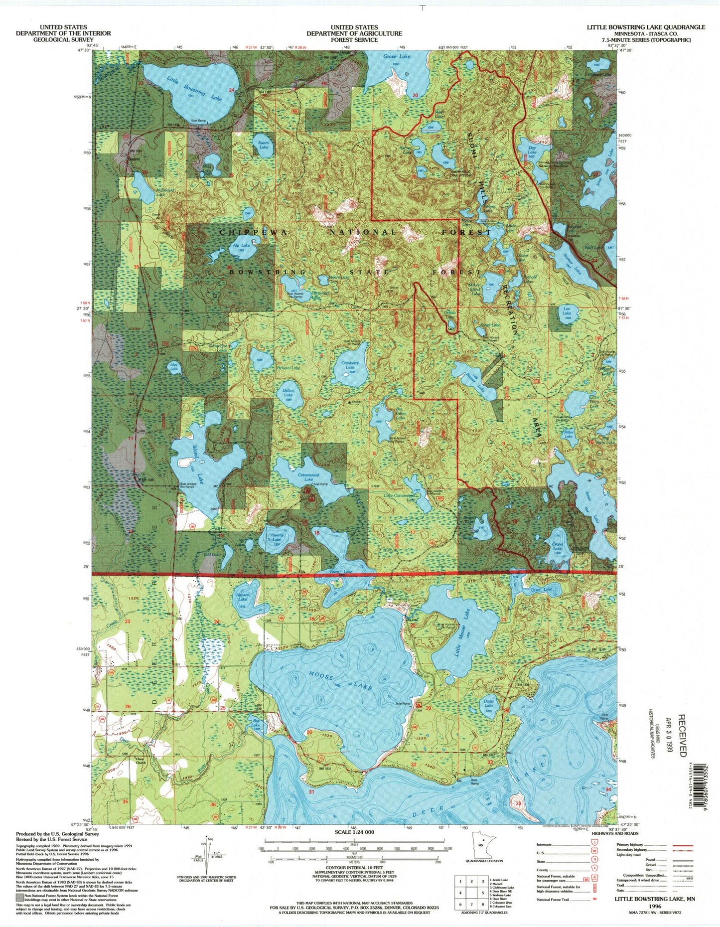
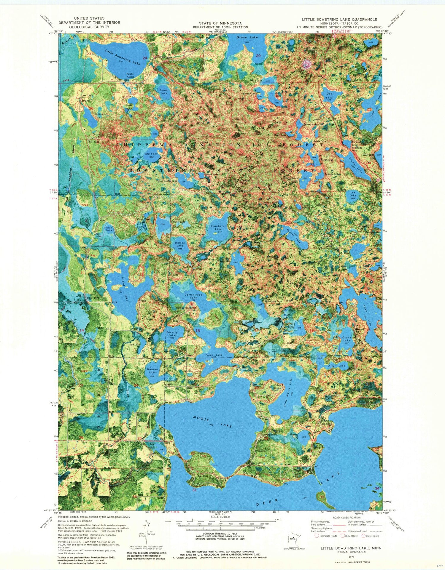
Historical USGS topographic quad map of Little Bowstring Lake in the state of Minnesota. Typical map scale is 1:24,000, but may vary for certain years, if available. Print size: 24" x 27"
This quadrangle is in the following counties: Itasca.
The map contains contour lines, roads, rivers, towns, and lakes. Printed on high-quality waterproof paper with UV fade-resistant inks, and shipped rolled.
Contains the following named places: Adele Lake, Alex Lake, Alp Lake, Amen Lake, Hooligan Lake, Balloon Lake, Bay Lake, Beaver Lake, Beaver Lake, Big Green Lake, Big Horn Lake, Camp Five Lakes, Carpenter Lake, Clara Church, Cottonwood Lake, Cranberry Lake, Crane Lake, Dalton Lake, Day Lake, Deer Lake, Doam Lake, Doctor Lake, Edd Lake, Fawn Lake, Forjer Lake, Grave Lake, Green Lake, Hanson Lake, Island Lake, Island Lake Creek, Jim Lake, Kremer Lake, Lee Lake, Little Bowstring Lake, Little Cottonwood Lake, Little Horn Lake, Little Moose Lake, Maki Lake, McDonald Lake, Miller Lake, Moore Lake, Moose Lake, Mud Lake, Myers Lake, Mystery Lake, Otter Lake, Oxbow Lake, Pickerel Lake, Pothole Lake, Poverty Lake, Spruce Island Lake, Suomi, Suomi Church, Suomi Lake, Surprise Lake, Suomi Hills Recreation Area, Suomi Hills Trail System, Day Lake Lookout Tower, Township of Deer River, Deer Lake Dam, Boiler Lake, Suomi Post Office (historical), Surprise Lake Wayside Park