
MyTopo
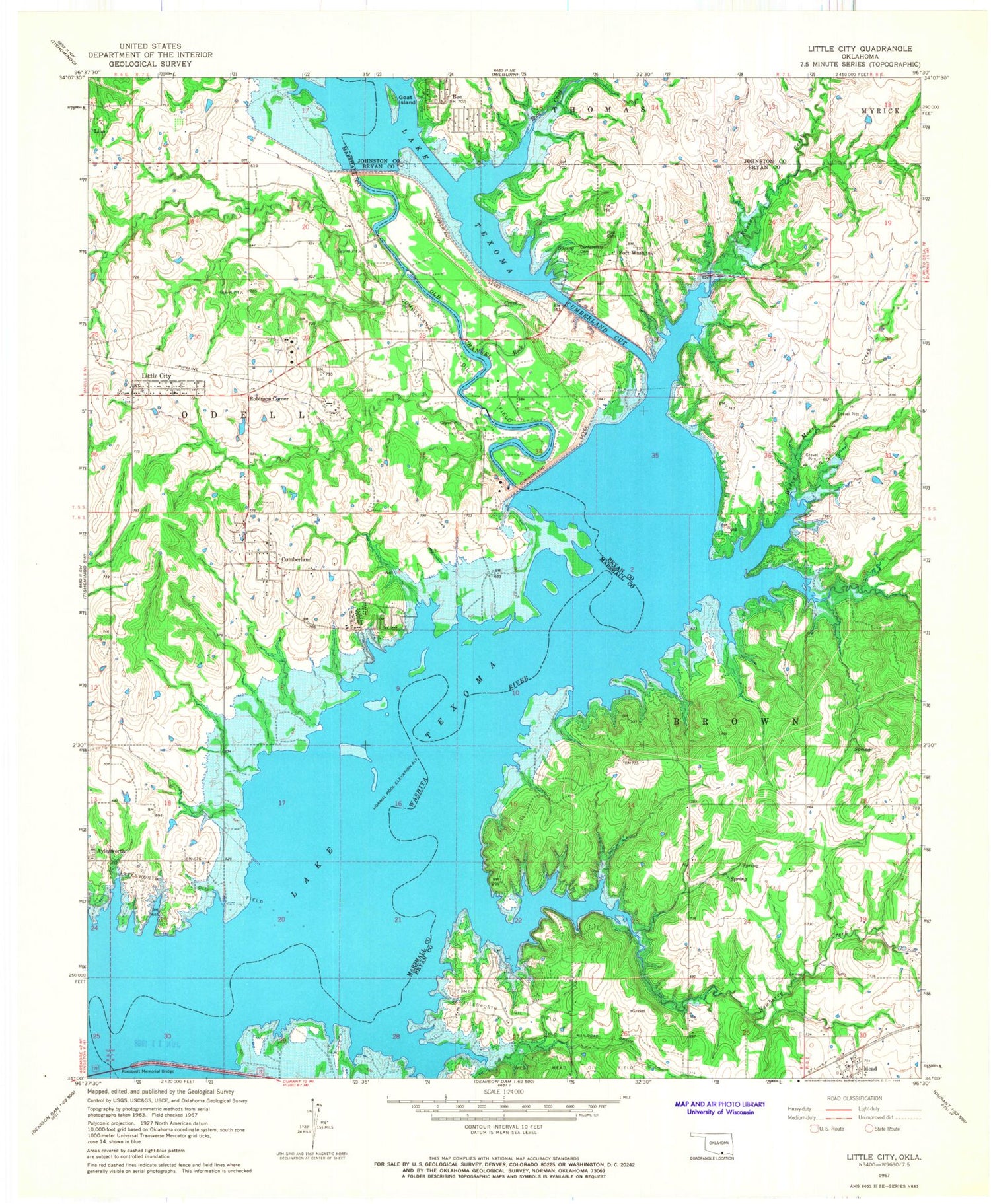
Classic USGS Little City Oklahoma 7.5'x7.5' Topo Map
Couldn't load pickup availability
Historical USGS topographic quad map of Little City in the state of Oklahoma. Map scale may vary for some years, but is generally around 1:24,000. Print size is approximately 24" x 27"
This quadrangle is in the following counties: Bryan, Johnston, Marshall.
The map contains contour lines, roads, rivers, towns, and lakes. Printed on high-quality waterproof paper with UV fade-resistant inks, and shipped rolled.
Contains the following named places: Aylesworth Cemetery, Bee, Confederate Cemetery, Cumberland, Cumberland Cemetery, Cumberland Census Designated Place, Cumberland Cut, Cumberland Levee, Cumberland Oil Field, Denny McCoy 1 Dam, Denny McCoy 1 Reservoir, Fort Washita, Goat Island, Kansas Creek, Lakewood Volunteer Fire Department, Linn, Little City, Little City Census Designated Place, Mead Post Office, Newberry Creek, Oknoname 013018 Dam, Oknoname 013018 Reservoir, Oknoname 023001 Dam, Oknoname 023001 Reservoir, Old Channel Washita River, Post Cemetery, Robinson Corner, Rock Creek, Southeast Aylesworth Oil Field, Texoma Public Hunting Area, Township of Brown, Tri - City Fire Department, Tri - City Fire Department Station 2, Weder Number 1 Dam, Weder Number 1 Reservoir, West Bryan County Fire and Rescue, West Mead Oil Field, Widow Moore Creek, ZIP Code: 73449


