MyTopo
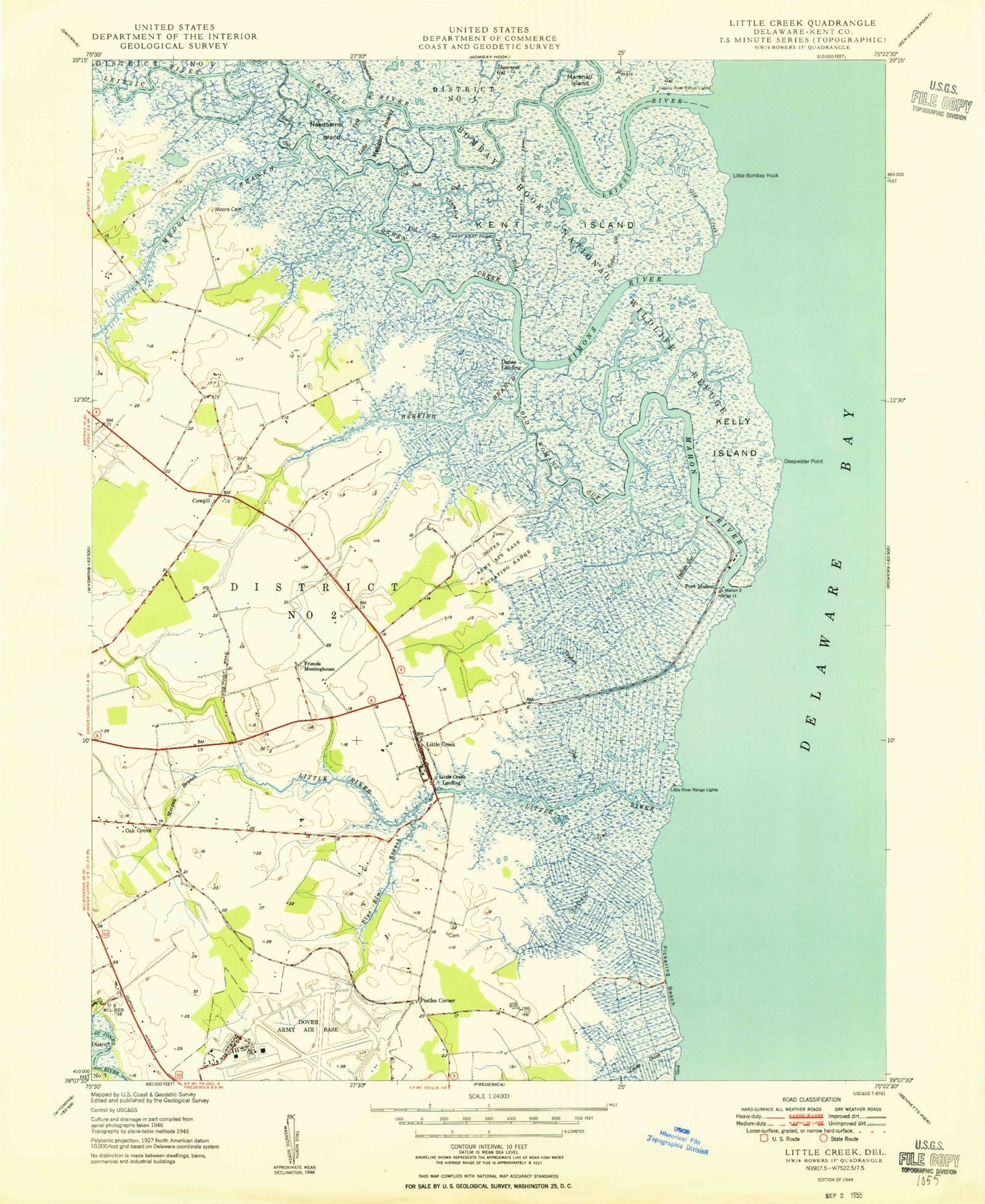
Classic USGS Little Creek Delaware 7.5'x7.5' Topo Map
Couldn't load pickup availability
Historical USGS topographic quad map of Little Creek in the state of Delaware. Typical map scale is 1:24,000, but may vary for certain years, if available. Print size: 24" x 27"
This quadrangle is in the following counties: Kent.
The map contains contour lines, roads, rivers, towns, and lakes. Printed on high-quality waterproof paper with UV fade-resistant inks, and shipped rolled.
Contains the following named places: Bay Gut, Boat Gut, Cattail Gut, Cedar Gut, Deepwater Point, Cherbourg Round Barn, Devers Gut, Drum Gut, East West Canal, Flat Gut, Friends Meetinghouse Cemetery, Green Creek, Herring Branch, Indian Gut, Jenkins Ditch, Joes Hole, Kelly Island, Kellys Ditch, Kent Island, Lewis Ditch, Little Bombay Hook, Little Creek, Little Fork, Little River, Mahon River, Marshall Island, Marshtown Gut, Tyn Head Court, Moors Cemetery, Morgan Branch, Muddy Branch, Needhams Island, North South Canal, Oak Grove, Old Creek, Old Womans Gut, Pickering Beach, Pipe Elm Branch, Port Mahon, Ragged Island, Simons River, Taylors Gut, Old Stone Tavern, Octagonal School House, Old Marina Canal, Cowgills Corner, Donas Landing, Little Creek Landing, Postles Corner, Hilldale, Generals Greene, Duck Creek, Leipsic River, Little River Range Lights, Kings Cliff Mobile Home Park, Laffertys Corner, Little Creek Bridge, Little Creek Wildlife Area, Chandelle Estates Airport, Little Creek Hundred, Leipsic River Range Lights, Little Creek Methodist Church, Dover Division, Dover Behavioral Health System, Dover East Estates Mobile Home Park, Tudor Industrial Park, MCD Business Park, Dover East Industrial Park, Little Creek Town Hall, Little Creek Post Office, Little Creek United Methodist Church, Town of Little Creek, Oak Shadows, Shadybrook Farms, Generals Green, Doverbrook Gardens, Dover Air Force Base, Little Creek Volunteer Fire Company, Tarburton Pit, Dover Air Force Base, Bay Gut, Boat Gut, Cattail Gut, Cedar Gut, Deepwater Point, Cherbourg Round Barn, Devers Gut, Drum Gut, East West Canal, Flat Gut, Friends Meetinghouse Cemetery, Green Creek, Herring Branch, Indian Gut, Jenkins Ditch, Joes Hole, Kelly Island, Kellys Ditch, Kent Island, Lewis Ditch, Little Bombay Hook, Little Creek, Little Fork, Little River, Mahon River, Marshall Island, Marshtown Gut, Tyn Head Court, Moors Cemetery, Morgan Branch, Muddy Branch, Needhams Island, North South Canal, Oak Grove, Old Creek, Old Womans Gut, Pickering Beach, Pipe Elm Branch, Port Mahon, Ragged Island, Simons River, Taylors Gut, Old Stone Tavern, Octagonal School House, Old Marina Canal, Cowgills Corner, Donas Landing, Little Creek Landing, Postles Corner, Hilldale, Generals Greene, Duck Creek, Leipsic River, Little River Range Lights, Kings Cliff Mobile Home Park, Laffertys Corner, Little Creek Bridge, Little Creek Wildlife Area, Chandelle Estates Airport, Little Creek Hundred, Leipsic River Range Lights, Little Creek Methodist Church, Dover Division, Dover Behavioral Health System, Dover East Estates Mobile Home Park, Tudor Industrial Park, MCD Business Park, Dover East Industrial Park, Little Creek Town Hall, Little Creek Post Office, Little Creek United Methodist Church, Town of Little Creek, Oak Shadows, Shadybrook Farms, Generals Green, Doverbrook Gardens, Dover Air Force Base, Little Creek Volunteer Fire Company, Tarburton Pit, Dover Air Force Base


