MyTopo
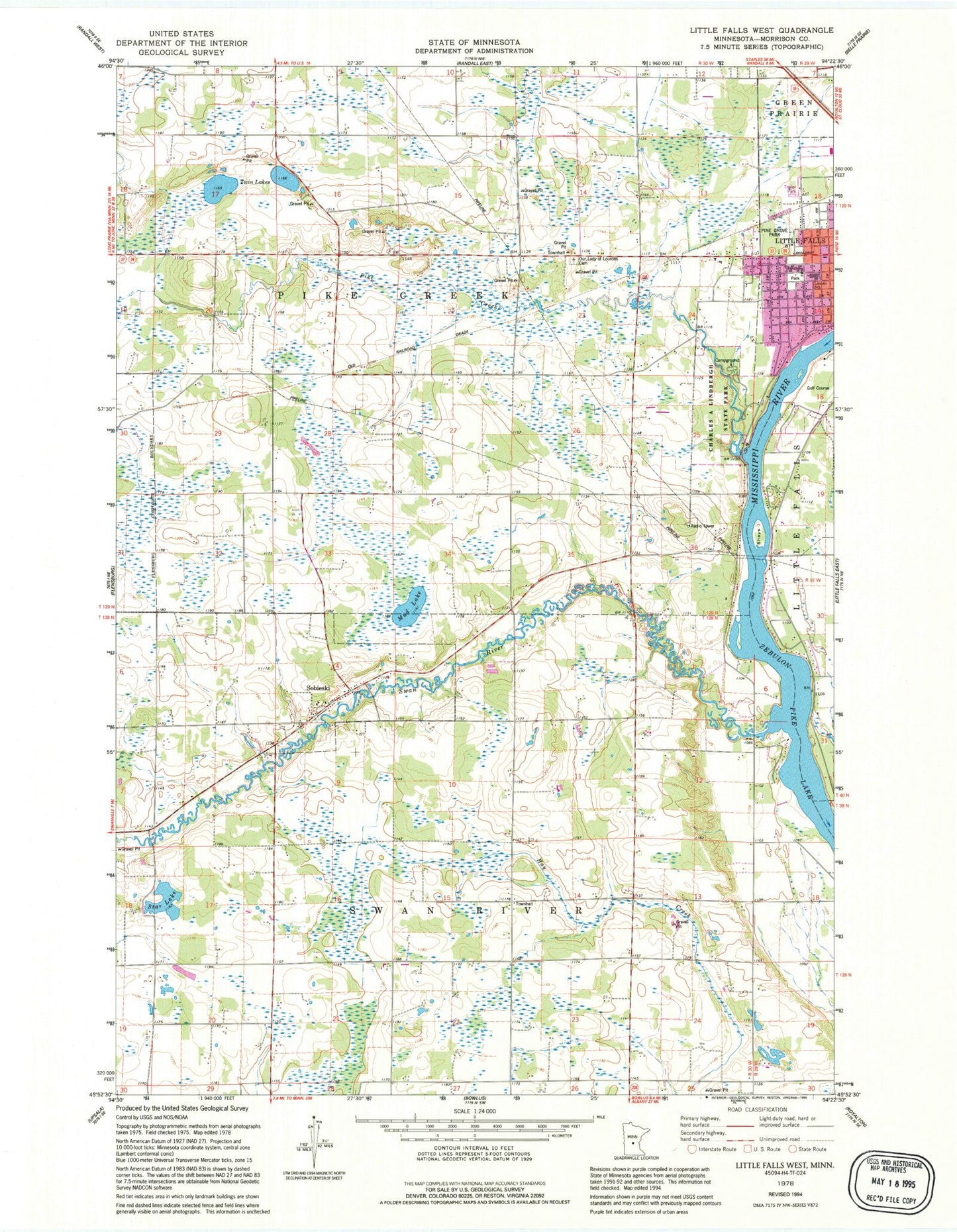
Classic USGS Little Falls West Minnesota 7.5'x7.5' Topo Map
Couldn't load pickup availability
Historical USGS topographic quad map of Little Falls West in the state of Minnesota. Map scale may vary for some years, but is generally around 1:24,000. Print size is approximately 24" x 27"
This quadrangle is in the following counties: Morrison.
The map contains contour lines, roads, rivers, towns, and lakes. Printed on high-quality waterproof paper with UV fade-resistant inks, and shipped rolled.
Contains the following named places: Charles A Lindbergh House, Charles A Lindbergh State Park, Charles A Weyerhaeuser Museum, City of Sobieski, Ed Cash Cemetery, Jaycee Park, Kay Burial Ground, Kiwanis Ball Fields, Lincoln Elementary School, Lindbergh House Historical Marker, Little Falls Country Club, Little Falls Fire Department Station 2, Mud Lake, Our Lady of Lourdes Cemetery, Pike Creek, Pine Grove Park, Pine Grove Zoo, Saint Stanislaus Church Cemetery, Shayes Island, Sobieski, Star Lake, Swan River, Township of Pike Creek, Township of Swan River, Twin Lakes, Twin Lakes Cemetery