MyTopo
Classic USGS Little Fielder Draw Texas 7.5'x7.5' Topo Map
Regular price
$16.95
Regular price
Sale price
$16.95
Unit price
per
Couldn't load pickup availability
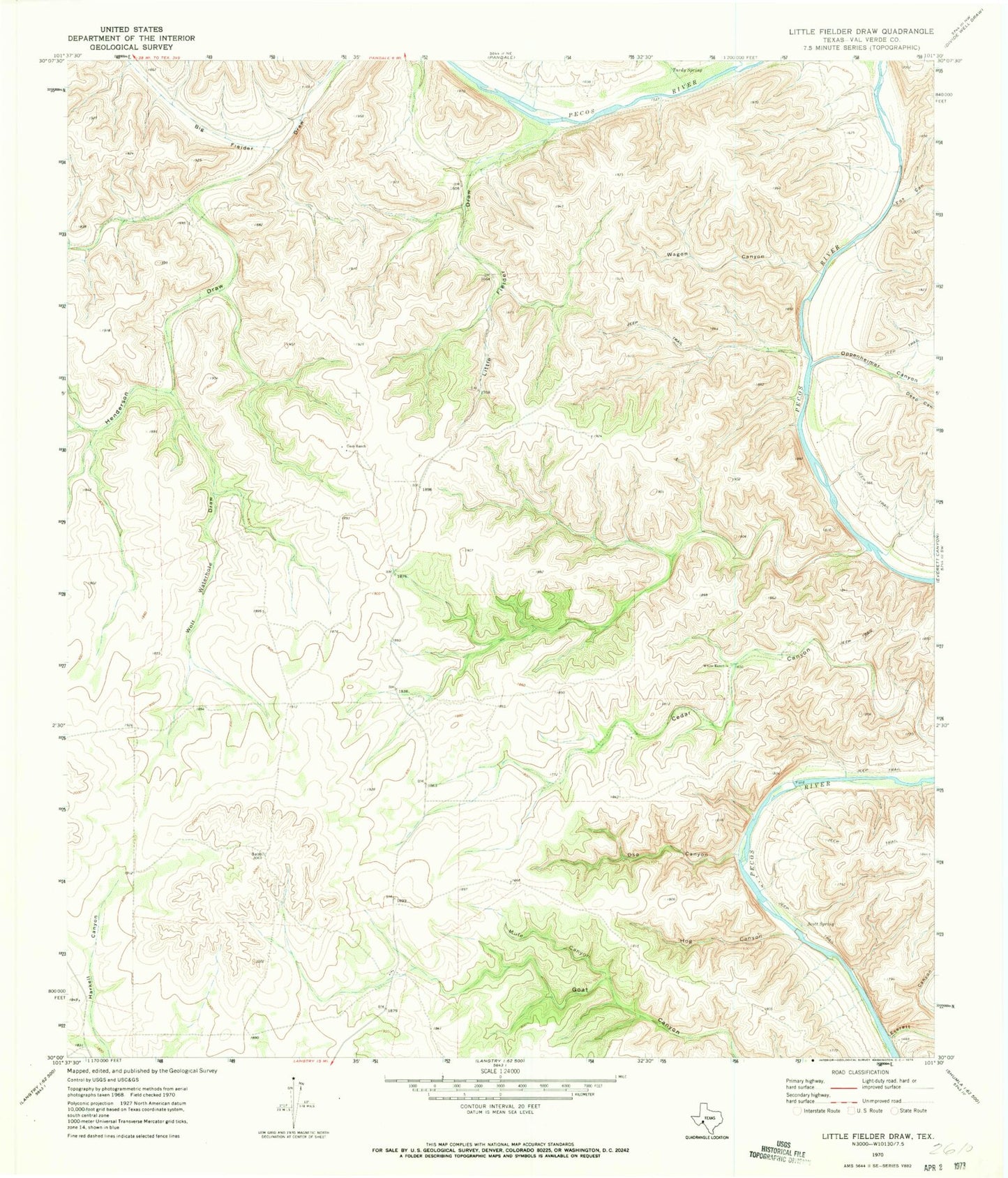
Historical USGS topographic quad map of Little Fielder Draw in the state of Texas. Typical map scale is 1:24,000, but may vary for certain years, if available. Print size: 24" x 27"
This quadrangle is in the following counties: Val Verde.
The map contains contour lines, roads, rivers, towns, and lakes. Printed on high-quality waterproof paper with UV fade-resistant inks, and shipped rolled.
Contains the following named places: Cash Ranch, Deep Canyon, Everett Canyon, Fox Canyon, Henderson Draw, Hog Canyon, Little Fielder Draw, Mule Canyon, Oppenheimer Canyon, Oso Canyon, Scott Spring, Tardy Spring, Wagon Canyon, White Ranch, Wolf Waterhole Draw, Cox Springs, Everett Springs, 4M Ranch Airfield