MyTopo
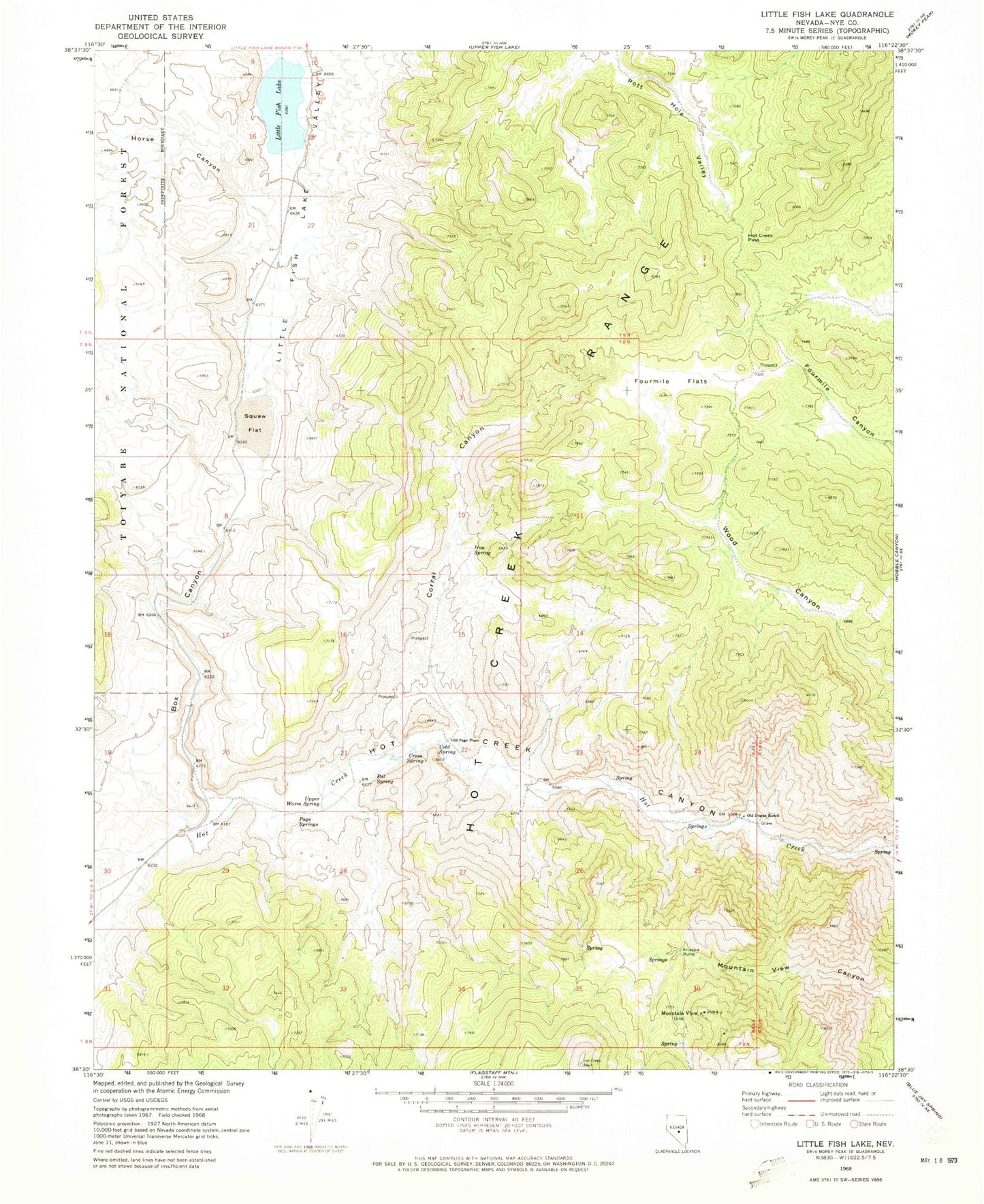
Classic USGS Little Fish Lake Nevada 7.5'x7.5' Topo Map
Couldn't load pickup availability
Historical USGS topographic quad map of Little Fish Lake in the state of Nevada. Map scale may vary for some years, but is generally around 1:24,000. Print size is approximately 24" x 27"
This quadrangle is in the following counties: Nye.
The map contains contour lines, roads, rivers, towns, and lakes. Printed on high-quality waterproof paper with UV fade-resistant inks, and shipped rolled.
Contains the following named places: Box Canyon, Cold Spring, Corral Canyon, Cress Spring, Dead Cow Ridge, Fish Lake Valley Creek, Fourmile Flats, Horse Canyon, Hot Creek Pass, Hot Creek Range, Indian Garden Creek, Indian Jim Mine, Iron Spring, Little Fish Lake, Little Fish Lake Valley, Mountain View, Mountain View Mill, Old Dugan Place Hot Spring, Old Dugan Ranch, Old Page Place, Page Mine, Page Springs, Pat Spring, Pot Hole, Squaw Flat, Upper Warm Spring