
MyTopo
Classic USGS Little Hocking Ohio 7.5'x7.5' Topo Map
Couldn't load pickup availability
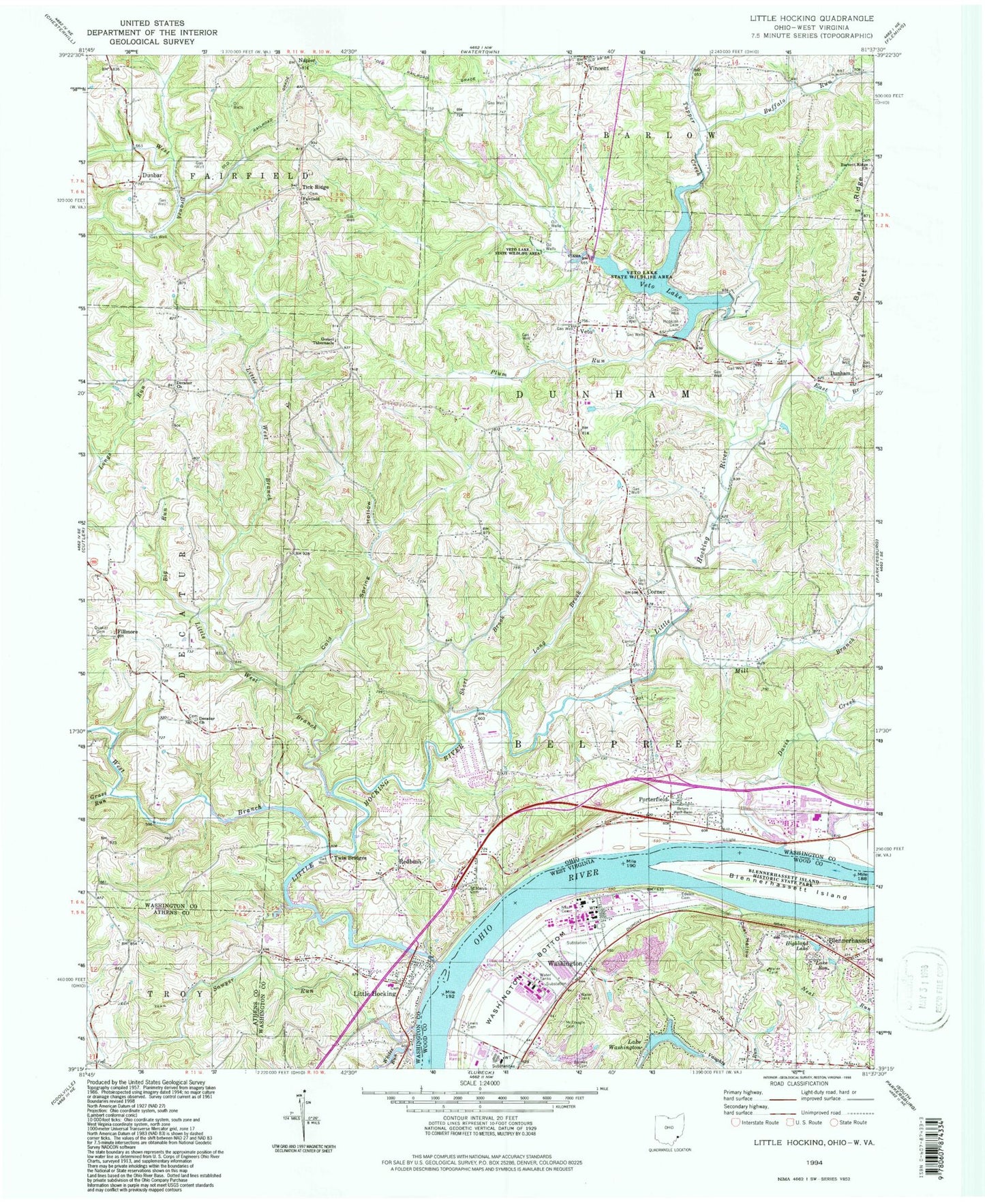
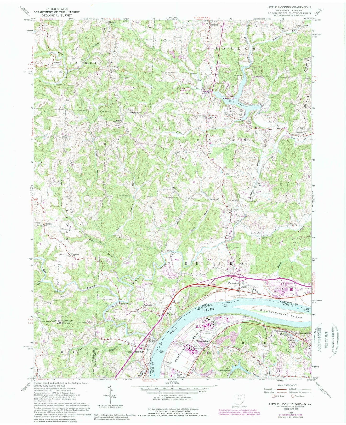
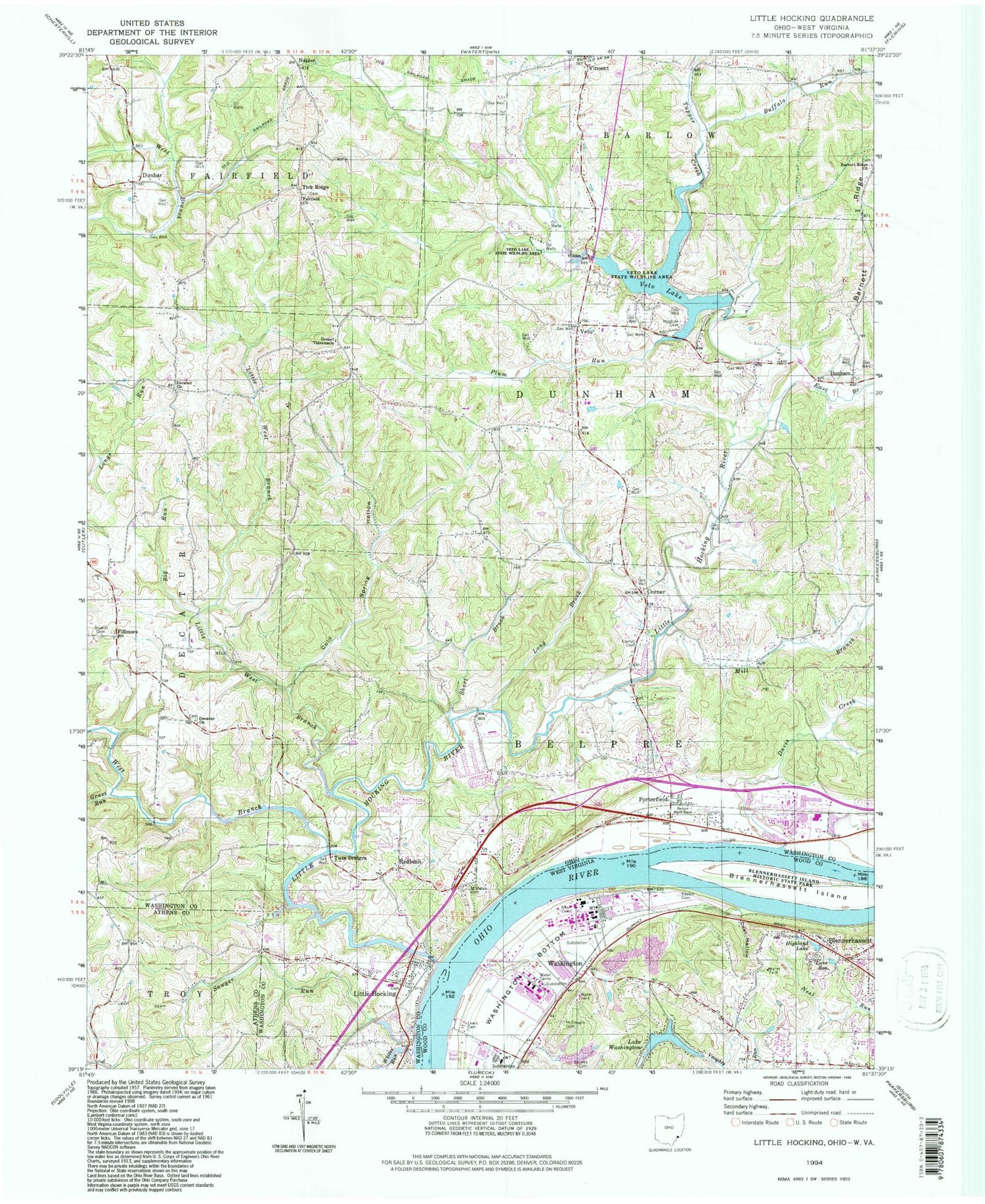
Historical USGS topographic quad map of Little Hocking in the states of Ohio, West Virginia. Typical map scale is 1:24,000, but may vary for certain years, if available. Print size: 24" x 27"
This quadrangle is in the following counties: Athens, Washington, Wood.
The map contains contour lines, roads, rivers, towns, and lakes. Printed on high-quality waterproof paper with UV fade-resistant inks, and shipped rolled.
Contains the following named places: Big Run, Buffalo Run, Cold Spring Hollow, Corner Cemetery, Decatur Church, Decatur Presbyterian Church (historical), Fairchild Church, Gospel Tabernacle, Hopkins Cemetery, Little West Branch Little Hocking River, Long Brook, Mill Branch, Plum Run, Quaker Cemetery, Saint Marys Cemetery, Short Brook, Twin Bridges, Redbush, Little Hocking Elementary School, Lock and Dam Number 19 (historical), Veto Lake Wildlife Area, Oxbow Golf Course, Lewis Landing, Goodnoughs Landing, Whites Run, Sawyer Run, Veto Presbyterian Church, Davis Creek, Dunbar, Corner, Dunham, Fillmore, Napier, Tick Ridge, Little Hocking, Veto, East Branch Little Hocking River, Little Hocking River, Tupper Creek, Veto Lake, Porterfield, Grass Run, West Branch Little Hocking River, Ohio Power Company Dam Number Three, Ohio Power Pond Number Three, Veto Lake Dam, WEYQ-FM (Marietta), Township of Belpre, Township of Dunham, Barnett Ridge Cemetery, Decatur Methodist Episcopal Cemetery, Decatur Presbyterian Cemetery, Fairfield Church Cemetery, Full Gospel Temple, Little Hocking Cemetery, Veto Cemetery, Dunham Township Volunteer Fire Department, Little Hocking Fire Department, Little Hocking Census Designated Place, Vincent Census Designated Place, Holiday Tree Farm, Little Hocking Post Office, Evergreen Memorial Cemetery, Lewis Cemetery, Barnes Cemetery, Blennerhassett, Blennerhassett Island, Coal Hollow, Edelen Cemetery, Highland Lake, McDougle Cemetery, Neal Cemetery, Lake Ron, Washington, Washington Bottom, Lake Washington, Lock and Dam Number 19, WHCM-FM (Parkersburg), Blennerhassett Island Historical State Park, Washington Post Office, Lake Washington Dam, Neale Cemetery, Richards Cemetery, Blennerhassett Census Designated Place, General Electric Plastics Medical Unit, Blennerhassett Island Bridge