MyTopo
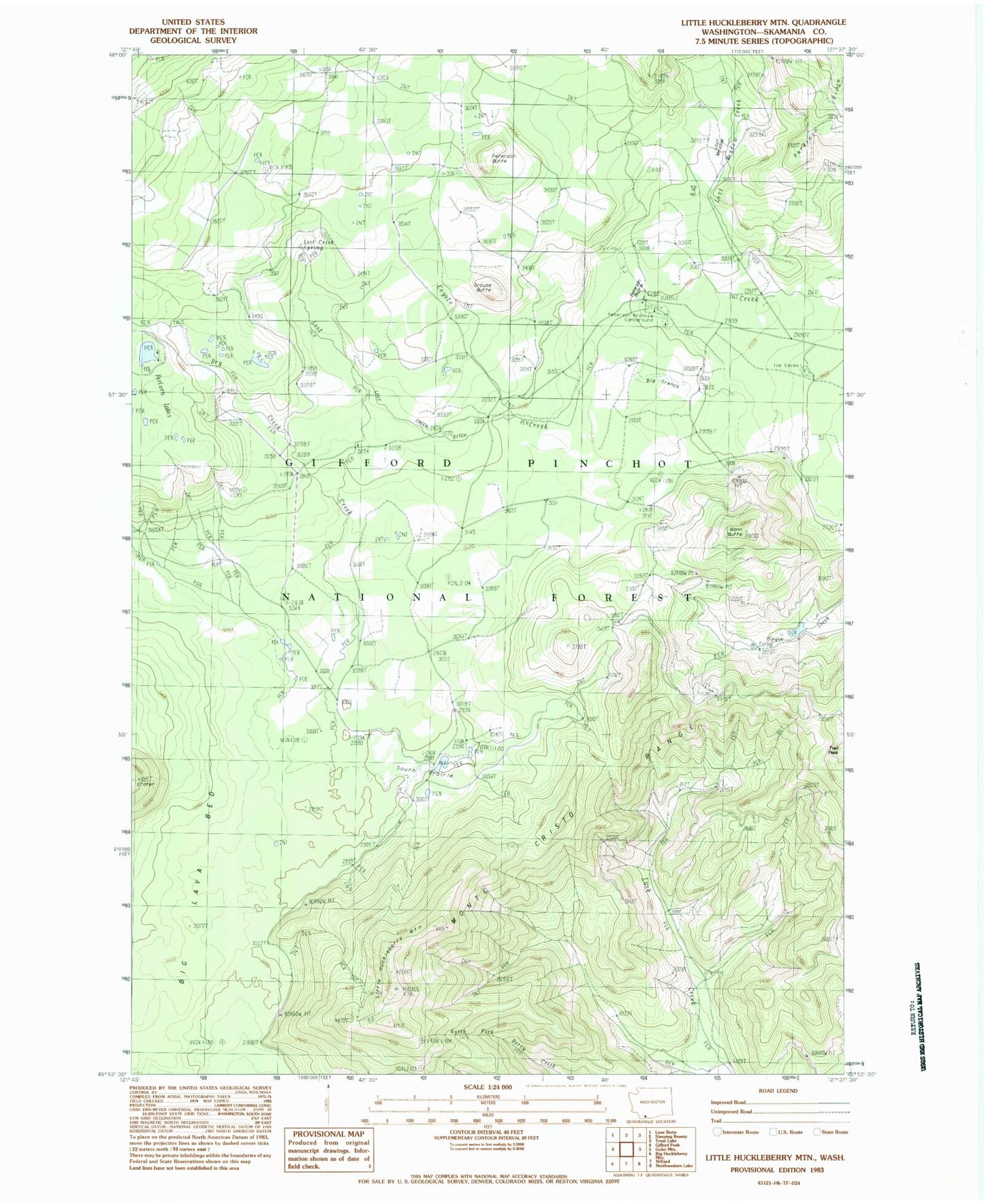
Classic USGS Little Huckleberry Mountain Washington 7.5'x7.5' Topo Map
Couldn't load pickup availability
Historical USGS topographic quad map of Little Huckleberry Mountain in the state of Washington. Map scale may vary for some years, but is generally around 1:24,000. Print size is approximately 24" x 27"
This quadrangle is in the following counties: Skamania.
The map contains contour lines, roads, rivers, towns, and lakes. Printed on high-quality waterproof paper with UV fade-resistant inks, and shipped rolled.
Contains the following named places: Big Lava Bed, Big Trench, Cougar Way, Coyote Creek, Dry Creek, Grouse Butte, Huckle Lookout, Ice Cave Campground, Little Huckleberry Mountain, Little Huckleberry Mountain Lookout, Little Huckleberry Trail, Lost Creek, Lost Creek Ditch, Lost Creek Spring, Lost Meadow Creek, Lusk Creek Trail, Mann Butte, Peterson Butte, Peterson Guard Station, Peterson Prairie Campground, Peterson Prairie Guard Station, South Prairie, South Prairie Lake, Trail Peak