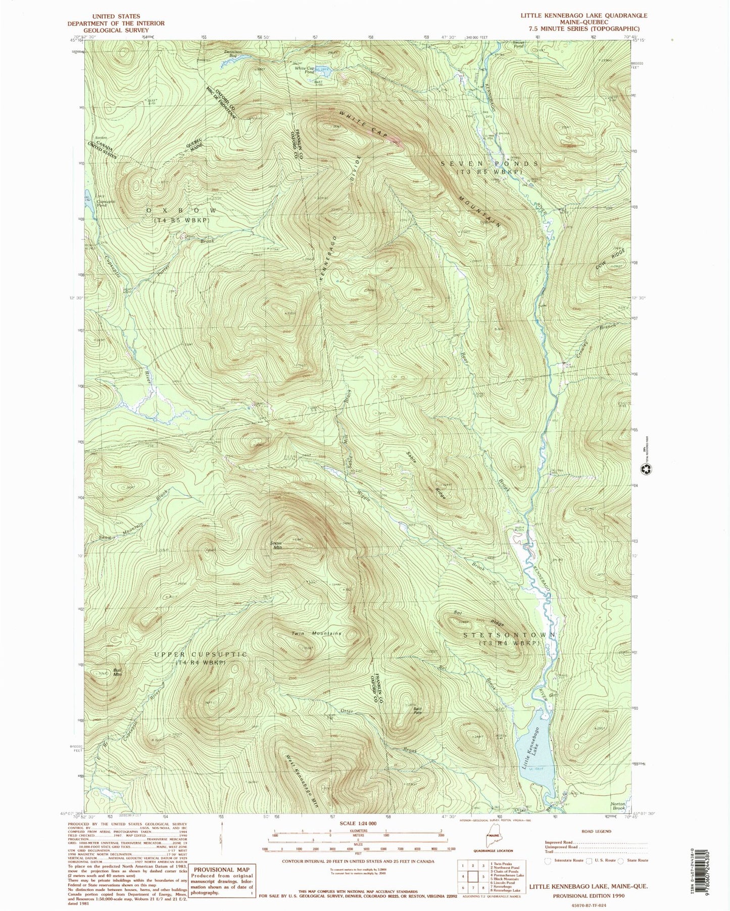
MyTopo
Classic USGS Little Kennebago Lake Maine 7.5'x7.5' Topo Map
Couldn't load pickup availability
Historical USGS topographic quad map of Little Kennebago Lake in the state of Maine. Typical map scale is 1:24,000, but may vary for certain years, if available. Print size: 24" x 27"
This quadrangle is in the following counties: Franklin, Oxford.
The map contains contour lines, roads, rivers, towns, and lakes. Printed on high-quality waterproof paper with UV fade-resistant inks, and shipped rolled.
Contains the following named places: Bald Pate, Bear Brook, Brown Dam Camp (historical), Bull Mountain, Camp Number 12 (historical), Cow Ridge, Crowley Branch, Cupsuptic Pond, Dennison Bog, East Branch Camp (historical), Kennebago Divide, Little Kennebago Lake, Number Four Camp (historical), Otter Brook, Otter Camp (historical), Porter Brook, Sable Mill Brook, Sable Ridge, Snow Mountain, Sol Brook, Sol Ridge, Twin Mountains, White Cap Mountain, White Cap Pond, Wiggle Brook, Upper Cupsuptic Township, Seven Ponds Township