MyTopo
Classic USGS Little Lake Michigan 7.5'x7.5' Topo Map
Couldn't load pickup availability
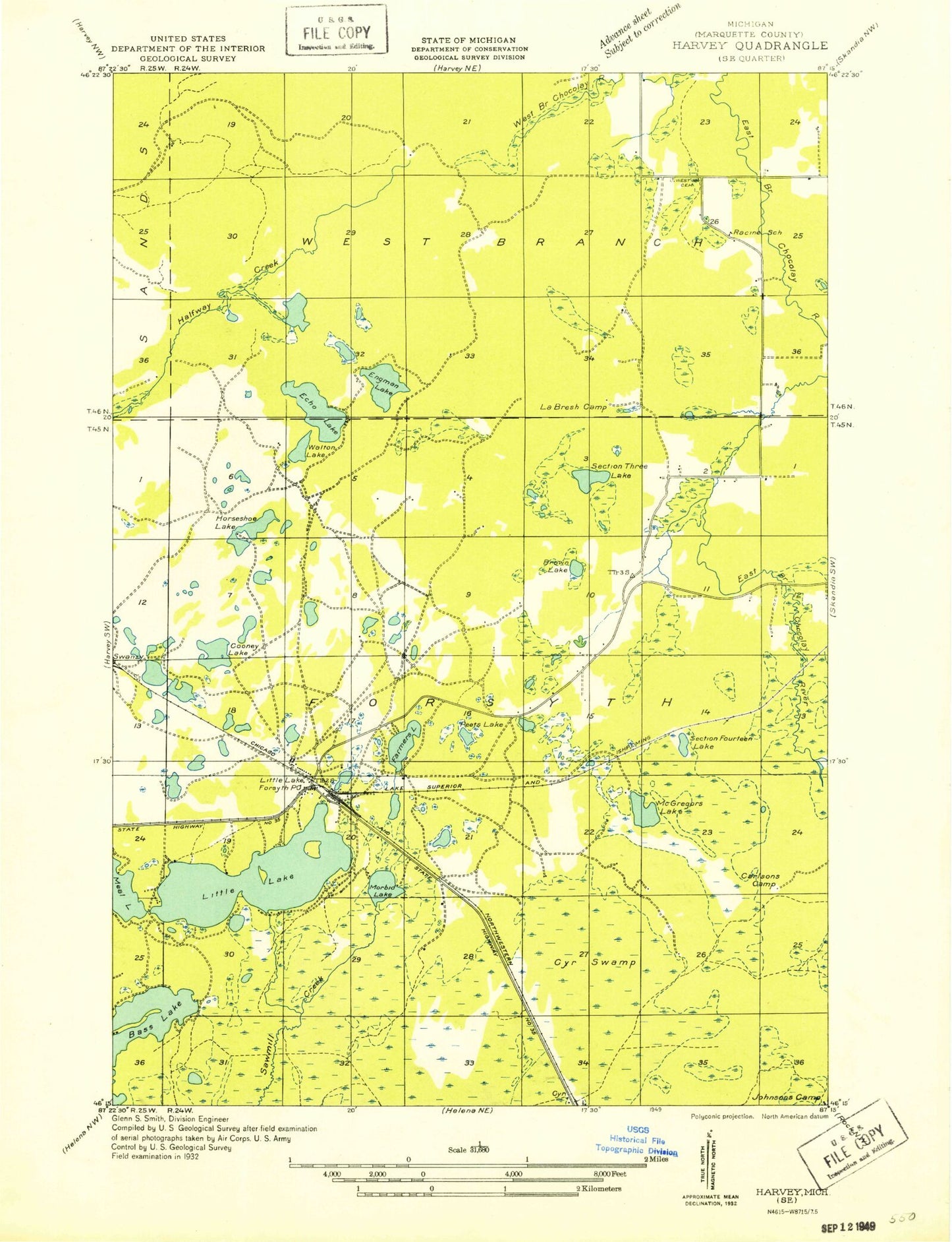
Historical USGS topographic quad map of Little Lake in the state of Michigan. Map scale may vary for some years, but is generally around 1:24,000. Print size is approximately 24" x 27"
This quadrangle is in the following counties: Marquette.
The map contains contour lines, roads, rivers, towns, and lakes. Printed on high-quality waterproof paper with UV fade-resistant inks, and shipped rolled.
Contains the following named places: Bass Lake, Beauyan Lake, Big Trout Lake, Brown Lake, Cameron Lake, Cedar Bank, Dollar Lake, Duck Lake, Engman Lake, Farmer Lake, Froling Falls, Gravels Pond, Grimm Lake, Gwinn-Sawyer Medical Center, Holy Innocents Episcopal Church, K I Sawyer School, K. I. Sawyer Census Designated Place, Lake Haven Estates Mobile Home Park, Leo P McDonald School, Little Lake, Little Lake Campground, Little Lake Gospel Chapel, Little Lake Post Office, Little Lake Station, MacGregor Lake, Martin Lake, Mehl Lake, Moccasin Lake, Morbit Lake, Northwestern Lake, Provost Lake, Red Fox Run Golf Course, Sheen Creek, Silver Lake, Silver Lead Creek, Sporley Lake, Swanzy, Swanzy Lake, Three Lake, Upper Chocolay Falls, Victory Lutheran Church, West Branch Cemetery, Wilson Lake, Wise Man Creek, ZIP Code: 49833