
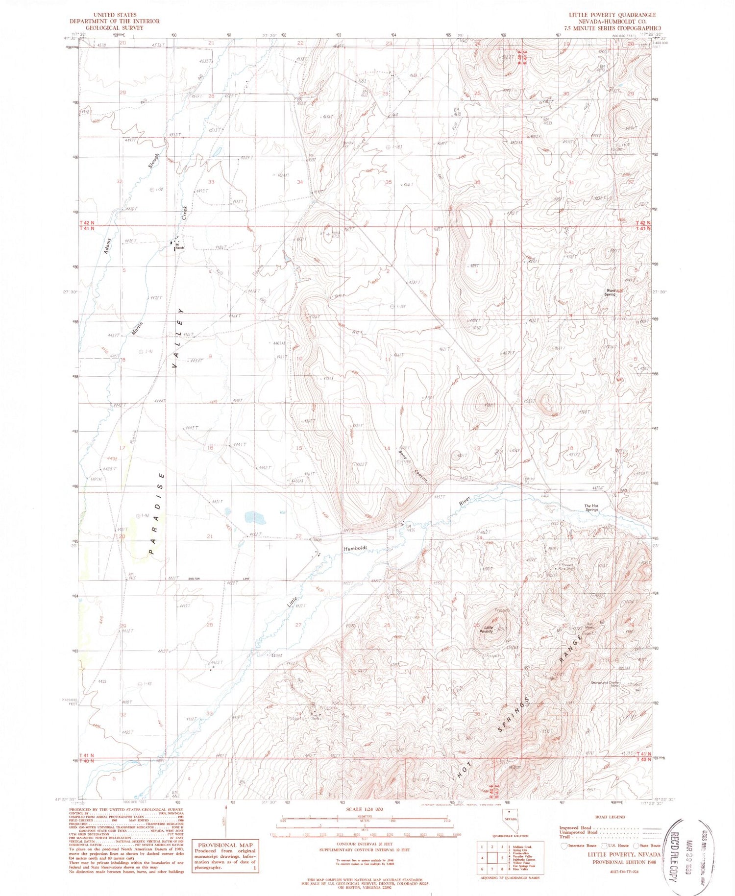
MyTopo
Classic USGS Little Poverty Nevada 7.5'x7.5' Topo Map
Regular price
$16.95
Regular price
Sale price
$16.95
Unit price
per
Couldn't load pickup availability
Historical USGS topographic quad map of Little Poverty in the state of Nevada. Map scale may vary for some years, but is generally around 1:24,000. Print size is approximately 24" x 27"
This quadrangle is in the following counties: Humboldt.
The map contains contour lines, roads, rivers, towns, and lakes. Printed on high-quality waterproof paper with UV fade-resistant inks, and shipped rolled.
Contains the following named places: 4 R Ranch Landing Strip, 89426, Bone Canyon, George and Charlie Mine, Holt Mine, Hot Springs Dam Site, Hot Springs Ranch, King Group Mine, Little Poverty, Ninetysix Ranch, Paradise Valley Township, Pennywinkle, Stocks Farming Company Ranch, The Hot Springs, Ward Spring


