MyTopo
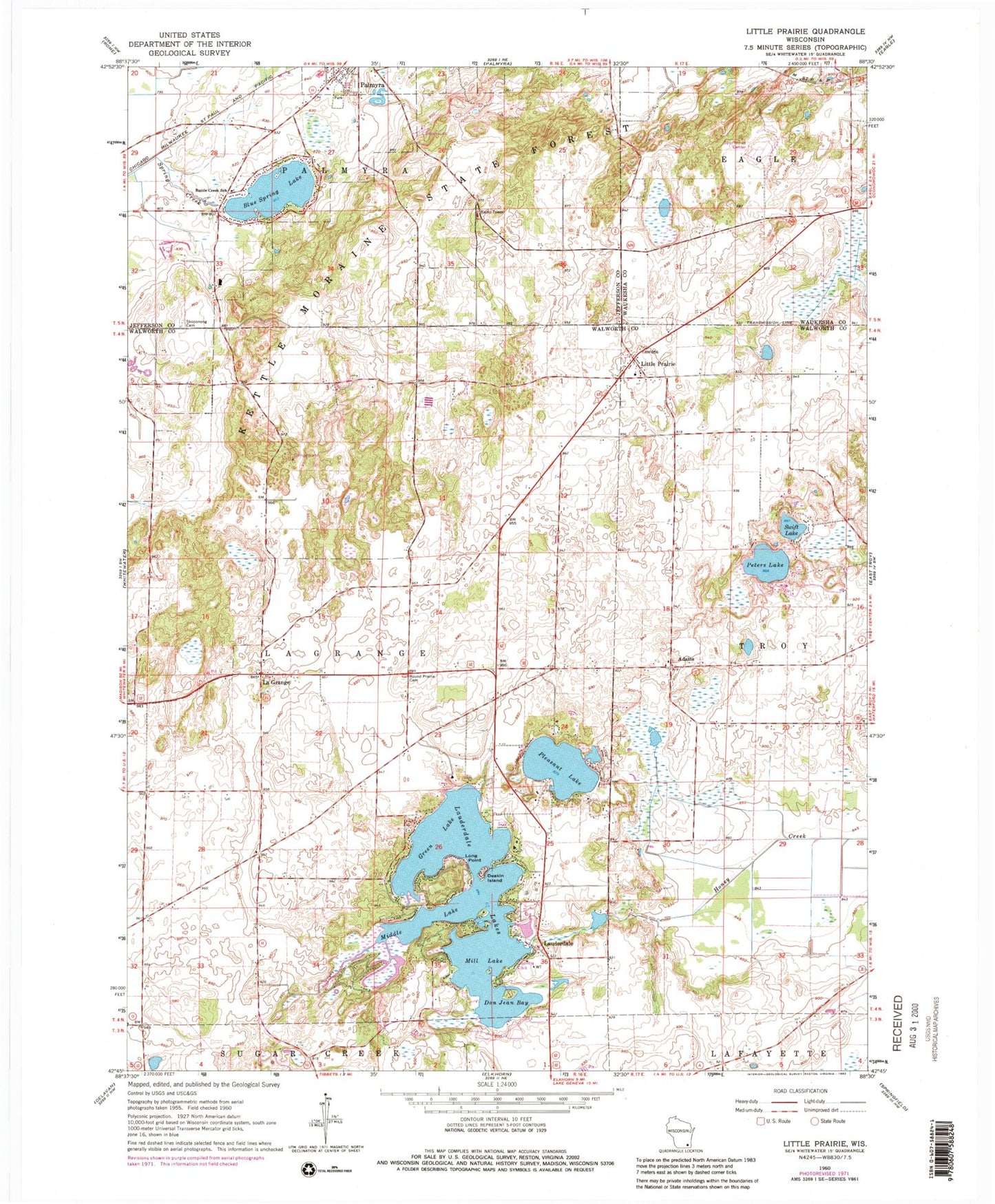
Classic USGS Little Prairie Wisconsin 7.5'x7.5' Topo Map
Couldn't load pickup availability
Historical USGS topographic quad map of Little Prairie in the state of Wisconsin. Typical map scale is 1:24,000, but may vary for certain years, if available. Print size: 24" x 27"
This quadrangle is in the following counties: Jefferson, Walworth, Waukesha.
The map contains contour lines, roads, rivers, towns, and lakes. Printed on high-quality waterproof paper with UV fade-resistant inks, and shipped rolled.
Contains the following named places: Adams, Battle Creek School, Blue Spring Lake, Deakin Island, Don Jean Bay, Green Lake, La Grange, Lauderdale, Lauderdale Lakes, Little Prairie, Long Point, Middle Lake, Mill Lake, Peters Lake, Pleasant Lake, Round Prairie Cemetery, Skoponong Cemetery, Sportsman Center, Swift Lake, Tamarack Airport, Town of La Grange, Blue Springs Lake 2WP1137 Dam, Lauderdale Lakes 2-WP-618 Dam, Lauderdale Lakes 12, Palmyra - Eagle Middle - High School, Palmyra - Eagle Middle School, Dewings Island, Dunhams Bay, Ewings Landing, Pleasant Island, Spring Prairie Point, Stewarts Bay, Tratts Point, Wilkinsons Point, Wolfs Point, Kettle Moraine Oak Opening State Natural Area, Adams Cemetery, Little Prairie Cemetery, Eagle Oak Opening State Natural Area, Lauderdale Shores, Lauderdale Lakes Census Designated Place, Lauderdale - LaGrange Fire Department, Cedar Grove Pond, Hillside Cemetery