MyTopo
Classic USGS Little River Alabama 7.5'x7.5' Topo Map
Couldn't load pickup availability
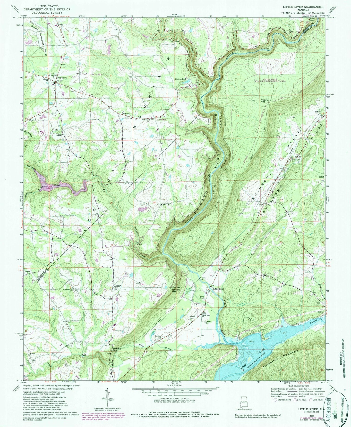
Historical USGS topographic quad map of Little River in the state of Alabama. Typical map scale is 1:24,000, but may vary for certain years, if available. Print size: 24" x 27"
This quadrangle is in the following counties: Cherokee, DeKalb.
The map contains contour lines, roads, rivers, towns, and lakes. Printed on high-quality waterproof paper with UV fade-resistant inks, and shipped rolled.
Contains the following named places: Black Oak Baptist Church, Coffey Cemetery, Daniels Cemetery, Daniels Gap, Little River, Loop, Mount Zion Church, Pleasant Hill Church, Shinbone Valley, Starling Cemetery, Starling Gap, Thomson Gap, Unity Church Cemetery, Black Oak Church Cemetery, Daniels Mill (historical), Pleasant Hill Cemetery, Tuckers Chapel Church Cemetery, Welcome Hill Church Cemetery, Congo Spring, Taft Spring, Bear Creek, Camprock Creek, Canyon Park, Needle Rock, Powell, Ruhama Baptist Church, Ruhama Junior High School, Wolf Creek, Cashs Lake, Cash Dam, Lickskillet, Johnnies Creek, Mount Moriah Church, Spring Creek, Welcome Hill Baptist Church, Barrets Chapel, Daniels Chapel Methodist Church, Little River Baptist Church, Tuckers Chapel Methodist Church, Walkers Chapel Methodist Church, Congo, Sigsbee, Taft, Dogtown, Lookout Mountain Church, Little River Canyon, Mount Zion (historical), Tucker (historical), Free Pentecost Church, Canyon Mouth Park, Coffey Plantation (historical), Needle Rock, Flying M Ranch Airport, Tuckers Chapel Volunteer Fire Department, Dogtown Volunteer Fire Department