MyTopo
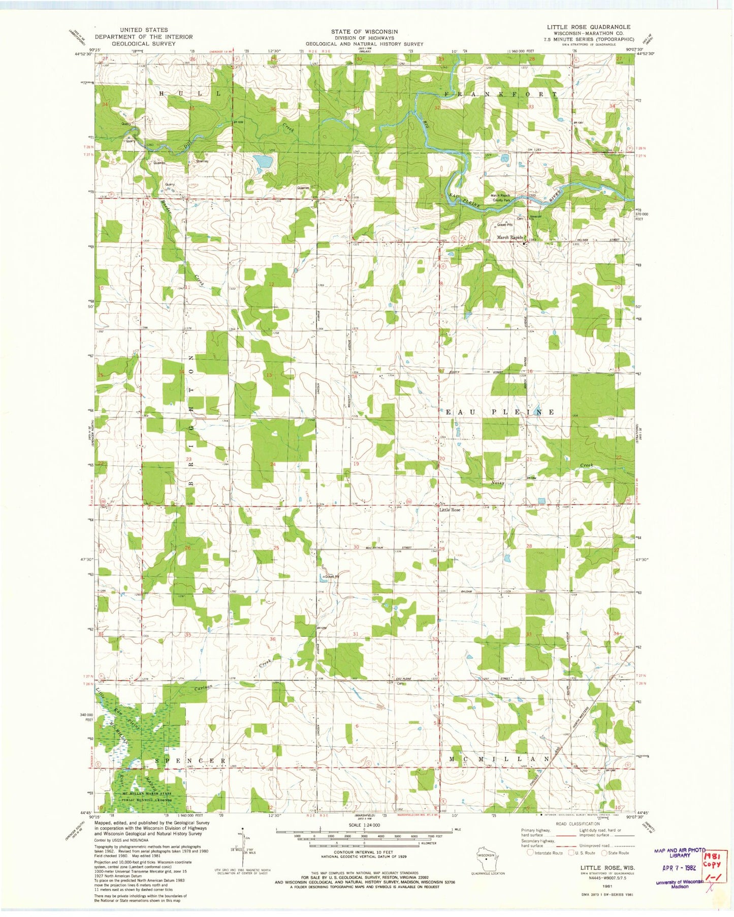
Classic USGS Little Rose Wisconsin 7.5'x7.5' Topo Map
Couldn't load pickup availability
Historical USGS topographic quad map of Little Rose in the state of Wisconsin. Map scale may vary for some years, but is generally around 1:24,000. Print size is approximately 24" x 27"
This quadrangle is in the following counties: Marathon.
The map contains contour lines, roads, rivers, towns, and lakes. Printed on high-quality waterproof paper with UV fade-resistant inks, and shipped rolled.
Contains the following named places: 0.39 Reservoir, Carlson Creek, Del Fatti Construction Number 1 G-8737 Dam, Dill Creek, Emanuel Church, Enterprise School, Harding School, Kopp G 26 Dam, Lindbergh School, Little Rose, Lone Pine School, March Rapids, March Rapids County Park, McArthur School, Raeder Creek, Saint Adalbert Church, Timilin School, Town of Eau Pleine, Upham School, Wescott School, West Kerwin School