
MyTopo
Classic USGS Little Soldier Mountain Idaho 7.5'x7.5' Topo Map
Couldn't load pickup availability
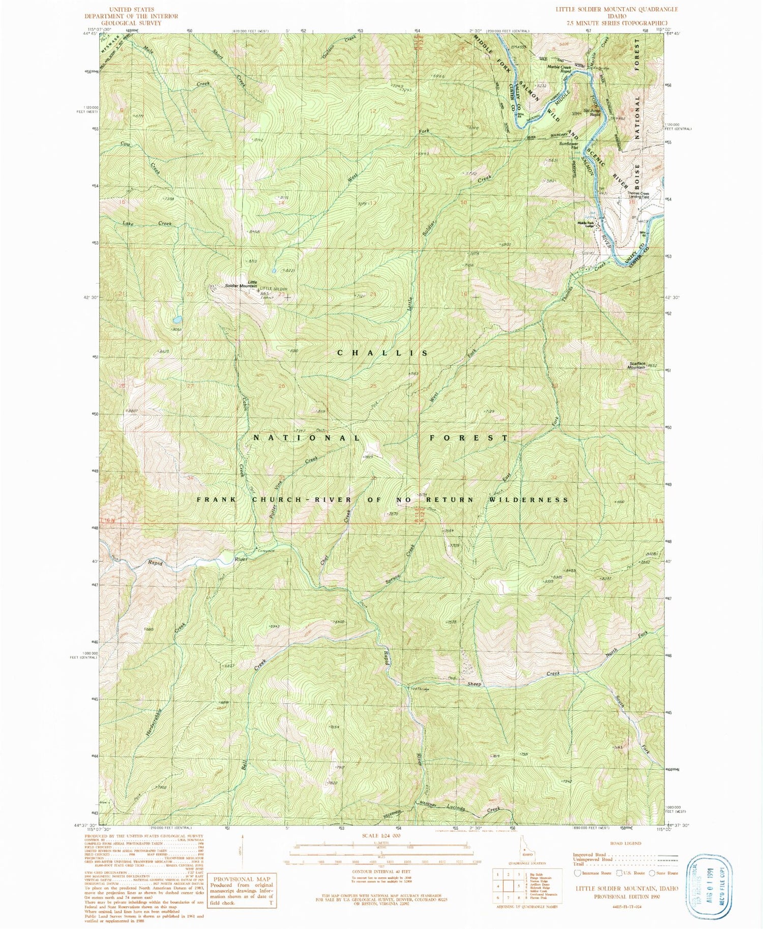
Historical USGS topographic quad map of Little Soldier Mountain in the state of Idaho. Map scale may vary for some years, but is generally around 1:24,000. Print size is approximately 24" x 27"
This quadrangle is in the following counties: Custer, Valley.
The map contains contour lines, roads, rivers, towns, and lakes. Printed on high-quality waterproof paper with UV fade-resistant inks, and shipped rolled.
Contains the following named places: Bell Creek, Cabin Creek, Chet Creek, East Fork Thomas Creek, Hardscrabble Creek, Little Soldier Campground, Little Soldier Creek, Little Soldier Mountain, Lucinda Creek, Marble Creek, Marble Creek Campground, Marble Creek Number Two Campsite, Marble Creek Rapid, Middle Fork Lodge, North Fork Sheep Creek, Potter Vine Creek, Scarface Mountain, Sheep Creek, Sheep Creek Bridge, Ski Jump Rapid, South Fork Sheep Creek, Spruce Creek, State Land Campground, Sunflower Campsite, Sunflower Flat, Thomas Creek, Thomas Creek Airport, West Fork Little Soldier Creek, West Fork Thomas Creek


